By Outdoor Next Editorial standards
On this page
Location & access
DOC track reference point, not a verified trailhead or the whole route. Check the official route directions before travel.
Official location informationLocation source
DOC track reference point, not a verified trailhead or the whole route.
Reference point: -43.70478, 170.09892. Stored to 5 decimal places (roughly 1 m resolution), not a claim of survey accuracy. Source positional accuracy is not specified.
DOC Maps walking and tramping point (WGS84) / Department of Conservation. Checked 2026-09-24.
Key facts
- Distance
- 10 km return via the same track
- Return time
- 3 hr
- Difficulty
- Easy to intermediate walking track (DOC category); gravel with some steps
- Start point
- White Horse Hill car park, end of Hooker Valley Road, Aoraki/Mount Cook National Park
- Parking
- Paid: $2.50 per half hour or $25 a day; free if you leave within 20 minutes; cards only
- Dogs allowed?
- No
- First bridge restriction
- Maximum 20 people at once; DOC notice published 22 September 2026
- Facility warning
- Winter notice absent from 1 October feed; water and flushing toilet restoration not confirmed
- Managed by
- Department of Conservation
Checked against official sources on 24 September 2026. Rules and conditions are set by Department of Conservation — confirm with them before you go.
Hooker Valley Track is a 10 km return walk taking about 3 hours from White Horse Hill car park to Hooker Lake and back. DOC grades it easy to intermediate, with gravel, steps and three bridges. The route description is not a live access guarantee: bridge restrictions, facilities and alpine conditions need a separate check.
Current bridge and access notices
Checked on 1 October 2026: DOC's route description confirms the new second bridge opened in July. However, a separate alert published on 22 September limits the first bridge to 20 people at once because of cable wear. It describes planned pause gates and compliance staff. Follow current signs and instructions, and allow for queues.
This October review covers the route's seasonal guidance and alert feed, not every retained fact or parking charge. The wider factual check remains dated 24 September 2026.
Older second-bridge construction notices are not today's access status. Recheck the route page and Canterbury alerts before setting off. The live feed also retains a predator-control warning; respect warning signs and leave bait alone.
Hooker Valley Track at a glance
DOC splits the walk into three sections. These are one-way times and distances; you return the same way.
| Section | Time | Distance |
|---|---|---|
| White Horse Hill car park to first swing bridge | 15 min | 1 km |
| First swing bridge to second swing bridge | 30 min | 1.5 km |
| Second swing bridge to Hooker Lake | 45 min | 2.5 km |
What you'll see on the way
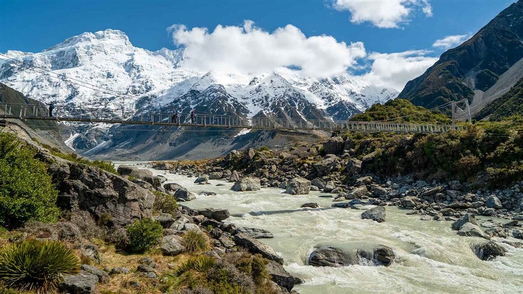
From the car park, the track passes signposted side tracks to Freda's Rock and the Alpine Memorial, then reaches Mueller Lookout just before the first swing bridge over the Hooker River. After crossing, it winds through moraine (rocky humps of glacial debris) to Kakīroa/Mount Sefton View Lookout, looking over Mueller Lake and Mueller Glacier.
A new second swing bridge over the Hooker River opened in July 2026. At 189 metres, DOC describes it as the longest suspension bridge in New Zealand. Past it, the valley floor widens into tussock, and a third and final swing bridge leads to Hooker Lake at the foot of Aoraki/Mount Cook. DOC notes icebergs dot the lake in summer.
The area is sacred to Ngāi Tahu and has Tōpuni status, a symbolic cloak of protection.
Start point, directions and parking
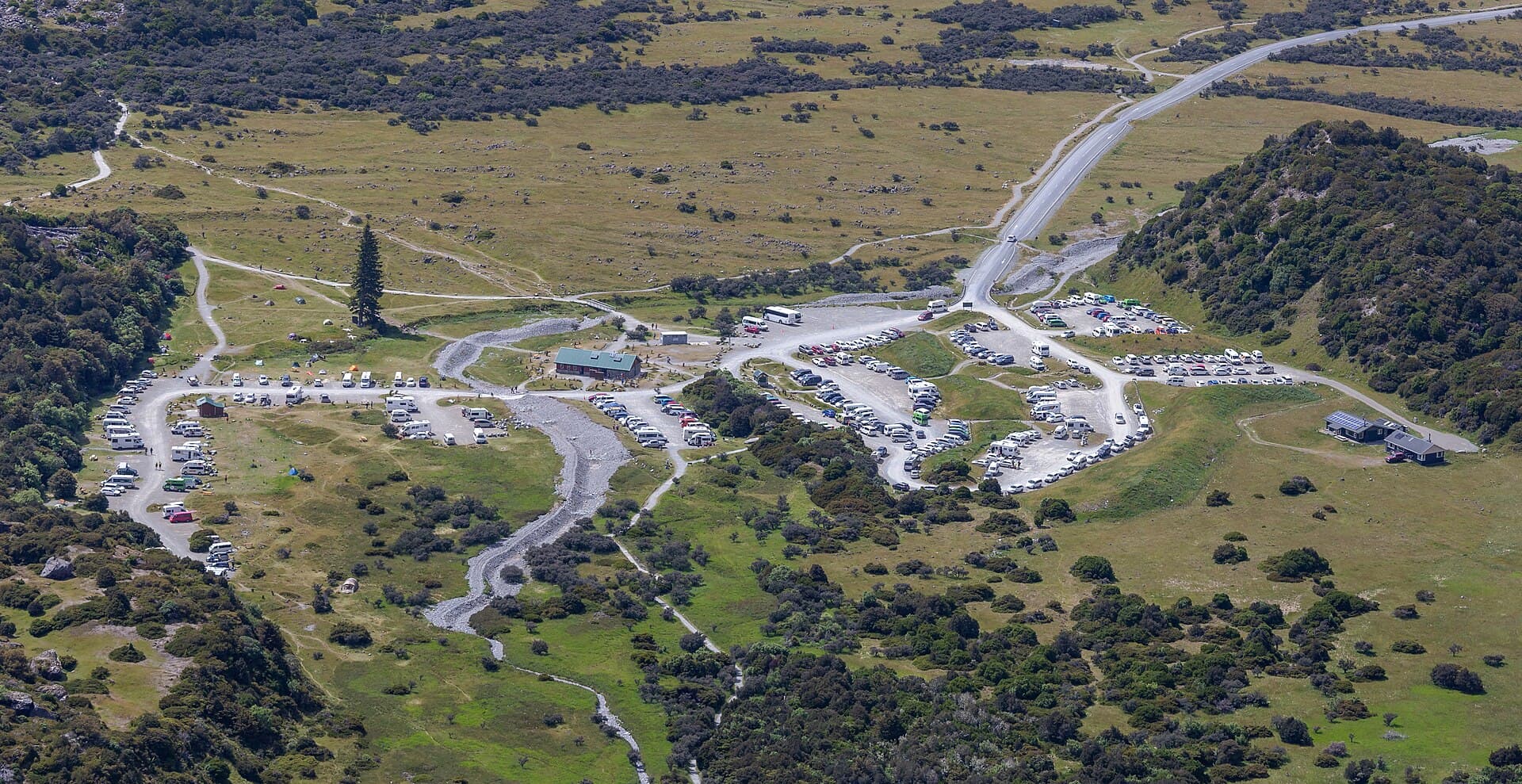
From Aoraki/Mount Cook Village, take SH80 towards Twizel. Hooker Valley Road is the first left as you leave the village, and White Horse Hill car park is at the end of it. DOC's driving times are about 5 minutes from the village, 50 minutes from Twizel and 1 hour 30 minutes from Tekapo.
DOC's paid-parking guidance gives these arrangements, checked on 24 September 2026:
| Item | What DOC says |
|---|---|
| Fees | $2.50 per half hour, or $25 a day with unlimited entries and exits that day |
| Free period | 20 minutes |
| Payment | Debit or credit card at the machines; no cash |
| Overnight | Arrive one day and leave the next and you pay for two days ($50) |
| Overstaying | You may be issued a breach notice fee of $75 |
| Annual permits | $10 for Mackenzie district residents; $60 general permit; buy online only |
| Camping | Not permitted in the car park, even if you've paid |
Cameras record entry and exit times, and DOC notes its paid car parks can be full at peak times, so have a backup plan. If you're staying nearby, see our guide to freedom camping at Lake Pukaki.
Facilities: restoration not confirmed
DOC's general route description lists toilets, a shelter and treated water at White Horse Hill, plus toilets beyond the second bridge. Do not treat that standard list as current availability.
The winter facilities notice was absent from the 1 October alert feed; that alone does not confirm water or flushing toilets have resumed. The DOC feed had carried that notice at the 24 September check. No dated restoration confirmation was found in this review. Confirm arrangements with DOC and carry drinking water; calendar spring does not confirm services have resumed.
Book overnight stays separately through White Horse Hill Campsite; paid day parking is not camping permission.
Track status and closures: where to check
- DOC's track page shows alerts at the top of the Hooker Valley Track page. Read the details, not only the headline.
- The road in: snow can close SH80. Check NZTA highway conditions for Canterbury.
- Local conditions: ask the Aoraki/Mount Cook National Park Visitor Centre if access, ice or facilities are unclear.
When to go
DOC doesn't name a best time of day. What it does say is that the Aoraki/Mount Cook region gets very fast changes in weather, and strong wind, high rainfall, heavy snowfall and rapid temperature changes are common at any time of year. Check the NIWA forecast for Aoraki/Mount Cook National Park before you set out.
In winter the track can become very icy and extremely slippery in shaded areas, and DOC recommends microspikes and hiking poles. For a wider look at seasons around the country, see the best time to visit New Zealand.
Safety
- Stay out of the water and off the ice. DOC says the lakes are very cold (typically about 3°C) and can quickly cause hypothermia. Stay off frozen lakes, and don't climb icebergs, which can tip unexpectedly.
- Keep to the track. It's designed to avoid avalanche risk.
- Pack for a short alpine walk. Use DOC's short walks gear list and add warm, windproof layers.
- Follow the Land Safety Code. Choose the right trip, understand the weather, pack warm clothes and extra food, share your plans, and look after each other. Read the five steps on DOC's Land Safety Code page.
Dogs, drones and other rules
Dogs are not allowed on Hooker Valley Track, and flying a drone without a permit is strictly prohibited. See DOC's rules on drones on conservation land if you're thinking of applying for a permit.
For a shorter outing, compare Kea Point and Governors Bush in our Aoraki/Mount Cook hiking guide. Sealy Tarns is a steeper alternative, not a like-for-like substitute. Carry what the conditions require using the day-hike packing list, and be prepared to change the destination.
More photographs
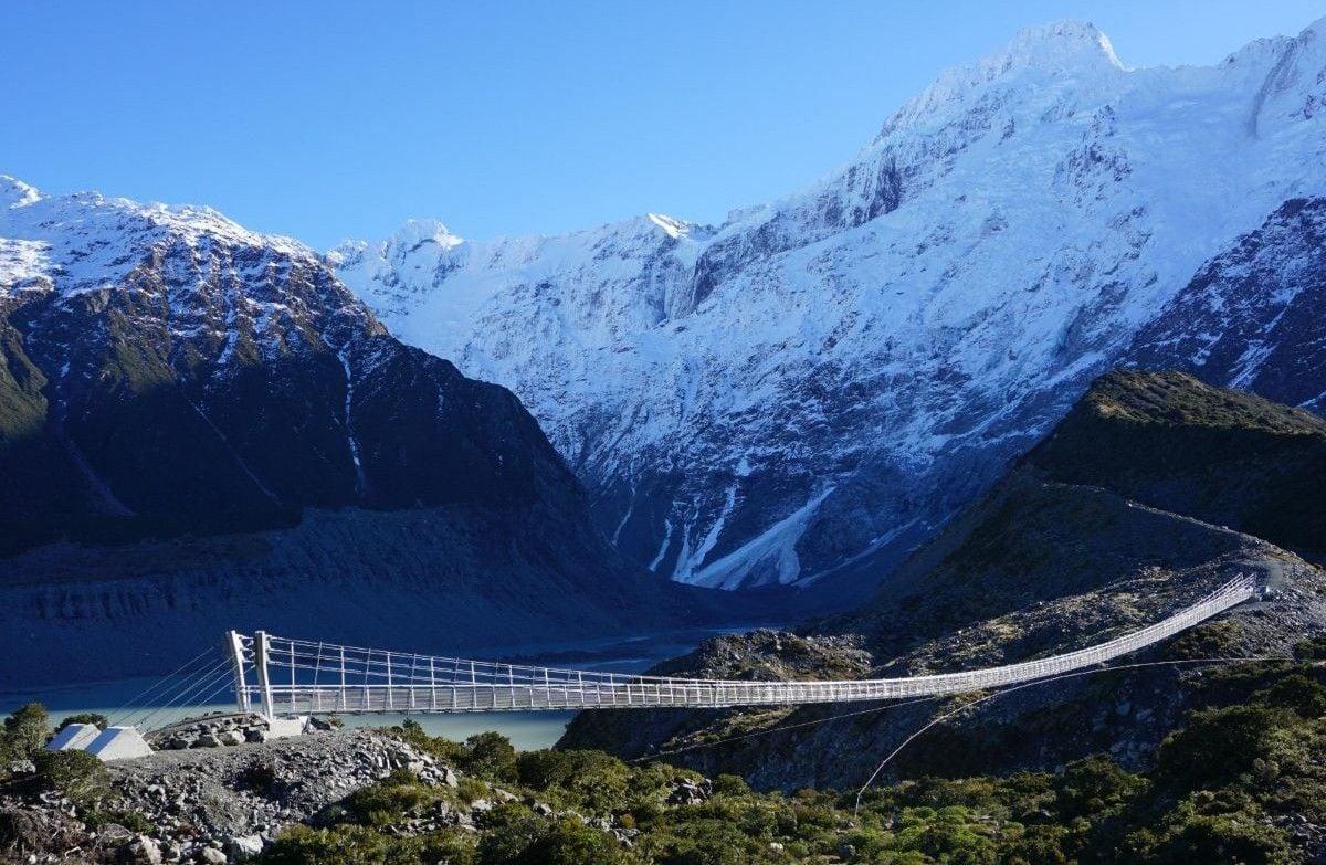
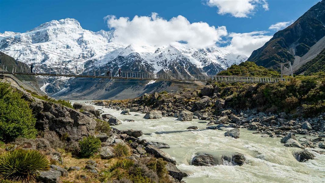
Area context. Bridge, Hooker Valley Track. Published in DOC's Hooker Valley Track guide. Photograph date not supplied; this is route-area context, not a verified trailhead or current-condition photograph.
Photo: Department of Conservation (NZ) / CC BY 4.0 / DetailsFrequently asked questions
How long does the Hooker Valley Track take?
DOC lists Hooker Valley Track as 10 km return via the same track, taking about 3 hours return. You walk from White Horse Hill car park to Hooker Lake and come back the same way.
Do you have to pay to park at Hooker Valley Track?
Yes. DOC charges $2.50 per half hour or $25 a day at White Horse Hill car park. Parking is free if you arrive and leave within 20 minutes; otherwise you must pay at the machines, which take debit and credit cards but not cash.
Is Hooker Valley still closed for bridge construction?
DOC says the new second bridge opened in July 2026. A separate notice published on 22 September limits the first bridge to 20 people at once. Follow current signs and staff instructions, and recheck DOC alerts: reopening one structure is not a guarantee of unrestricted access on your visit date.
Is the Hooker Valley Track open in winter?
Do not assume access from the season alone. DOC warns about very icy, slippery shaded sections and recommends microspikes and hiking poles in winter. Snow can close SH80, and temporary track or bridge restrictions may apply. Check DOC alerts, the weather and highway conditions before travelling.
Is drinking water available at White Horse Hill?
Confirm with DOC and bring drinking water. The winter facilities notice seen on 24 September was absent from the 1 October 2026 alert feed, but that alone does not confirm water or flushing toilets have resumed. The general route description is not a dated service-restoration notice.
Sources & official links
- 1.Hooker Valley Track— Department of Conservation
- 2.Hooker Valley Track live alert data, including 22 September 2026 bridge notice— Department of Conservation
- 3.Paid car parks— Department of Conservation
- 4.Canterbury alerts— Department of Conservation
- 5.Weather— Department of Conservation
- 6.Be prepared with the Land Safety Code— Department of Conservation
- 7.Plan My Walk— NZ Mountain Safety Council