Skip to content

New Zealand walking tracks

Coastal walks, lakeside trails and mountain hikes.

Essentials
About nearby results

Your location stays in this page's memory. It is not stored, added to links or sent to a server. Leaving or reloading clears it. Distances are straight-line estimates to reference points, not driving distances, track lengths or verified entrances. Not a navigation tool. 4 of 1581 tracks in this collection have source-checked reference points. The others have no nearby distance.

128 walking tracks in our collection

  • The 42 Traverse
    Area context · Photo: Steven Cox · CC BY 4.0

    The 42 Traverse. Published in DOC's 42 Traverse guide. Photograph date not supplied; this is route-area context, not a verified trailhead or current-condition photograph.

    Photo: Steven Cox / CC BY 4.0 / Details

    Central North Island Walking track

    42 Traverse

    Department of Conservation

    Distance
    46 km one way
    Walking time
    1 - 2 days
    Track grade
    Advanced

    Location reference not verified. Nearby distance unavailable.

    Article checked 2026-10-08. Confirm current access with the track manager.

    Route notes & sources
    • The 42 Traverse is a challenging multi-use 46 km track through the Tongariro Forest Conservation Area.
    • Slip on the 42 Traverse; First published on 18 September 2024. Last reviewed on 29 September 2026.
    • DOC directory time: 1 - 2 days. Grade: Advanced.
    • Source checked 2026-10-08; reconfirm current access and conditions with DOC.
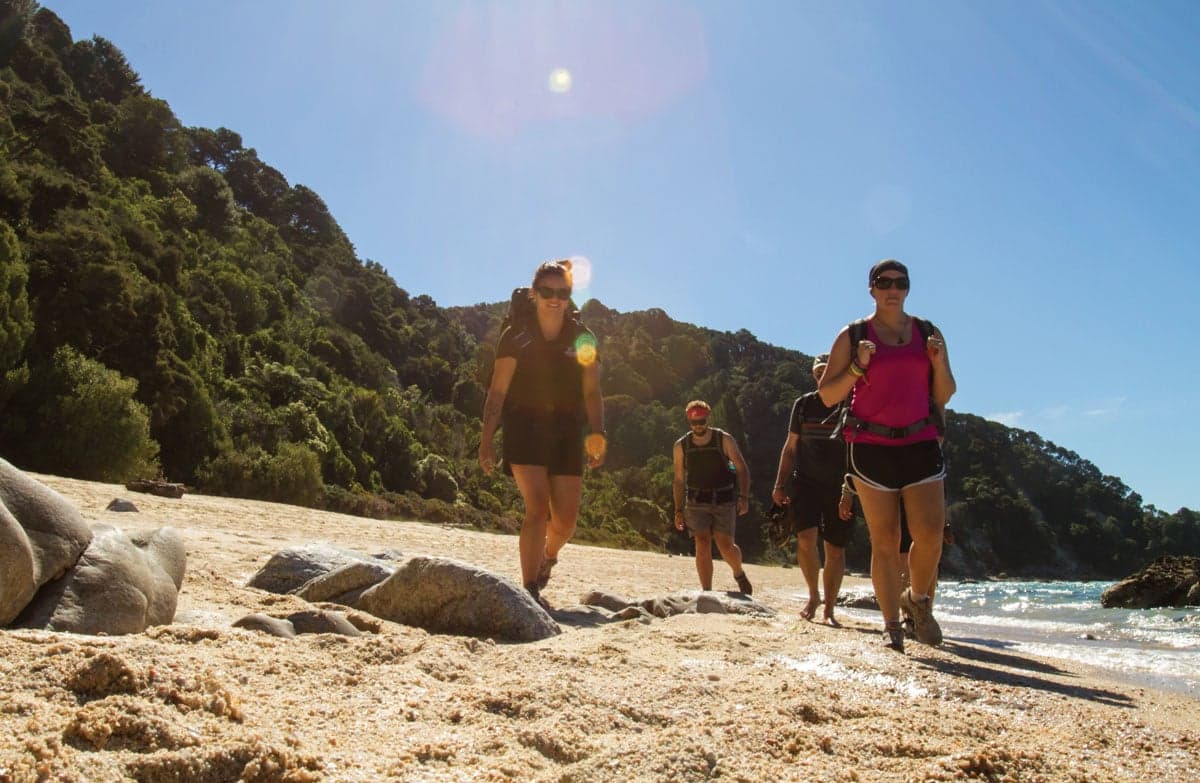
  • Walkers on beach.
    Area context · Photo: Department of Conservation (NZ) · CC BY 4.0

    Day 1: Marahau to Anchorage. Published in DOC's Abel Tasman Coast Track guide. Photograph date not supplied; this is route-area context, not a verified trailhead or current-condition photograph.

    Photo: Department of Conservation (NZ) / CC BY 4.0 / Details

    Tasman Walking track

    Abel Tasman Coast Track

    Department of Conservation

    Distance
    60 km one way
    Walking time
    3–5 days one way
    Track grade
    Intermediate tramping track

    Location reference not verified. Nearby distance unavailable.

    Article checked 2026-09-26. Confirm current access with the track manager.

    Route notes & sources
    • A multi-day coastal Great Walk whose overnight sequence must fit the compulsory Awaroa tidal crossing.
    • Awaroa: cross only in daylight, within 1 hr 30 min before to 2 hr after low tide, and only if conditions permit. Storm surge, tide height and rain can narrow the window; there is no bypass.
    • Notices checked 26 September: Bark Bay Hut's stove is unsafe and disconnected; Falls River to Torrent Bay works run 31 August to 23 October 2026; helicopter conifer control is scheduled between Bark Bay and Awaroa during 9 September to 31 October 2026. Follow staff instructions.
    • Checked 26 September 2026. Recheck DOC notices and conditions before travel; this is not a live opening report.
  • A walker seen from behind carrying a grey and orange backpack, with hills in the background.
    Illustrative photograph · Photo: Cody Black · Unsplash License

    General backpacking illustration; location unverified. This is not a photograph of the named route or evidence of its terrain, condition or difficulty.

    Photo: Cody Black / Unsplash License / Details

    Tasman Walking track

    Anatoki and Historic Kill Devil Pack Tracks

    Department of Conservation

    Distance
    Not confirmed on the checked DOC page; see individual route sections
    Walking time
    3-5 days
    Track grade
    Advanced

    Location reference not verified. Nearby distance unavailable.

    Article checked 2026-10-08. Confirm current access with the track manager.

    Route notes & sources
    • Explore beautiful beech forest, dramatic gorge scenery and rock debris dam at Lake Stanley. Trampers can also enjoy a historic hut experience in restored character huts from 1930s gold mining days.
    • Anatoki Track storm damage; First published on 12 January 2026. Last reviewed on 30 September 2026.
    • Kill Devil - Waingaro Track hut maintenance; First published on 24 September 2026.
    • Predator control in Parapara area of Kahurangi National Park; First published on 11 May 2026. Last reviewed on 24 September 2026.
    • Predator control in Cobb area of Kahurangi National Park; First published on 15 May 2026. Last reviewed on 1 July 2026.
    • DOC directory time: 3-5 days. Grade: Advanced.
    • Source checked 2026-10-08; reconfirm current access and conditions with DOC.
  • A walker seen from behind carrying a grey and orange backpack, with hills in the background.
    Illustrative photograph · Photo: Cody Black · Unsplash License

    General backpacking illustration; location unverified. This is not a photograph of the named route or evidence of its terrain, condition or difficulty.

    Photo: Cody Black / Unsplash License / Details

    Tasman Walking track

    Angelus Hut tracks and routes

    Department of Conservation

    Distance
    Not confirmed on the checked DOC page; see individual route sections
    Walking time
    2-3 days
    Track grade
    Advanced; Expert

    Location reference not verified. Nearby distance unavailable.

    Article checked 2026-10-08. Confirm current access with the track manager.

    Route notes & sources
    • Angelus Hut at 1,650 metres, sits on the shores of Lake Angelus surrounded by spectacular mountain views. From May to October in most years, the lake is frozen, snow blankets all four routes, and you may have to dig your way to the hut.
    • Damaged foot-bridge south of Cascade Track; First published on 8 July 2026. Last reviewed on 11 September 2026.
    • DOC directory time: 2-3 days. Grade: Advanced; Expert.
    • Source checked 2026-10-08; reconfirm current access and conditions with DOC.
  • A walker seen from behind carrying a grey and orange backpack, with hills in the background.
    Illustrative photograph · Photo: Cody Black · Unsplash License

    General backpacking illustration; location unverified. This is not a photograph of the named route or evidence of its terrain, condition or difficulty.

    Photo: Cody Black / Unsplash License / Details

    Wellington Walking track

    Aorangi Crossing

    Department of Conservation

    Distance
    30 km one way
    Walking time
    2-3 days
    Track grade
    Advanced

    Location reference not verified. Nearby distance unavailable.

    Article checked 2026-10-08. Confirm current access with the track manager.

    Route notes & sources
    • Cross the Aorangi Range from Putangirua Pinnacles to Cape Palliser.
    • Putangirua Pinnacles car park closed; First published on 21 February 2026. Last reviewed on 3 September 2026.
    • DOC directory time: 2-3 days. Grade: Advanced.
    • Source checked 2026-10-08; reconfirm current access and conditions with DOC.
  • A walker seen from behind carrying a grey and orange backpack, with hills in the background.
    Illustrative photograph · Photo: Cody Black · Unsplash License

    A backpack carried outdoors; location unverified. This is not a retailer or current-stock photograph. Not a verified photograph of the place or itinerary in this guide.

    Photo: Cody Black / Unsplash License / Details

    Auckland Walking track

    Aotea Track

    Department of Conservation

    Distance
    Not confirmed; check the manager's route description.
    Walking time
    2-3 days
    Track grade
    Advanced tramping track

    Location reference not verified. Nearby distance unavailable.

    Article checked 2026-09-26. Confirm current access with the track manager.

    Route notes & sources
    • A hut-based island tramp requiring the published South Fork diversion around the closed part of Kaiaraara Track.
    • Checked 2026-09-26, not a live opening guarantee. Recheck the manager's notices and signs before departure.
    • Kaiaraara Track is closed from the hut bridge to Coopers Castle Junction. DOC directs walkers between Mt Heale and Kaiaraara huts via South Fork Track.
    • South Fork streams can be dangerous after rain; do not cross after heavy rain. Historic circuit distances and stage times are not confirmed for the diversion.
  • A walker seen from behind carrying a grey and orange backpack, with hills in the background.
    Illustrative photograph · Photo: Cody Black · Unsplash License

    General backpacking illustration; location unverified. This is not a photograph of the named route or evidence of its terrain, condition or difficulty.

    Photo: Cody Black / Unsplash License / Details

    West Coast Walking track

    Arahura and Styx valleys tracks

    Department of Conservation

    Distance
    11 km one way
    Walking time
    2–4 days
    Track grade
    Advanced

    Location reference not verified. Nearby distance unavailable.

    Article checked 2026-10-08. Confirm current access with the track manager.

    Route notes & sources
    • The Arahura and Styx valleys are popular areas for tramping and hunting. The main access in both valleys is via benched formations constructed during the early gold mining days.
    • Windfall and slips on Styx Valley tracks; First published on 1 September 2026. Last reviewed on 22 September 2026.
    • DOC directory time: 2–4 days. Grade: Advanced.
    • Source checked 2026-10-08; reconfirm current access and conditions with DOC.
  • A walker seen from behind carrying a grey and orange backpack, with hills in the background.
    Illustrative photograph · Photo: Cody Black · Unsplash License

    General backpacking illustration; location unverified. This is not a photograph of the named route or evidence of its terrain, condition or difficulty.

    Photo: Cody Black / Unsplash License / Details

    Taranaki Walking track

    Around the Mountain Circuit

    Department of Conservation

    Distance
    52 km loop
    Walking time
    4–5 days loop
    Track grade
    Advanced; Expert

    Location reference not verified. Nearby distance unavailable.

    Article checked 2026-10-08. Confirm current access with the track manager.

    Route notes & sources
    • The challenging Around the Mountain Circuit offers you spectacular bush and alpine scenery. It is best tramped from October to April.
    • Around the Mountain Circuit partially closed; First published on 20 April 2023. Last reviewed on 29 September 2026.
    • Oaonui Track closed; First published on 25 July 2025. Last reviewed on 29 September 2026.
    • DOC directory time: 4–5 days loop. Grade: Advanced; Expert.
    • Source checked 2026-10-08; reconfirm current access and conditions with DOC.
  • A walker seen from behind carrying a grey and orange backpack, with hills in the background.
    Illustrative photograph · Photo: Cody Black · Unsplash License

    General backpacking illustration; location unverified. This is not a photograph of the named route or evidence of its terrain, condition or difficulty.

    Photo: Cody Black / Unsplash License / Details

    Canterbury Walking track

    Avalanche Peak - Crow River Route

    Department of Conservation

    Distance
    Not confirmed on the checked DOC page; see individual route sections
    Walking time
    2 days
    Track grade
    Expert

    Location reference not verified. Nearby distance unavailable.

    Article checked 2026-10-08. Confirm current access with the track manager.

    Route notes & sources
    • This route makes a good weekend trip, all against a backdrop of some of the best features of Arthur’s Pass National Park – glaciers, mountain peaks and ice-fed rivers. Crow Hut is at the bush edge in an alpine meadow.
    • DOC directory time: 2 days. Grade: Expert.
    • Source checked 2026-10-08; reconfirm current access and conditions with DOC.
  • A walker seen from behind carrying a grey and orange backpack, with hills in the background.
    Illustrative photograph · Photo: Cody Black · Unsplash License

    General backpacking illustration; location unverified. This is not a photograph of the named route or evidence of its terrain, condition or difficulty.

    Photo: Cody Black / Unsplash License / Details

    Canterbury Walking track

    Ball Pass Crossing

    Department of Conservation

    Distance
    Not confirmed on the checked DOC page; see individual route sections
    Walking time
    2 - 3 days
    Track grade
    Expert

    Location reference not verified. Nearby distance unavailable.

    Article checked 2026-10-08. Confirm current access with the track manager.

    Route notes & sources
    • Ball Pass Crossing is a demanding 2 - 3 day alpine route, crossing the Mount Cook Range between the Hooker and Tasman Valleys.
    • DOC directory time: 2 - 3 days. Grade: Expert.
    • Source checked 2026-10-08; reconfirm current access and conditions with DOC.
  • A walker seen from behind carrying a grey and orange backpack, with hills in the background.
    Illustrative photograph · Photo: Cody Black · Unsplash License

    General backpacking illustration; location unverified. This is not a photograph of the named route or evidence of its terrain, condition or difficulty.

    Photo: Cody Black / Unsplash License / Details

    Canterbury Walking track

    Black Hill Hut tracks

    Department of Conservation

    Distance
    Not confirmed on the checked DOC page; see individual route sections
    Walking time
    2 days
    Track grade
    Advanced

    Location reference not verified. Nearby distance unavailable.

    Article checked 2026-10-08. Confirm current access with the track manager.

    Route notes & sources
    • Walk to Black Hill Hut on one of these tracks or combine them to make a circuit.
    • DOC directory time: 2 days. Grade: Advanced.
    • Source checked 2026-10-08; reconfirm current access and conditions with DOC.
  • A walker seen from behind carrying a grey and orange backpack, with hills in the background.
    Illustrative photograph · Photo: Cody Black · Unsplash License

    General backpacking illustration; location unverified. This is not a photograph of the named route or evidence of its terrain, condition or difficulty.

    Photo: Cody Black / Unsplash License / Details

    Central North Island Walking track

    Boyd, Oamaru and Cascade Hut tracks

    Department of Conservation

    Distance
    Not confirmed on the checked DOC page; see individual route sections
    Walking time
    2 - 4 days
    Track grade
    Advanced

    Location reference not verified. Nearby distance unavailable.

    Article checked 2026-10-08. Confirm current access with the track manager.

    Route notes & sources
    • Combine these tracks for a multi-night tramp with lush beech forest, river crossings and wildlife. Several huts and road ends allow you to tailor a trip to suit.
    • DOC directory time: 2 - 4 days. Grade: Advanced.
    • Source checked 2026-10-08; reconfirm current access and conditions with DOC.
  • A walker seen from behind carrying a grey and orange backpack, with hills in the background.
    Illustrative photograph · Photo: Cody Black · Unsplash License

    General backpacking illustration; location unverified. This is not a photograph of the named route or evidence of its terrain, condition or difficulty.

    Photo: Cody Black / Unsplash License / Details

    Otago Walking track

    Breast Hill Track

    Department of Conservation

    Distance
    Not confirmed on the checked DOC page; see individual route sections
    Walking time
    3 days
    Track grade
    Advanced

    Location reference not verified. Nearby distance unavailable.

    Article checked 2026-10-08. Confirm current access with the track manager.

    Route notes & sources
    • This tramping track links Ahuriri Valley and Lake Hāwea via Mount Martha Saddle, Tīmaru River, and Breast Hill. It's a demanding tramp for experienced hikers. This track is part of Te Araroa Trail.
    • DOC directory time: 3 days. Grade: Advanced.
    • Source checked 2026-10-08; reconfirm current access and conditions with DOC.
  • A walker seen from behind carrying a grey and orange backpack, with hills in the background.
    Illustrative photograph · Photo: Cody Black · Unsplash License

    General backpacking illustration; location unverified. This is not a photograph of the named route or evidence of its terrain, condition or difficulty.

    Photo: Cody Black / Unsplash License / Details

    Canterbury Walking track

    Bush Stream and Camp Stream tracks

    Department of Conservation

    Distance
    Not confirmed on the checked DOC page; see individual route sections
    Walking time
    2-3 days
    Track grade
    Advanced; Expert

    Location reference not verified. Nearby distance unavailable.

    Article checked 2026-10-08. Confirm current access with the track manager.

    Route notes & sources
    • These tracks link the Rangitata River valley near Mesopotamia with Round Hill by Lake Tekapo. They are part of Te Araroa.
    • Predator control operation for part of the Te Kahui Kaupeka Conservation Park; First published on 1 May 2026. Last reviewed on 15 May 2026.
    • DOC directory time: 2-3 days. Grade: Advanced; Expert.
    • Source checked 2026-10-08; reconfirm current access and conditions with DOC.
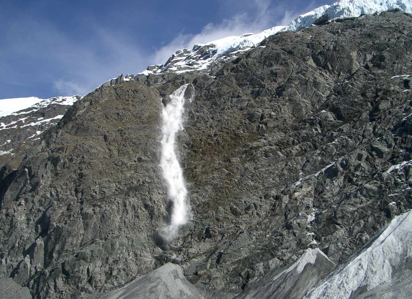
  • Avalanche on Cascade Saddle.
    Area context · Photo: Eiji Kitai · CC BY 4.0

    Avalanche on the Cascade Saddle Route. Published in DOC's Cascade Saddle Route guide. Photograph date not supplied; this is route-area context, not a verified trailhead or current-condition photograph.

    Photo: Eiji Kitai / CC BY 4.0 / Details

    Otago Walking track

    Cascade Saddle Route

    Department of Conservation

    Distance
    Not confirmed on the checked DOC page; see individual route sections
    Walking time
    4-5 days one way
    Track grade
    Expert

    Location reference not verified. Nearby distance unavailable.

    Article checked 2026-10-08. Confirm current access with the track manager.

    Route notes & sources
    • The Cascade Saddle Route is an alpine crossing recommended for experienced trampers as a fine weather, summer route.
    • Slip on Dart track – exit via Rees track only; First published on 12 January 2026. Last reviewed on 3 August 2026.
    • Upper Snowy Creek bridge removed; First published on 18 May 2026.
    • DOC directory time: 4-5 days one way. Grade: Expert.
    • Source checked 2026-10-08; reconfirm current access and conditions with DOC.
  • A walker seen from behind carrying a grey and orange backpack, with hills in the background.
    Illustrative photograph · Photo: Cody Black · Unsplash License

    General backpacking illustration; location unverified. This is not a photograph of the named route or evidence of its terrain, condition or difficulty.

    Photo: Cody Black / Unsplash License / Details

    Canterbury Walking track

    Casey Saddle - Binser Saddle Route

    Department of Conservation

    Distance
    Not confirmed on the checked DOC page; see individual route sections
    Walking time
    2 days
    Track grade
    Advanced

    Location reference not verified. Nearby distance unavailable.

    Article checked 2026-10-08. Confirm current access with the track manager.

    Route notes & sources
    • This is a pleasant 2 day tramp, crossing easy saddles on well-defined tracks through open mountain beech forest.
    • DOC directory time: 2 days. Grade: Advanced.
    • Source checked 2026-10-08; reconfirm current access and conditions with DOC.
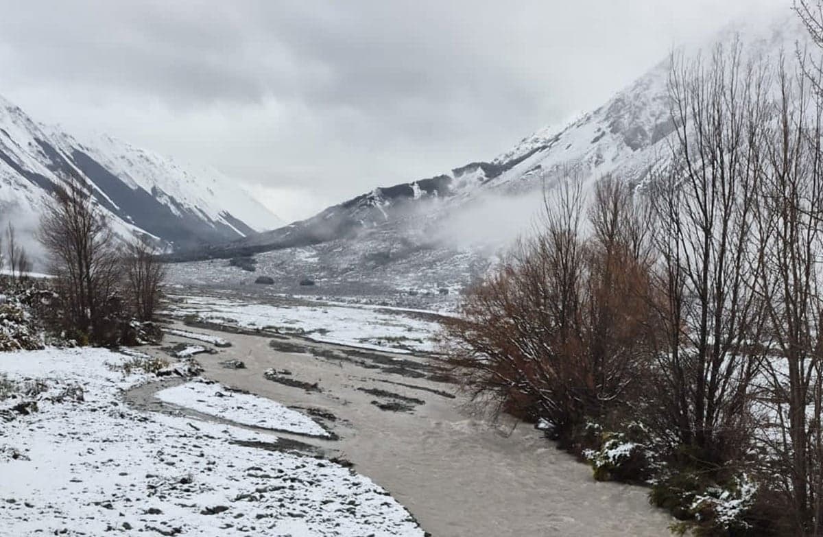
  • An icy snow-covered mountain landscape with a small river running through.
    Area context · Photo: Department of Conservation (NZ) · CC BY 4.0

    Cass River in flood. Published in DOC's Cass-Lagoon Saddle Track guide. Photograph date not supplied; this is route-area context, not a verified trailhead or current-condition photograph.

    Photo: Department of Conservation (NZ) / CC BY 4.0 / Details

    Canterbury Walking track

    Cass-Lagoon Saddle Track

    Department of Conservation

    Distance
    Not confirmed on the checked DOC page; see individual route sections
    Walking time
    2 - 3 days
    Track grade
    Advanced; Expert

    Location reference not verified. Nearby distance unavailable.

    Article checked 2026-10-08. Confirm current access with the track manager.

    Route notes & sources
    • Cass - Lagoon Saddle in Craigieburn Forest Park is a two-day round trip suitable for fit, moderately experienced and equipped parties. This track is part of Te Araroa Trail.
    • Hamilton Hut closed; First published on 5 October 2026.
    • DOC directory time: 2 - 3 days. Grade: Advanced; Expert.
    • Source checked 2026-10-08; reconfirm current access and conditions with DOC.
  • A walker seen from behind carrying a grey and orange backpack, with hills in the background.
    Illustrative photograph · Photo: Cody Black · Unsplash License

    General backpacking illustration; location unverified. This is not a photograph of the named route or evidence of its terrain, condition or difficulty.

    Photo: Cody Black / Unsplash License / Details

    Marlborough Walking track

    Chalice–Goulter Track

    Department of Conservation

    Distance
    Not confirmed on the checked DOC page; see individual route sections
    Walking time
    2-3 days
    Track grade
    Advanced

    Location reference not verified. Nearby distance unavailable.

    Article checked 2026-10-08. Confirm current access with the track manager.

    Route notes & sources
    • Follow the Goulter River from Lake Chalice.
    • DOC directory time: 2-3 days. Grade: Advanced.
    • Source checked 2026-10-08; reconfirm current access and conditions with DOC.
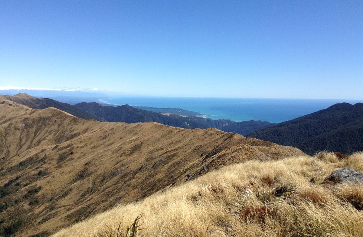
  • View from Croesus Track.
    Area context · Photo: Ben Williams · CC BY 2.0

    View from Croesus Track. Published in DOC's Croesus Track guide. Photograph date not supplied; this is route-area context, not a verified trailhead or current-condition photograph.

    Photo: Ben Williams / CC BY 2.0 / Details

    West Coast Walking track

    Croesus Track

    Department of Conservation

    Distance
    22.1 km one way
    Walking time
    1–2 days one way
    Track grade
    Advanced

    Location reference not verified. Nearby distance unavailable.

    Article checked 2026-10-08. Confirm current access with the track manager.

    Route notes & sources
    • Croesus Track is one of the finest surviving examples of a miners' track on the West Coast. Croesus Track is part of Paparoa Track and a premier mountain bike ride.
    • DOC directory time: 1–2 days one way. Grade: Advanced.
    • Source checked 2026-10-08; reconfirm current access and conditions with DOC.
  • A walker seen from behind carrying a grey and orange backpack, with hills in the background.
    Illustrative photograph · Photo: Cody Black · Unsplash License

    General backpacking illustration; location unverified. This is not a photograph of the named route or evidence of its terrain, condition or difficulty.

    Photo: Cody Black / Unsplash License / Details

    Otago Walking track

    Dingle Burn Track

    Department of Conservation

    Distance
    49 km one way
    Walking time
    3 - 4 days
    Track grade
    Advanced

    Location reference not verified. Nearby distance unavailable.

    Article checked 2026-10-08. Confirm current access with the track manager.

    Route notes & sources
    • A three to four-day tramping track through an upland valley in Hāwea Conservation Park. It also provides access to Ahuriri Conservation Park. The track can be walked from either end.
    • DOC directory time: 3 - 4 days. Grade: Advanced.
    • Source checked 2026-10-08; reconfirm current access and conditions with DOC.
  • A walker seen from behind carrying a grey and orange backpack, with hills in the background.
    Illustrative photograph · Photo: Cody Black · Unsplash License

    General backpacking illustration; location unverified. This is not a photograph of the named route or evidence of its terrain, condition or difficulty.

    Photo: Cody Black / Unsplash License / Details

    Tasman Walking track

    Douglas Range

    Department of Conservation

    Distance
    Not confirmed on the checked DOC page; see individual route sections
    Walking time
    5-7 days
    Track grade
    Expert

    Location reference not verified. Nearby distance unavailable.

    Article checked 2026-10-08. Confirm current access with the track manager.

    Route notes & sources
    • The route links the Aorere and Cobb valleys in Golden Bay. It is unmarked and suitable for trampers with a high degree of fitness and off-track experience.
    • Anatoki Track storm damage; First published on 12 January 2026. Last reviewed on 30 September 2026.
    • Predator control in Parapara area of Kahurangi National Park; First published on 11 May 2026. Last reviewed on 24 September 2026.
    • DOC directory time: 5-7 days. Grade: Expert.
    • Source checked 2026-10-08; reconfirm current access and conditions with DOC.
  • Dundas Hut.
    Area context · Photo: Julian Baker · CC BY 4.0

    Dundas Hut. Published in DOC's Dundas Circuit guide. Photograph date not supplied; this is route-area context, not a verified trailhead or current-condition photograph.

    Photo: Julian Baker / CC BY 4.0 / Details

    Wellington Walking track

    Dundas Circuit

    Department of Conservation

    Distance
    Not confirmed on the checked DOC page; see individual route sections
    Walking time
    3 days
    Track grade
    Advanced; Expert

    Location reference not verified. Nearby distance unavailable.

    Article checked 2026-10-08. Confirm current access with the track manager.

    Route notes & sources
    • A challenging loop for experienced, well-equipped backcountry trampers in the northern Tararua Forest Park.
    • DOC directory time: 3 days. Grade: Advanced; Expert.
    • Source checked 2026-10-08; reconfirm current access and conditions with DOC.
  • A walker seen from behind carrying a grey and orange backpack, with hills in the background.
    Illustrative photograph · Photo: Cody Black · Unsplash License

    General backpacking illustration; location unverified. This is not a photograph of the named route or evidence of its terrain, condition or difficulty.

    Photo: Cody Black / Unsplash License / Details

    Fiordland Walking track

    Dusky Track

    Department of Conservation

    Distance
    84 km one way
    Walking time
    8- 10 days
    Track grade
    Advanced

    Location reference not verified. Nearby distance unavailable.

    Article checked 2026-10-08. Confirm current access with the track manager.

    Route notes & sources
    • This difficult tramping track between Lake Hauroko and Lake Manapouri offers huge lakes, gushing rivers, vast forested valleys and lots of mud for experienced and well equipped trampers.
    • DOC directory time: 8- 10 days. Grade: Advanced.
    • Source checked 2026-10-08; reconfirm current access and conditions with DOC.
  • A walker seen from behind carrying a grey and orange backpack, with hills in the background.
    Illustrative photograph · Photo: Cody Black · Unsplash License

    General backpacking illustration; location unverified. This is not a photograph of the named route or evidence of its terrain, condition or difficulty.

    Photo: Cody Black / Unsplash License / Details

    Canterbury Walking track

    East Ahuriri Track

    Department of Conservation

    Distance
    Not confirmed on the checked DOC page; see individual route sections
    Walking time
    1 - 2 days
    Track grade
    Advanced

    Location reference not verified. Nearby distance unavailable.

    Article checked 2026-10-08. Confirm current access with the track manager.

    Route notes & sources
    • East Ahuriri Track is part of Te Araroa Trail.
    • DOC directory time: 1 - 2 days. Grade: Advanced.
    • Source checked 2026-10-08; reconfirm current access and conditions with DOC.

DOC routes and local favourites

1581 route listings across 19 regions, including all 1571 unique entries in the DOC walking directory checked 2026-10-08. Some DOC listings group several walks. Regional comparisons, skills and booking guides are separate.

DOC walking directory Hiking guides

Walking times, distances and grades retain their source qualifications. Source checks are not live access reports; confirm the route, season and current conditions with its manager.

Choosing a walking track Conditions & alerts