Skip to content

New Zealand walking tracks

Coastal walks, lakeside trails and mountain hikes.

Essentials
About nearby results

Your location stays in this page's memory. It is not stored, added to links or sent to a server. Leaving or reloading clears it. Distances are straight-line estimates to reference points, not driving distances, track lengths or verified entrances. Not a navigation tool. 4 of 1581 tracks in this collection have source-checked reference points. The others have no nearby distance.

680 walking tracks in our collection

  • A walker seen from behind carrying a grey and orange backpack, with hills in the background.
    Illustrative photograph · Photo: Cody Black · Unsplash License

    General backpacking illustration; location unverified. This is not a photograph of the named route or evidence of its terrain, condition or difficulty.

    Photo: Cody Black / Unsplash License / Details

    Hawke's Bay Walking track

    A’Deanes Bush Walk

    Department of Conservation

    Distance
    1 km loop
    Walking time
    30 min
    Track grade
    Easy

    Location reference not verified. Nearby distance unavailable.

    Article checked 2026-10-08. Confirm current access with the track manager.

    Route notes & sources
    • Take a walk through A’Deanes Bush Scenic Reserve in beautiful native forest dominated by mataī and kahikatea as well as a large tōtara tree. The reserve is on a flat river terrace.
    • DOC directory time: 30 min. Grade: Easy.
    • Source checked 2026-10-08; reconfirm current access and conditions with DOC.
  • A walker seen from behind carrying a grey and orange backpack, with hills in the background.
    Illustrative photograph · Photo: Cody Black · Unsplash License

    General backpacking illustration; location unverified. This is not a photograph of the named route or evidence of its terrain, condition or difficulty.

    Photo: Cody Black / Unsplash License / Details

    Marlborough Walking track

    Acheron Lookout Loop Walk

    Department of Conservation

    Distance
    1 km loop
    Walking time
    20 min
    Track grade
    Easy

    Location reference not verified. Nearby distance unavailable.

    Article checked 2026-10-08. Confirm current access with the track manager.

    Route notes & sources
    • A short loop walk with views that starts from Acheron Accommodation House.
    • DOC directory time: 20 min. Grade: Easy.
    • Source checked 2026-10-08; reconfirm current access and conditions with DOC.
  • A walker seen from behind carrying a grey and orange backpack, with hills in the background.
    Illustrative photograph · Photo: Cody Black · Unsplash License

    General backpacking illustration; location unverified. This is not a photograph of the named route or evidence of its terrain, condition or difficulty.

    Photo: Cody Black / Unsplash License / Details

    Canterbury Walking track

    Acland Falls Track

    Department of Conservation

    Distance
    600-800 m one way
    Walking time
    25-30 min
    Track grade
    Easy

    Location reference not verified. Nearby distance unavailable.

    Article checked 2026-10-08. Confirm current access with the track manager.

    Route notes & sources
    • This track takes you to the 14 m high Acland Falls from Clarke Flat or Te Wanahu Flat.
    • DOC directory time: 25-30 min. Grade: Easy.
    • Source checked 2026-10-08; reconfirm current access and conditions with DOC.
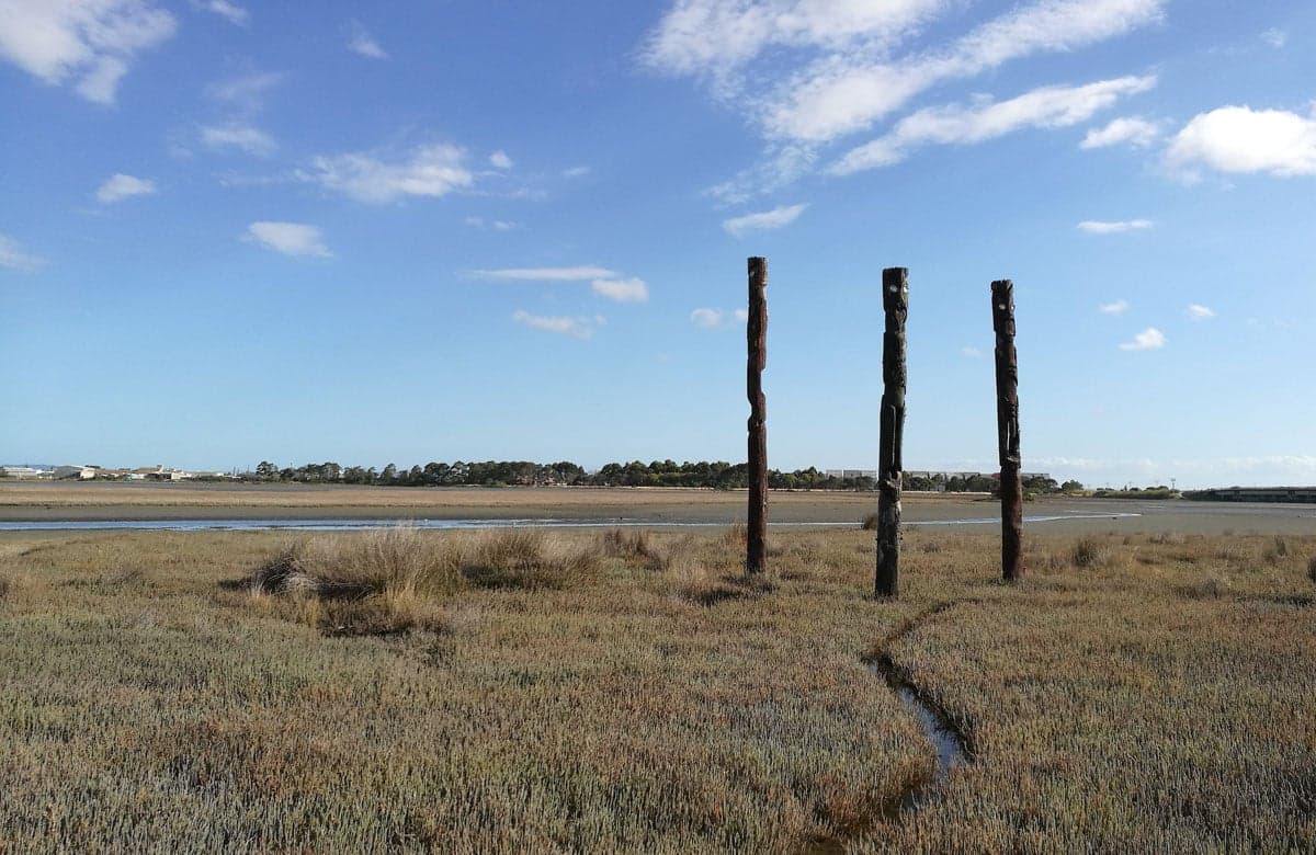
  • Pou at Ahuriri Estuary.
    Area context · Photo: Benhi Dixon · CC BY-SA 4.0

    Pou at Ahuriri Estuary, Napier. Published in DOC's Ahuriri Estuary Walking Track guide. Photograph date not supplied; this is route-area context, not a verified trailhead or current-condition photograph.

    Photo: Benhi Dixon / CC BY-SA 4.0 / Details

    Hawke's Bay Walking track

    Ahuriri Estuary Walking Track

    Department of Conservation

    Distance
    2.8 km one way
    Walking time
    1 hr
    Track grade
    Easy

    Location reference not verified. Nearby distance unavailable.

    Article checked 2026-10-08. Confirm current access with the track manager.

    Route notes & sources
    • View a community of wading birds, fish, mud dwellers and aquatic plant life from the estuary track and boardwalk. Over 70 species of resident and migratory waterbirds use the estuary as a feeding and resting area.
    • DOC directory time: 1 hr. Grade: Easy.
    • Source checked 2026-10-08; reconfirm current access and conditions with DOC.
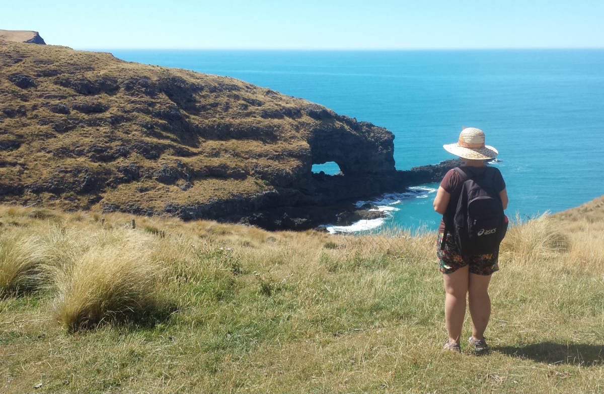
  • Akaroa head.
    Area context · Photo: Michael Smeaton · CC BY 4.0

    Akaroa head. Published in DOC's Akaroa Head Scenic Reserve walk guide. Photograph date not supplied; this is route-area context, not a verified trailhead or current-condition photograph.

    Photo: Michael Smeaton / CC BY 4.0 / Details

    Canterbury Walking track

    Akaroa Head Scenic Reserve walk

    Department of Conservation

    Distance
    1 km return via same track
    Walking time
    40 min return
    Track grade
    Easy

    Location reference not verified. Nearby distance unavailable.

    Article checked 2026-10-08. Confirm current access with the track manager.

    Route notes & sources
    • Easily accessed from Akaroa with a 4WD, this short walk includes the relics of a rich history, dramatic views and stunning wildlife.
    • DOC directory time: 40 min return. Grade: Easy.
    • Source checked 2026-10-08; reconfirm current access and conditions with DOC.
  • A walker seen from behind carrying a grey and orange backpack, with hills in the background.
    Illustrative photograph · Photo: Cody Black · Unsplash License

    General backpacking illustration; location unverified. This is not a photograph of the named route or evidence of its terrain, condition or difficulty.

    Photo: Cody Black / Unsplash License / Details

    West Coast Walking track

    Alborns Walk

    Department of Conservation

    Distance
    2.7 km loop
    Walking time
    1 hr 30 min
    Track grade
    Easy

    Location reference not verified. Nearby distance unavailable.

    Article checked 2026-10-08. Confirm current access with the track manager.

    Route notes & sources
    • Walk through old mine workings on this well-graded loop track.
    • DOC directory time: 1 hr 30 min. Grade: Easy.
    • Source checked 2026-10-08; reconfirm current access and conditions with DOC.
  • A walker seen from behind carrying a grey and orange backpack, with hills in the background.
    Illustrative photograph · Photo: Cody Black · Unsplash License

    General backpacking illustration; location unverified. This is not a photograph of the named route or evidence of its terrain, condition or difficulty.

    Photo: Cody Black / Unsplash License / Details

    Otago Walking track

    Allans Beach Walking Track

    Department of Conservation

    Distance
    500 m return via same track
    Walking time
    10 min
    Track grade
    Easy

    Location reference not verified. Nearby distance unavailable.

    Article checked 2026-10-08. Confirm current access with the track manager.

    Route notes & sources
    • It's only a 5-minute walk through dunes to this superb white sandy beach, filled with amazing wildlife that call this area home.
    • DOC directory time: 10 min. Grade: Easy.
    • Source checked 2026-10-08; reconfirm current access and conditions with DOC.
  • A walker seen from behind carrying a grey and orange backpack, with hills in the background.
    Illustrative photograph · Photo: Cody Black · Unsplash License

    General backpacking illustration; location unverified. This is not a photograph of the named route or evidence of its terrain, condition or difficulty.

    Photo: Cody Black / Unsplash License / Details

    West Coast Walking track

    Alpine Nature Walk

    Department of Conservation

    Distance
    800 m loop
    Walking time
    20 min
    Track grade
    Easiest

    Location reference not verified. Nearby distance unavailable.

    Article checked 2026-10-08. Confirm current access with the track manager.

    Route notes & sources
    • The Alpine Nature Walk in Lewis Pass provides an opportunity to break up a long drive while enjoying spectacular scenery and beech forest.
    • DOC directory time: 20 min. Grade: Easiest.
    • Source checked 2026-10-08; reconfirm current access and conditions with DOC.
  • A walker seen from behind carrying a grey and orange backpack, with hills in the background.
    Illustrative photograph · Photo: Cody Black · Unsplash License

    General backpacking illustration; location unverified. This is not a photograph of the named route or evidence of its terrain, condition or difficulty.

    Photo: Cody Black / Unsplash License / Details

    Taranaki Walking track

    Ambury Monument Walk

    Department of Conservation

    Distance
    380 m one way
    Walking time
    10 min
    Track grade
    Easiest

    Location reference not verified. Nearby distance unavailable.

    Article checked 2026-10-08. Confirm current access with the track manager.

    Route notes & sources
    • Walk to the Ambury Monument, a memorial to climber Arthur Ambury who gave his life in 1918 in a heroic attempt to save his climbing partner.
    • DOC directory time: 10 min. Grade: Easiest.
    • Source checked 2026-10-08; reconfirm current access and conditions with DOC.
  • A walker seen from behind carrying a grey and orange backpack, with hills in the background.
    Illustrative photograph · Photo: Cody Black · Unsplash License

    General backpacking illustration; location unverified. This is not a photograph of the named route or evidence of its terrain, condition or difficulty.

    Photo: Cody Black / Unsplash License / Details

    West Coast Walking track

    Amethyst Rimu Walk

    Department of Conservation

    Distance
    2.5 km return via same track
    Walking time
    1 hr
    Track grade
    Easy

    Location reference not verified. Nearby distance unavailable.

    Article checked 2026-10-08. Confirm current access with the track manager.

    Route notes & sources
    • View some of the largest rimu trees still standing in New Zealand on this track.
    • DOC directory time: 1 hr. Grade: Easy.
    • Source checked 2026-10-08; reconfirm current access and conditions with DOC.
  • A walker seen from behind carrying a grey and orange backpack, with hills in the background.
    Illustrative photograph · Photo: Cody Black · Unsplash License

    General backpacking illustration; location unverified. This is not a photograph of the named route or evidence of its terrain, condition or difficulty.

    Photo: Cody Black / Unsplash License / Details

    Gisborne Walking track

    Anaura Bay Walkway

    Department of Conservation

    Distance
    4.5 km loop
    Walking time
    2 hr
    Track grade
    Easy

    Location reference not verified. Nearby distance unavailable.

    Article checked 2026-10-08. Confirm current access with the track manager.

    Route notes & sources
    • This track passes through coastal forest, pine-clad valleys and dense native bush - with a fairly easy grade it's suitable for children, although some climbing is required and there are a few steep places.
    • Anaura Bay Walkway partial closure; First published on 25 March 2022. Last reviewed on 10 August 2026.
    • DOC directory time: 2 hr. Grade: Easy.
    • Source checked 2026-10-08; reconfirm current access and conditions with DOC.
  • A walker seen from behind carrying a grey and orange backpack, with hills in the background.
    Illustrative photograph · Photo: Cody Black · Unsplash License

    General backpacking illustration; location unverified. This is not a photograph of the named route or evidence of its terrain, condition or difficulty.

    Photo: Cody Black / Unsplash License / Details

    Bay of Plenty Walking track

    Aongatete Link Track

    Department of Conservation

    Distance
    2.9 km (to North-South Track) one way
    Walking time
    1 hr 30 min one way
    Track grade
    Easy

    Location reference not verified. Nearby distance unavailable.

    Article checked 2026-10-08. Confirm current access with the track manager.

    Route notes & sources
    • This track leads to some attractive swimming holes that are worth exploring and can be used as an alternative route to North South Track.
    • DOC directory time: 1 hr 30 min one way. Grade: Easy.
    • Source checked 2026-10-08; reconfirm current access and conditions with DOC.
  • A walker seen from behind carrying a grey and orange backpack, with hills in the background.
    Illustrative photograph · Photo: Cody Black · Unsplash License

    General backpacking illustration; location unverified. This is not a photograph of the named route or evidence of its terrain, condition or difficulty.

    Photo: Cody Black / Unsplash License / Details

    Bay of Plenty Walking track

    Aongatete Nature Trail

    Department of Conservation

    Distance
    640 m loop
    Walking time
    15 min
    Track grade
    Easiest

    Location reference not verified. Nearby distance unavailable.

    Article checked 2026-10-08. Confirm current access with the track manager.

    Route notes & sources
    • This family-friendly loop takes you through a lowland forest area. There are interpretative signs about the local environment.
    • DOC directory time: 15 min. Grade: Easiest.
    • Source checked 2026-10-08; reconfirm current access and conditions with DOC.
  • A walker seen from behind carrying a grey and orange backpack, with hills in the background.
    Illustrative photograph · Photo: Cody Black · Unsplash License

    General backpacking illustration; location unverified. This is not a photograph of the named route or evidence of its terrain, condition or difficulty.

    Photo: Cody Black / Unsplash License / Details

    Bay of Plenty Walking track

    Aongatete Short Loop Walk

    Department of Conservation

    Distance
    2.4 km loop
    Walking time
    1 hr return
    Track grade
    Easy

    Location reference not verified. Nearby distance unavailable.

    Article checked 2026-10-08. Confirm current access with the track manager.

    Route notes & sources
    • A 1-hour loop walk through attractive lowland forest.
    • DOC directory time: 1 hr return. Grade: Easy.
    • Source checked 2026-10-08; reconfirm current access and conditions with DOC.
  • A walker seen from behind carrying a grey and orange backpack, with hills in the background.
    Illustrative photograph · Photo: Cody Black · Unsplash License

    General backpacking illustration; location unverified. This is not a photograph of the named route or evidence of its terrain, condition or difficulty.

    Photo: Cody Black / Unsplash License / Details

    Tasman Walking track

    Aorere Goldfields Track

    Department of Conservation

    Distance
    Not confirmed on the checked DOC page; see individual route sections
    Walking time
    3 hr loop
    Track grade
    Easy

    Location reference not verified. Nearby distance unavailable.

    Article checked 2026-10-08. Confirm current access with the track manager.

    Route notes & sources
    • Aorere Goldfields Track is a 3-hour loop, which gives you access to explore some of the more accessible gold-mining remnants.
    • DOC directory time: 3 hr loop. Grade: Easy.
    • Source checked 2026-10-08; reconfirm current access and conditions with DOC.
  • A walker seen from behind carrying a grey and orange backpack, with hills in the background.
    Illustrative photograph · Photo: Cody Black · Unsplash License

    General backpacking illustration; location unverified. This is not a photograph of the named route or evidence of its terrain, condition or difficulty.

    Photo: Cody Black / Unsplash License / Details

    Otago Walking track

    Aramoana Saltmarsh Walking Track

    Department of Conservation

    Distance
    1 km return via same track
    Walking time
    20 to 30 min
    Track grade
    Easy

    Location reference not verified. Nearby distance unavailable.

    Article checked 2026-10-08. Confirm current access with the track manager.

    Route notes & sources
    • Experience Aramoana’s unique saltmarshes. This short boardwalk track offers gorgeous harbour views. It is suitable for all ages and abilities.
    • DOC directory time: 20 to 30 min. Grade: Easy.
    • Source checked 2026-10-08; reconfirm current access and conditions with DOC.
  • A walker seen from behind carrying a grey and orange backpack, with hills in the background.
    Illustrative photograph · Photo: Cody Black · Unsplash License

    General backpacking illustration; location unverified. This is not a photograph of the named route or evidence of its terrain, condition or difficulty.

    Photo: Cody Black / Unsplash License / Details

    Central North Island Walking track

    Aratiatia Rapids Lookout Walk

    Department of Conservation

    Distance
    620 m return via same track
    Walking time
    10 min
    Track grade
    Easiest

    Location reference not verified. Nearby distance unavailable.

    Article checked 2026-10-08. Confirm current access with the track manager.

    Route notes & sources
    • Several times a day the gates at the Aratiatia dam are opened to release the full flow of the river - a spectacular sight from the lookout points. Stay safe and keep clear of the rapids at all times.
    • DOC directory time: 10 min . Grade: Easiest.
    • Source checked 2026-10-08; reconfirm current access and conditions with DOC.
  • A walker seen from behind carrying a grey and orange backpack, with hills in the background.
    Illustrative photograph · Photo: Cody Black · Unsplash License

    General backpacking illustration; location unverified. This is not a photograph of the named route or evidence of its terrain, condition or difficulty.

    Photo: Cody Black / Unsplash License / Details

    Otago Walking track

    Arawata Bridle Track

    Department of Conservation

    Distance
    1.4 km one way
    Walking time
    45 min one way
    Track grade
    Easy

    Location reference not verified. Nearby distance unavailable.

    Article checked 2026-10-08. Confirm current access with the track manager.

    Route notes & sources
    • The Arawata Bridle Track follows part of the original bridle trail that connected Queenstown and Glenorchy.
    • DOC directory time: 45 min one way. Grade: Easy.
    • Source checked 2026-10-08; reconfirm current access and conditions with DOC.
  • A walker seen from behind carrying a grey and orange backpack, with hills in the background.
    Illustrative photograph · Photo: Cody Black · Unsplash License

    General backpacking illustration; location unverified. This is not a photograph of the named route or evidence of its terrain, condition or difficulty.

    Photo: Cody Black / Unsplash License / Details

    Marlborough Walking track

    Archer Track

    Department of Conservation

    Distance
    9 km one way
    Walking time
    3 hr 30 min
    Track grade
    Easy

    Location reference not verified. Nearby distance unavailable.

    Article checked 2026-10-08. Confirm current access with the track manager.

    Route notes & sources
    • This walking and mountain biking track passes through native and pine forest from Penzance Bay to Elaine Bay.
    • DOC directory time: 3 hr 30 min. Grade: Easy.
    • Source checked 2026-10-08; reconfirm current access and conditions with DOC.
  • A walker seen from behind carrying a grey and orange backpack, with hills in the background.
    Illustrative photograph · Photo: Cody Black · Unsplash License

    General backpacking illustration; location unverified. This is not a photograph of the named route or evidence of its terrain, condition or difficulty.

    Photo: Cody Black / Unsplash License / Details

    Wellington Walking track

    Arcus Loop Track

    Department of Conservation

    Distance
    3.5 km loop
    Walking time
    50 min
    Track grade
    Easy

    Location reference not verified. Nearby distance unavailable.

    Article checked 2026-10-08. Confirm current access with the track manager.

    Route notes & sources
    • This is an easy loop track near Ōtaki. This track is part of Te Araroa Trail.
    • Predator control Tararua Forest Park; First published on 3 March 2026. Last reviewed on 21 May 2026.
    • DOC directory time: 50 min. Grade: Easy.
    • Source checked 2026-10-08; reconfirm current access and conditions with DOC.
  • A walker seen from behind carrying a grey and orange backpack, with hills in the background.
    Illustrative photograph · Photo: Cody Black · Unsplash License

    General backpacking illustration; location unverified. This is not a photograph of the named route or evidence of its terrain, condition or difficulty.

    Photo: Cody Black / Unsplash License / Details

    West Coast Walking track

    Arnold River Dam Walk

    Department of Conservation

    Distance
    2.1 km loop
    Walking time
    1 hr
    Track grade
    Easiest

    Location reference not verified. Nearby distance unavailable.

    Article checked 2026-10-08. Confirm current access with the track manager.

    Route notes & sources
    • The track passes a hydroelectric power station, a stand of kahikateamiro-rimu forest and views over the dam.
    • DOC directory time: 1 hr. Grade: Easiest.
    • Source checked 2026-10-08; reconfirm current access and conditions with DOC.
  • A walker seen from behind carrying a grey and orange backpack, with hills in the background.
    Illustrative photograph · Photo: Cody Black · Unsplash License

    General backpacking illustration; location unverified. This is not a photograph of the named route or evidence of its terrain, condition or difficulty.

    Photo: Cody Black / Unsplash License / Details

    Gisborne Walking track

    Arohaki Lagoon Track

    Department of Conservation

    Distance
    6 km return via same track
    Walking time
    3 hr
    Track grade
    Easy

    Location reference not verified. Nearby distance unavailable.

    Article checked 2026-10-08. Confirm current access with the track manager.

    Route notes & sources
    • Arohaki Lagoon is one of the must see sites in the Whirinaki.
    • DOC directory time: 3 hr. Grade: Easy.
    • Source checked 2026-10-08; reconfirm current access and conditions with DOC.
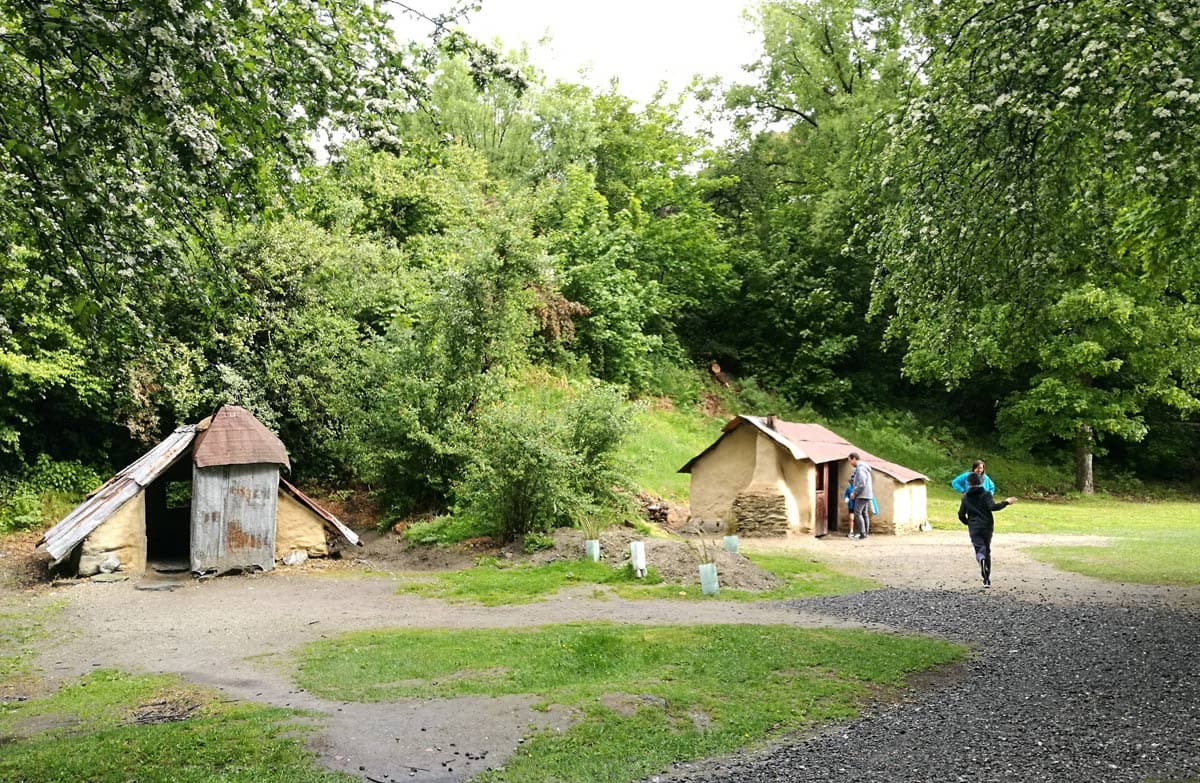
  • Buildings at Arrowtown Chinese Settlement.
    Area context · Photo: Benhi Dixon · CC BY-SA 4.0

    Buildings at Arrowtown Chinese Settlement. Published in DOC's Arrowtown Chinese Settlement guide. Photograph date not supplied; this is route-area context, not a verified trailhead or current-condition photograph.

    Photo: Benhi Dixon / CC BY-SA 4.0 / Details

    Otago Walking track

    Arrowtown Chinese Settlement

    Department of Conservation

    Distance
    Not confirmed on the checked DOC page; see individual route sections
    Walking time
    At your leisure
    Track grade
    Easiest

    Location reference not verified. Nearby distance unavailable.

    Article checked 2026-10-08. Confirm current access with the track manager.

    Route notes & sources
    • Take a short walk around this partially restored and well interpreted Chinese settlement from the 1880s.
    • DOC directory time: At your leisure. Grade: Easiest.
    • Source checked 2026-10-08; reconfirm current access and conditions with DOC.
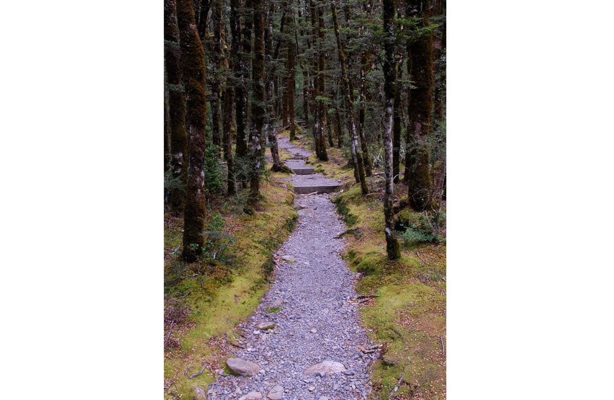
  • Bridal Veil track, Arthur’s Pass.
    Area context · Photo: Oli Studholme · CC BY 2.0

    Bridal Veil Track, Arthur’s Pass. Published in DOC's Arthur’s Pass Walking Track guide. Photograph date not supplied; this is route-area context, not a verified trailhead or current-condition photograph.

    Photo: Oli Studholme / CC BY 2.0 / Details

    Canterbury Walking track

    Arthur’s Pass Walking Track

    Department of Conservation

    Distance
    6.8 km return via same track
    Walking time
    2 h 40 min
    Track grade
    Easy

    Location reference not verified. Nearby distance unavailable.

    Article checked 2026-10-08. Confirm current access with the track manager.

    Route notes & sources
    • Experience the best of Arthur’s Pass's diverse alpine vegetation, waterfalls, wetlands, rich history and stunning mountain views on this walk.
    • Arthur's Pass Walking Track bridge damage; First published on 13 January 2026. Last reviewed on 5 September 2026.
    • DOC directory time: 2 h 40 min. Grade: Easy.
    • Source checked 2026-10-08; reconfirm current access and conditions with DOC.

DOC routes and local favourites

1581 route listings across 19 regions, including all 1571 unique entries in the DOC walking directory checked 2026-10-08. Some DOC listings group several walks. Regional comparisons, skills and booking guides are separate.

DOC walking directory Hiking guides

Walking times, distances and grades retain their source qualifications. Source checks are not live access reports; confirm the route, season and current conditions with its manager.

Choosing a walking track Conditions & alerts