By Outdoor Next Editorial standards
On this page
Key facts
- Distance
- 4 km return via same track
- Walking time
- 1 hr 20 min
- Track grade
- Easy
- Location
- Tongariro National Park
- Dog access
- No dogs. Other pets on conservation land rules.
Checked against official sources on 8 October 2026. Rules and conditions are set by Department of Conservation — confirm with them before you go.
Route overview
The 39 m Waitonga Falls is Tongariro National Park’s highest waterfall. The well-formed track passes through mountain beech and kaikawaka forest.
This DOC directory entry covers Waitonga Falls Track in Central North Island, within Tongariro National Park. Where DOC groups several walks, times and grades refer to the listed options rather than a single continuous itinerary.
Distance, time and grade
- Distance: 4 km return via same track
- Walking time: 1 hr 20 min
- DOC grade: Easy
Access and alerts
Source checked 2026-10-08. This page is a dated snapshot, not a live track-status report. Check current DOC route information immediately before travelling. An absence of listed alerts does not establish that a route is open.
Dog access
No dogs. Other pets on conservation land rules.
Description
Tongariro National Park’s highest waterfall, the 39 metre Waitonga Falls, is reached via a well-formed track through mountain beech and kaikawaka (mountain cedar) forest.
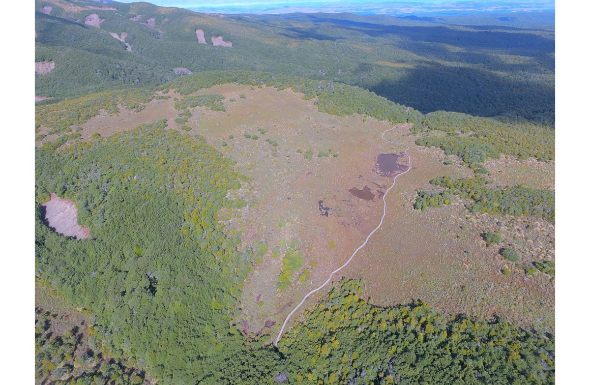
On clear calm days there are fantastic views of Mount Ruapehu and the surrounding countryside. You can see reflections of the mountain in the Rotokawa pools, part of an alpine wetland area.
Getting there
The track begins from the parking area 11 kilometres up the Ohakune Mountain Road.
Know before you go
The weather in Tongariro National Park is extremely changeable all year around. Prepare for all weather conditions:
What to take with you:
windproof/waterproof raincoat and overtrousers
spare warm clothing
sturdy, comfortable shoes or boots
food and drink
map for unmarked routes (available at DOC offices)
sunglasses and sunscreen
first aid kit
Weather forecast
Waitonga Falls weather forecast – NIWA website
No drones
Flying a drone without a permit is strictly prohibited.
Drone use on conservation land
Nature and conservation
The track is rich in plant life, with mistletoe on the beech trees, and a variety of orchids along the banks. In the alpine wetland area, you can see sundews and bladderworts in addition to the usual larger vegetation of the bog.
Sources and reuse
Route descriptions and practical information reproduced from the Department of Conservation, Crown copyright, under CC BY 4.0, subject to DOC's copyright policy. Formatting has been adapted, including flattening page sections; follow the original DOC page for maps, section-specific layout, current notices and linked documents. Outdoor Next is independent and is not endorsed by DOC.
The accompanying photograph is published in DOC's official route gallery with an explicit reuse licence. Its original caption and credit are retained; it does not establish current track conditions.
