By Outdoor Next Editorial standards
On this page
Location & access
DOC track reference point, not a verified trailhead, entrance or the whole route. Check the official route directions before travel.
Official location informationLocation source
DOC track reference point, not a verified trailhead, entrance or the whole route.
Reference point: -44.77627, 168.91270. WGS84 coordinates retained at the official service's returned precision; decimal resolution is not survey accuracy. Source positional accuracy is not specified.
DOC Maps walking and tramping reference point (WGS84), exact official-page GUID / Department of Conservation. Checked 2026-10-12.
Key facts
- Distance
- 49 km one way
- Walking time
- 3 - 4 days
- Track grade
- Advanced
- Location
- Arrowtown area / Macetown Historic Reserve / Wānaka area
- Dog access
- No dogs. Other pets on conservation land rules.
Checked against official sources on 8 October 2026. Rules and conditions are set by Department of Conservation — confirm with them before you go.
Route overview
The Motatapu Track follows much of an historic route that linked the Wānaka and Arrowtown areas. It's a demanding alpine tramp for experienced parties. This track is part of Te Araroa Trail.
This DOC directory entry covers Motatapu Track in Otago, within Arrowtown area / Macetown Historic Reserve / Wānaka area. Where DOC groups several walks, times and grades refer to the listed options rather than a single continuous itinerary.
Distance, time and grade
- Distance: 49 km one way
- Walking time: 3 - 4 days
- DOC grade: Advanced
Access and alerts
Source checked 2026-10-08. This page is a dated snapshot, not a live track-status report. Check current DOC route information immediately before travelling. An absence of listed alerts does not establish that a route is open.
Dog access
No dogs. Other pets on conservation land rules.
Description
This track is part of Te Araroa Trail.
Fern Burn carpark to Fern Burn Hut
Time: 3 - 4 hr, 7 km
The track meanders gently along the true right of the Fern Burn through riparian shrubland and grassy flats before climbing into a forest of mountain, silver and red beech. At this point the Fern Burn narrows and cascades and waterfalls become a feature. The track briefly enters the 4,144 ha Stack Conservation Area, which has other access points from the Spotts Creek and Roys Peak tracks.
It is possible for experienced parties to negotiate the conservation area and use these routes. The Motatapu Track continues to the bush edge and then on to upland tussock country and the 12-bunk Fern Burn Hut.
Fern Burn Hut to Highland Creek Hut
Time 3 – 5 hr, 6 km
This section is more arduous. It continues along the Upper Fern Burn through tussock country before reaching 1,275-m Jack Hall’s Saddle. The saddle and nearby creek were named after a local shepherd. Then there's a steep descent into a creek bed, before traversing another two ridges descending to Highland Creek. The descent is very slippery in wet weather. The 12-bunk Highland Creek Hut nestles in this spectacular upland basin.
Highland Creek Hut to Roses Hut
Time: 6 – 8 hr, 11 km
This is the most challenging section of Motatapu Track. It is physically demanding – allow plenty of time.
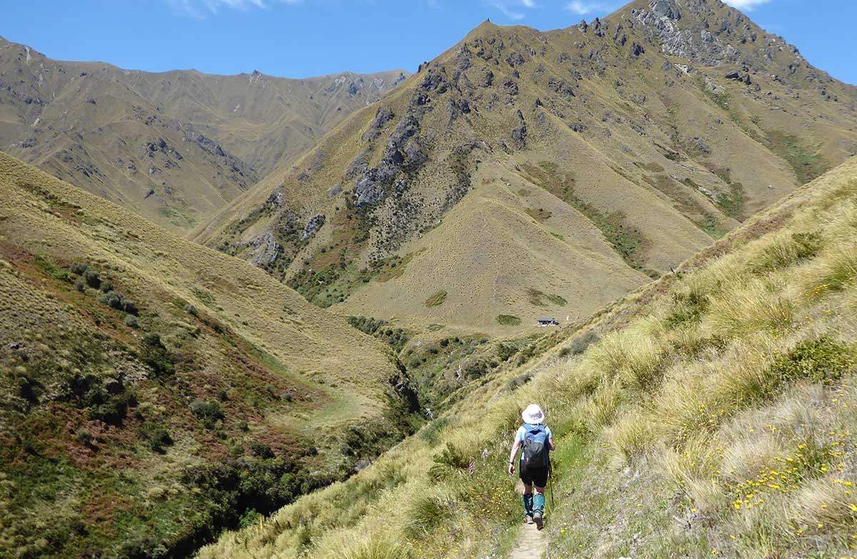
After crossing Highland Creek the marked track sidles and climbs above an unnamed creek onto a prominent spur. It continues up this spur before sidling along a steep tussock face; stunning views across the Motatapu Valley are a highlight of this section. The track then drops into a small gully and crosses the creek through a small patch of beech forest, then climbs out onto the leading south-west ridge off Knuckle Peak. Follow down this ridge to the Motatapu River and cross the river. There is no bridge.
The 12-bunk Roses Hut is an easy tramp across the open flats.
Roses Hut to Macetown
Time: 4 – 6 hr, 10 km
Cross the small creek to the old pack track that climbs the main ridge above 1,270 m Roses Saddle. At the crossover point between the Motatapu and Arrow catchments, the ridge descends to the Arrow River. During low and normal river levels, it’s quicker following the river to Macetown. This way you pass old gold workings, especially hand-stacked, stone walls.
If the river is high or discoloured, follow the track that sidles above the river before joining an old water race that leads to Macetown, passing several small dams and other gold mining relics. This track requires an unbridged crossing of the Arrow River to get to Macetown. The river is not always safe to cross, so be ready to wait for water levels to drop.
Find out about historic Macetown.
Macetown to Arrowtown
Time: 3 - 4 hr, 15 km
From Macetown, a 15 km 4WD road winds its way to Arrowtown. In good conditions, the numerous river crossings may be negotiated by 4WD vehicles or trampers with care. If the river is too high then you are advised to wait.
An alternative route via Big Hill Track (4-5 hr) starts from the 4WD road 20 min from Macetown. Although this route avoids some of the larger river crossings, it climbs above 1000 m and is not recommended in adverse weather. In fine conditions, it repays the effort with views over the Wakatipu Basin and beyond.
Take care when driving the 4WD track as areas can deteriorate after rains and winter causing slips and landslides. Watch for other road users, as the road is shared by walkers, vehicles and cyclists.
Getting there
The Motatapu Track can be accessed from either end.
From Wānaka: Turn off the road to the Matukituki Valley at Glendhu Bay, 12 km from Wānaka. The Fern Burn carpark and track start are signposted on this road.
From Arrowtown: Take the Macetown Road, this is a 15 km, 4WD road with 22 fords over the Arrow River. Access is also by foot (3-4 hours) and shuttle.
Managed access of Macetown Road
To preserve ongoing access to the road, these measures are in place:
a locked gateway structure with a squeeze barrier for cyclists and walkers
CCTV camera surveillance
a fee-based online permit system for vehicles
an annual road maintenance programmem
For more information see: Macetown 4WD Track – Managed Access System | NZFWDA
Know before you go
This is a demanding track
The track is exposed and physically challenging.
The terrain is steep and there are places with drop-offs beside the track. Take care, the track is narrow and vegetation can hide the drop off.
There are unbridged river crossings.
Only some of the track is benched. The rest is marked with poles.
It is only suitable for experienced trampers.
Allow extra time if you are not confident hiking in this type of terrain.
Weather
Summer is often very hot and dry.
Carry plenty of water, as water sources are limited. Boil or treat any water from the huts or streams.
There is little shade. Bring sun protection.
Cold, wintry weather can happen at any time of year. Higher areas can get snow, especially in winter.
Take warm, windproof clothing and suitable footwear.
Stay safe when crossing rivers and streams
If you plan to cross unbridged rivers or side streams, know how to cross safely and be prepared for if you cannot cross.
Do not cross if the river or stream is flooded, you cannot find safe entry and exit points or are unsure it’s safe. Turn back or wait for the river to drop. If in doubt, stay out.
How to cross rivers safely
NIWA river flow forecasts: View a video of national followed by regional river flows
Avalanche risk
This area has terrain that can produce avalanches that cross the track, usually from May into November. View avalanche information.
Private land and stock
The track crosses and runs beside private land.
Respect landowners’ stock and property.
Close all gates.
Use stiles where they are provided.
Fires
No fires.
No drones
Flying a drone without a permit is strictly prohibited.
Drone use on conservation land
Sources and reuse
Route descriptions and practical information reproduced from the Department of Conservation, Crown copyright, under CC BY 4.0, subject to DOC's copyright policy. Formatting has been adapted, including flattening page sections; follow the original DOC page for maps, section-specific layout, current notices and linked documents. Outdoor Next is independent and is not endorsed by DOC.
The accompanying photograph is published in DOC's official route gallery with an explicit reuse licence. Its original caption and credit are retained; it does not establish current track conditions.
