By Outdoor Next Editorial standards
On this page
Location & access
DOC track reference point, not a verified trailhead, entrance or the whole route. Check the official route directions before travel.
Official location informationLocation source
DOC track reference point, not a verified trailhead, entrance or the whole route.
Reference point: -36.73041, 175.68179. WGS84 coordinates retained at the official service's returned precision; decimal resolution is not survey accuracy. Source positional accuracy is not specified.
DOC Maps walking and tramping reference point (WGS84), exact official-page GUID / Department of Conservation. Checked 2026-10-12.
Key facts
- Distance
- Not confirmed on the checked DOC page; see individual route sections
- Walking time
- 20 min – 45 min
- Track grade
- Easiest
- Location
- Whangapoua and Matarangi area
- Dog access
- Dogs on a leash only. Other pets on conservation land rules.
Checked against official sources on 8 October 2026. Rules and conditions are set by Department of Conservation — confirm with them before you go.
Route overview
This popular short walk connects Matarangi and Rings Beach. It provides spectacular views over Matarangi, Kūaotunu and the Coromandel Peninsula.
This DOC directory entry covers Matarangi Bluff Track in Waikato, within Whangapoua and Matarangi area. Where DOC groups several walks, times and grades refer to the listed options rather than a single continuous itinerary.
Distance, time and grade
- Distance: Not confirmed on the checked DOC page; see individual route sections
- Walking time: 20 min – 45 min
- DOC grade: Easiest
Access and alerts
Source checked 2026-10-08. This page is a dated snapshot, not a live track-status report. Check current DOC route information immediately before travelling. An absence of listed alerts does not establish that a route is open.
Dog access
Dogs on a leash only. Other pets on conservation land rules.
Description
From Matarangi, the track takes you up a set of stairs to the saddle between Matarangi and Rings Beach. It passes a cellphone tower and then drops down to Rings Beach. There are views of the Coromandel Peninsula from the top.
It takes 15–20 minutes to walk from Matarangi to Rings Beach. You can walk back to Matarangi following the old Bluff Road that is now closed to vehicle traffic due to erosion (add an extra 15–20 minutes for the walk back to Matarangi).
The track is suited to walkers of all levels with easy gradients and only a small steep section with steps.
Getting there
Access to the track is from the end of Goldfields Drive in Matarangi or from the western end of Rings Beach. There is parking on both sides.
Know before you go
Kauri trees are present in the area. Please use the cleaning stations at track entrances to prevent the spread of kauri dieback.
The scenic Bluff Road skirting the coast between Matarangi and Kūaotunu is permanently closed to vehicle traffic due to a dangerous, collapsed cliff. Rings Beach is accessible by car from Kūaotunu at the eastern end of Bluff Road.
There are no public toilets at Rings Beach or along the track.
Dogs are not allowed off the lead on any of the tracks.
Nature and conservation
Nestled in the hills between Matarangi and Kūaotunu, the track was conceived by retired residents in 2010. Built entirely by volunteer labour, residents wanted to provide a recreational area with an educational element for the community.
The area has been enhanced with a native tree planting program since 2010 in cooperation with local schools. Over 4,000 trees were planted by 2016.
Wilding pines have been eliminated from 37 ha of the wetland area in the reserve. Suitable native trees have been planted to attract birds into the growing forest. Trapping of stoats, possums, rats and mice has allowed a remnant population of the endangered fernbird/mātātā to expand dramatically.
There is growing evidence of kiwi in the reserve and kiwi calls have been recorded in recent years.
History and culture
The Matarangi Bluff reserve was the site of forestry, mining and, until 1955, farming by the annual burn-off method. Forest regrowth started after that year and native trees were slow to establish, birdlife had been under threat and wilding pines dominated the landscape. However the community effort to control predators and plant trees is helping bring the forest and wildlife back.
Sources and reuse
Route descriptions and practical information reproduced from the Department of Conservation, Crown copyright, under CC BY 4.0, subject to DOC's copyright policy. Formatting has been adapted, including flattening page sections; follow the original DOC page for maps, section-specific layout, current notices and linked documents. Outdoor Next is independent and is not endorsed by DOC.
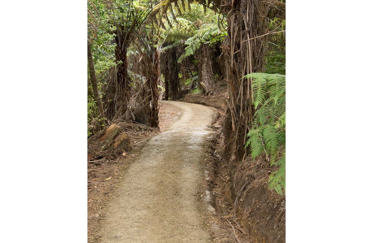
The accompanying photograph is published in DOC's official route gallery with an explicit reuse licence. Its original caption and credit are retained; it does not establish current track conditions.
