By Outdoor Next Editorial standards
On this page
Location & access
DOC track reference point, not a verified trailhead, entrance or the whole route. Check the official route directions before travel.
Official location informationLocation source
DOC track reference point, not a verified trailhead, entrance or the whole route.
Reference point: -44.84513, 169.27848. WGS84 coordinates retained at the official service's returned precision; decimal resolution is not survey accuracy. Source positional accuracy is not specified.
DOC Maps walking and tramping reference point (WGS84), exact official-page GUID / Department of Conservation. Checked 2026-10-12.
Key facts
- Distance
- 13.36 km return via same track
- Walking time
- 4-6 hr return
- Track grade
- Intermediate
- Location
- Pisa Conservation Area
- Seasonal restrictions
- Closed for lambing 1 October – 31 October.
- Dog access
- No dogs. Other pets on conservation land rules.
Checked against official sources on 8 October 2026. Rules and conditions are set by Department of Conservation — confirm with them before you go.
Route overview
Access the Locharburn Scenic Reserve and Pisa Conservation Area via a steep, direct hike.
This DOC directory entry covers Locharburn Track in Otago, within Pisa Conservation Area. Where DOC groups several walks, times and grades refer to the listed options rather than a single continuous itinerary.
Distance, time and grade
- Distance: 13.36 km return via same track
- Walking time: 4-6 hr return
- DOC grade: Intermediate
Access and alerts
Source checked 2026-10-08. This page is a dated snapshot, not a live track-status report. Check current DOC route information immediately before travelling. An absence of listed alerts does not establish that a route is open.
Seasonal restrictions
Closed for lambing 1 October – 31 October.
Dog access
No dogs. Other pets on conservation land rules.
Description
The Locharburn Track follows a steep fence line to the Locharburn Scenic Reserve, and eventually to a farm road that leads to the Pisa Conservation Area and links to the Pisa Ridge. Return the same way.
You can also use this trail to connect with the Pisa Range Ridge Track to access Mt Pisa and other destinations in the Pisa Conservation Area.
Getting there
From Wānaka, drive approximately 30 km south on SH6.There is no carpark, and the trailhead signs are not obvious from the road.Use coordinates -44.864903, 169.304895 to navigate to the trailhead.Find a safe place to park, and find the small signs at the trailhead.
Know before you go
Weather
In summer, very hot and dry conditions are common. Carrying an adequate supply of both drinking water and sun protection is essential.
If snow is present in winter, mountaineering experience is required along with knowledge of avalanche conditions.
Adverse weather
The weather can change rapidly in New Zealand. Hypothermia is a real risk even in summer.
Be prepared by having warm, waterproof, windproof clothing and the appropriate footwear.
Whiteout conditions caused by snow or low cloud may be present.
Check the Roys Peak weather forecast – NIWA website.
Avalanche risk
This area has terrain that can produce avalanches that cross the track, usually from May into November.
View avalanche information.
Firearms
Firearms are not permitted on easements through private property. Entry to Pisa Conservation Area with a firearm is only allowed via Rock Peak Track.
Dog access
Dogs are allowed in the Pisa Conservation Area, but entry/exit is restricted to the Rock Peak Track. All other entry points are via easements through private property and require landowner permission to enter with a dog.
Private property and permissions
This track crosses private land.
Respect the landowner's livestock and property:
stay on the marked track until you reach the conservation land
leave gates as you find them
use stiles where provided
keep your distance from livestock
Nature and conservation
Mountain totara, tussock hawkeed, kanuka, celery pine, ozothamnus vauvilliersii, manuka, bog pines, and various native shrubs.
Sources and reuse
Route descriptions and practical information reproduced from the Department of Conservation, Crown copyright, under CC BY 4.0, subject to DOC's copyright policy. Formatting has been adapted, including flattening page sections; follow the original DOC page for maps, section-specific layout, current notices and linked documents. Outdoor Next is independent and is not endorsed by DOC.
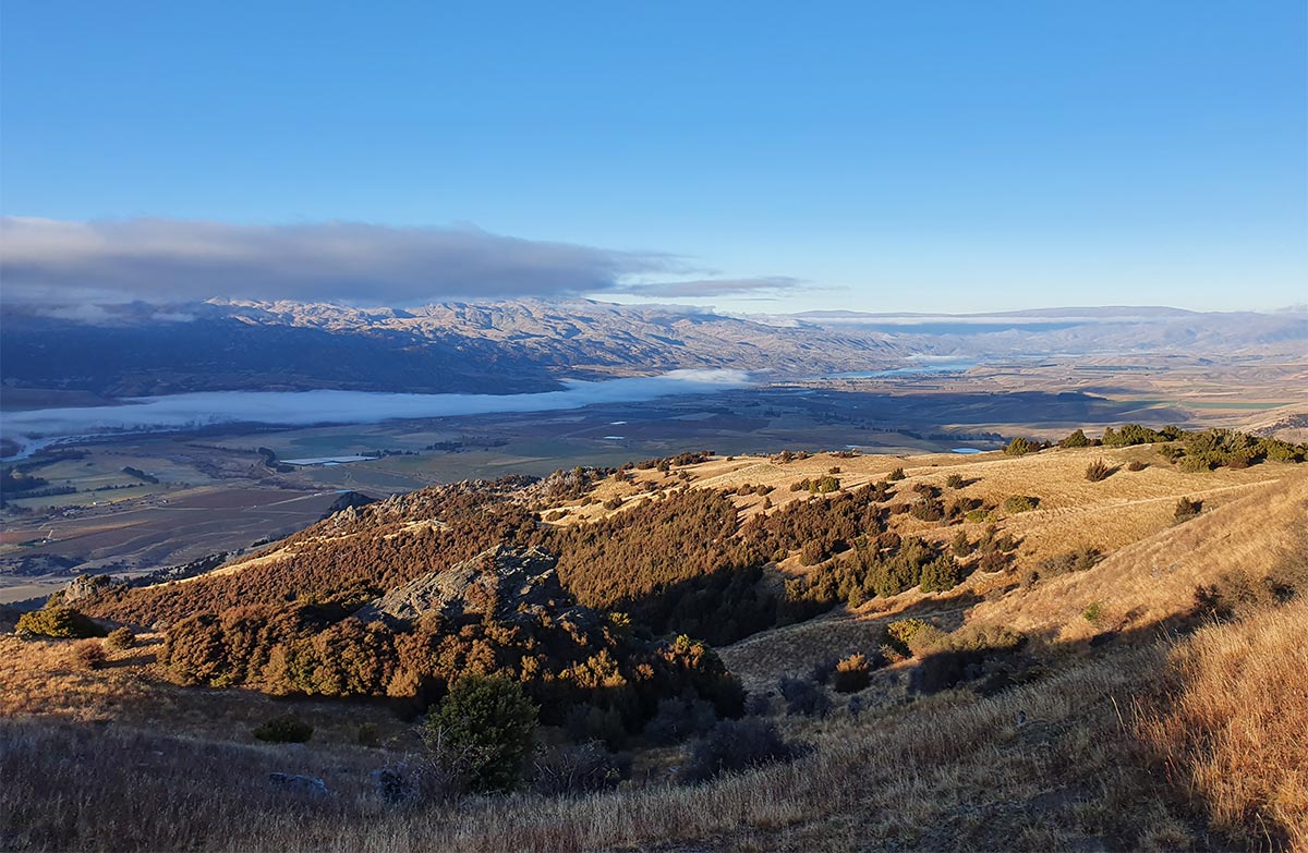
The accompanying photograph is published in DOC's official route gallery with an explicit reuse licence. Its original caption and credit are retained; it does not establish current track conditions.
