By Outdoor Next Editorial standards
On this page
Location & access
DOC track reference point, not a verified trailhead, entrance or the whole route. Check the official route directions before travel.
Official location informationLocation source
DOC track reference point, not a verified trailhead, entrance or the whole route.
Reference point: -43.23135, 171.71840. WGS84 coordinates retained at the official service's returned precision; decimal resolution is not survey accuracy. Source positional accuracy is not specified.
DOC Maps walking and tramping reference point (WGS84), exact official-page GUID / Department of Conservation. Checked 2026-10-12.
Key facts
- Distance
- 1.7 km loop
- Walking time
- 40 min
- Track grade
- Easiest
- Location
- Kura Tāwhiti (Castle Hill)
- Dog access
- No dogs. Other pets on conservation land rules.
Checked against official sources on 8 October 2026. Rules and conditions are set by Department of Conservation — confirm with them before you go.
Route overview
Discover the majestic limestone boulders of Kura Tāwhiti/Castle Hill. It’s a place of special significance to Ngāi Tahu.
This DOC directory entry covers Kura Tāwhiti Access Track in Canterbury, within Kura Tāwhiti (Castle Hill). Where DOC groups several walks, times and grades refer to the listed options rather than a single continuous itinerary.
Distance, time and grade
- Distance: 1.7 km loop
- Walking time: 40 min
- DOC grade: Easiest
Access and alerts
Source checked 2026-10-08. This page is a dated snapshot, not a live track-status report. Check current DOC route information immediately before travelling. An absence of listed alerts does not establish that a route is open.
Dog access
No dogs. Other pets on conservation land rules.
Description
About the walk
Magnificent limestone landscape
Rich cultural storytelling
Gravel track that’s steep in places, with some steps
Kura Tāwhiti Access Track leads you through a culturally and ecologically significant landscape. It is renowned for its towering limestone boulders.
For Ngāi Tahu and Ngāi Tūāhuriri, Kura Tāwhiti/Castle Hill is a place of special significance. Its importance is reflected by its Tōpuni status – a symbolic cloak of protection.
As you arrive, you’ll be greeted by pou whenua – carved posts representing three important ancestors. Two are Tūrākautahi and Tāne Tiki, the sons of Tūāhuriri. The third is Tāwhitinui, the ancestor whose body transformed into this landscape.
Nearby, there’s a shelter with carvings representing Kura Tāwhiti as a mahinga kai, a place for gathering food and resources.
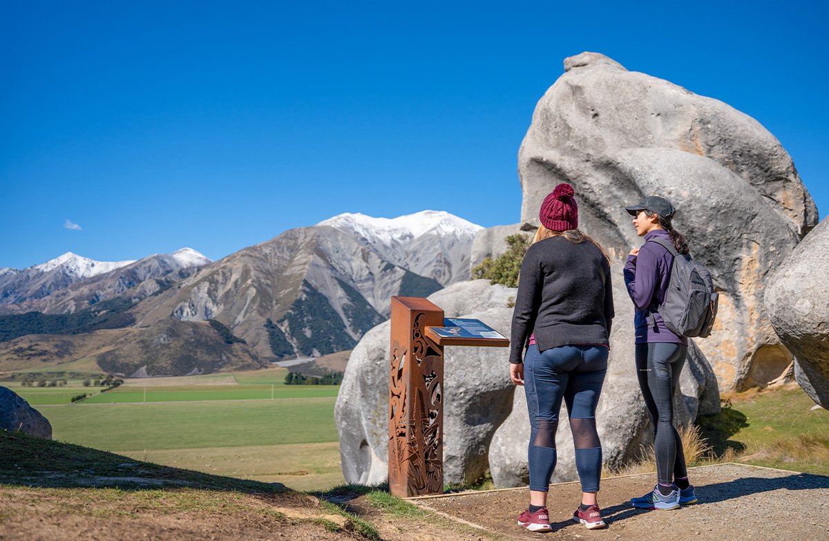
Follow the gravel track to get up close to the limestone boulders special to this place. The climb is steep in places, but you’ll get stunning views of:
Torlesse Range
Craigieburn Range
the Waimakariri Basin.
Complete the loop and return to the car park the same way you came.
Getting there
Directions
Kura Tāwhiti Access Track begins at Castle Hill/Kura Tāwhiti car park, in Canterbury’s Waimakariri Basin.
The car park is well signposted from SH73, which runs between Christchurch and the West Coast, over Arthur’s Pass.
If you’re driving from Christchurch, the car park is on your left 3 km before the signposted turnoff to Castle Hill Village.
Open in Google Maps
Travel times (by car)
Christchurch (1 hr 30 min)
Arthurs Pass (50 min)
Hokitika (2 hr 10 min)
Road conditions
Snow can close SH73. Check highway conditions before you travel.
Check highway conditions
Parking
Castle Hill/Kura Tāwhiti car park has:
free parking for cars and campervans
no marked mobility spaces.
Lock it or lose it
Thieves may target cars parked at Castle Hill/Kura Tāwhiti car park. Take valuables with you.
No overflow parking
If the car park is full, it’s not safe to park on the highway.
Instead, consider taking a side trip to Cave Stream Loop Walk (5 min by car). Parking spaces may be available when you return.
Know before you go
Mana whenua
Ngāi Tūāhuriri has mana whenua or customary authority over this special place.
Show respect
There are wāhi tapu (sacred places) here. Visit with respect.
Keep to the track
Only eat and drink at the shelter and car park
Don’t graffiti boulders – they are spiritually significant
Use toilets provided
Don’t dig holes or disturb the ground
Safety and hazards
Steep drops: There are high places and steep drops along Kura Tāwhiti Access Track. Keep to the track and be careful near cliffs.
When to go
Castle Hill/Kura Tāwhiti gets very busy during the summer season (November to April). It is popular with rock climbers.
The track gets icy in winter and after snowfall.
New Zealand weather changes rapidly. Check the weather forecast before you go, and be prepared.
Check weather forecast
Be prepared
Plan your visit
Bookings are not required for Kura Tāwhiti Access Track.
Toilets and an accessible toilet are located at Castle Hill/Kura Tāwhiti car park.
Drinking water is not available. Bring your own.
A shelter with picnic tables is provided at the car park.
Camping is available at Mistletoe Flats Campsite (10 min by car)
Food and petrol can be found in Springfield (30 min by car) and Arthurs Pass (50 min by car).
Mobile phone coverage can be unreliable.
What to take
Short Walks gear list
Care for nature
Rubbish bins are not provided. Take your rubbish with you.
Critically endangered plants grow at Kura Tāwhiti/Castle Hill. Keep to the gravel track and away from the bases of rock faces.
No drones
Flying a drone without a permit is strictly prohibited.
Drones on conservation land
Sources and reuse
Route descriptions and practical information reproduced from the Department of Conservation, Crown copyright, under CC BY 4.0, subject to DOC's copyright policy. Formatting has been adapted, including flattening page sections; follow the original DOC page for maps, section-specific layout, current notices and linked documents. Outdoor Next is independent and is not endorsed by DOC.
The accompanying photograph is published in DOC's official route gallery with an explicit reuse licence. Its original caption and credit are retained; it does not establish current track conditions.
