By Outdoor Next Editorial standards
On this page
Location & access
DOC track reference point, not a verified trailhead, entrance or the whole route. Check the official route directions before travel.
Official location informationLocation source
DOC track reference point, not a verified trailhead, entrance or the whole route.
Reference point: -35.21687, 173.95225. WGS84 coordinates retained at the official service's returned precision; decimal resolution is not survey accuracy. Source positional accuracy is not specified.
DOC Maps walking and tramping reference point (WGS84), exact official-page GUID / Department of Conservation. Checked 2026-10-12.
Key facts
- Distance
- 3.5 km one way
- Walking time
- 1 hr 30 min
- Track grade
- Easy
- Location
- Kerikeri area
- Dog access
- No dogs. Other pets on conservation land rules.
Checked against official sources on 8 October 2026. Rules and conditions are set by Department of Conservation — confirm with them before you go.
Route overview
Follow the bank of the Kerikeri River through regenerating forest and discover the remains of an historic power house, and Wharepoke and Rainbow Falls. This track is part of Te Araroa Trail.
This DOC directory entry covers Kerikeri River Track in Northland, within Kerikeri area. Where DOC groups several walks, times and grades refer to the listed options rather than a single continuous itinerary.
Distance, time and grade
- Distance: 3.5 km one way
- Walking time: 1 hr 30 min
- DOC grade: Easy
Access and alerts
Source checked 2026-10-08. This page is a dated snapshot, not a live track-status report. Check current DOC route information immediately before travelling. An absence of listed alerts does not establish that a route is open.
Dog access
No dogs. Other pets on conservation land rules.
Description
This track is part of Te Araroa Trail.
This is part of Te Araora Trail.
The track starts at Kerikeri Basin Reserve.
It passes through stands of young kauri, tōtara and associated native vegetation. As you walk along the track, you will pass the remains of the historic Kerikeri hydro-election station, built as part of the hydro-electric generation scheme that operated between 1930 and 1967. The building’s remains are open to the public.
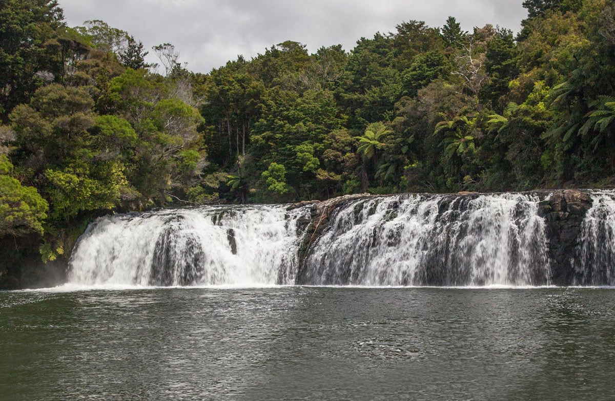
You can see interesting rock formations close to the Wharepoke Falls.
Ten minutes westward along the river from the Wharepoke Falls, the Kerikeri River Track goes under the Heritage Bypass and takes you to a seating area at the Fairy Pools.
The track ends at Rainbow Falls.
There are some steep drops near the track and the track is narrow in places. Stay on the track and supervise children.
You can also walk the track in the reverse direction.
Fishing is allowed in the Kerikeri River. Fishing permits and information are available from Fish & Game New Zealand.
Getting there
The Kerikeri River Track starts in the Kerikeri Basin Reserve and ends at the Rainbow Falls, Kerikeri.
Access the track from
the carpark at the start of Landing Road
Rainbow Falls Road
Heritage Bypass, north of the bridge
Edkins Road, signposted between 33 and 37 Edkins Road
Know before you go
Dogs are not permitted on the walking tracks in the Kerikeri Basin due to the risk they pose to kiwi and other wildlife.
Parking, picnicking and a BBQ area in the Kerikeri Basin Recreation Reserve at the eastern end of the track. To get there – travel along the Heritage Bypass, turn right into Waipapa Road, then right into Landing Road. The Kerikeri Basin Recreation Reserve is at the far end of Landing Road.
Parking, toilets and picnic facilities are also at the western end of the track – access from Rainbow Falls Road.
Safety
Carry warm, waterproof clothing, and food and drink, even on short walks. Stout shoes or walking boots are advisable.
There are significant risks associated with waterfall swimming and weirs. Learn more about river swimming risks.
There are steep drops and sections of narrow track. Stay on the track and supervise children.
Before leaving for your walk, make sure your vehicle is locked and any valuables out of sight.
Related links
Kerikeri hydro station
The Kerikeri River Track is part of the Te Araroa Trail
Nature and conservation
The Kerikeri River, at the Wharepoke Falls, and the larger Rainbow Falls, tumbles over basalt lava fields, which flowed into the river valley following volcanic eruptions some 200 million years ago.
Sources and reuse
Route descriptions and practical information reproduced from the Department of Conservation, Crown copyright, under CC BY 4.0, subject to DOC's copyright policy. Formatting has been adapted, including flattening page sections; follow the original DOC page for maps, section-specific layout, current notices and linked documents. Outdoor Next is independent and is not endorsed by DOC.
The accompanying photograph is published in DOC's official route gallery with an explicit reuse licence. Its original caption and credit are retained; it does not establish current track conditions.
