By Outdoor Next Editorial standards
On this page
Location & access
DOC track reference point, not a verified trailhead, entrance or the whole route. Check the official route directions before travel.
Official location informationLocation source
DOC track reference point, not a verified trailhead, entrance or the whole route.
Reference point: -44.69949, 170.96567. WGS84 coordinates retained at the official service's returned precision; decimal resolution is not survey accuracy. Source positional accuracy is not specified.
DOC Maps walking and tramping reference point (WGS84), exact official-page GUID / Department of Conservation. Checked 2026-10-12.
Key facts
- Distance
- Not confirmed on the checked DOC page; see individual route sections
- Walking time
- 20 min one way | 40 min one way
- Track grade
- Easy
- Location
- Hunters Hills area
- Dog access
- Dogs allowed. Keep dog under control at all times. Other pets on conservation land rules.
Checked against official sources on 8 October 2026. Rules and conditions are set by Department of Conservation — confirm with them before you go.
Route overview
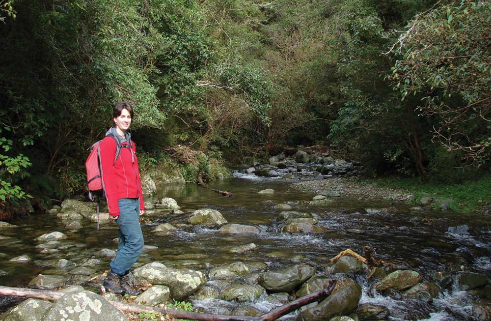
Stroll to a small waterfall or picnic along a sparkling stream and listen to the bird song.
This DOC directory entry covers Kelceys Bush tracks in Canterbury, within Hunters Hills area. Where DOC groups several walks, times and grades refer to the listed options rather than a single continuous itinerary.
Distance, time and grade
- Distance: Not confirmed on the checked DOC page; see individual route sections
- Walking time: 20 min one way | 40 min one way
- DOC grade: Easy
Access and alerts
Source checked 2026-10-08. This page is a dated snapshot, not a live track-status report. Check current DOC route information immediately before travelling. An absence of listed alerts does not establish that a route is open.
Dog access
Dogs allowed. Keep dog under control at all times. Other pets on conservation land rules.
Description
Sanders Falls Walk
Track category: Walking trackTime: 20 min one way
A gentle climb and some steps take you to a viewing platform overlooking the falls. The pipe alongside the track, and at the falls, supplied Waimate’s water from 1915 to 1932 when it was discontinued following a major flood. A short branch off this track leads you to a lookout and seat where you get great views up the valley.
Intake Track
Track category: Walking trackTime: 40 min one way
This track goes upstream following Waimate Creek past Rock Pool weir. There are several un-bridged creek crossings, so take care and be prepared to get your feet wet. The pipe alongside the track and the weir at Rock Pool are the remains of Waimate’s second water supply, which operated between 1926 and 1954.
Getting there
Kelceys Bush is northwest of Waimate. In Waimate turn off Queen Street (Highway 82) onto Mill Road. Follow this road to Kelceys Bush.
Know before you go
- Hunting is permitted within Kelceys Bush Conservation Area. Hunters may be present at any time.
Nature and conservation
This forest remnant is mainly broadleaf/kāpuka with mahoe, ribbonwood/mānatu, tree fuchsia/kōtukutuku and occasional kahikatea, mataī and tōtara.
A community group, Friends of Kelceys Bush, was formed in 2002 and they are actively engaged in managing and protecting the area.
History and culture
Kelceys Bush is named after two brothers Julius and Frank Kelcy (the spelling of their name became changed over time) who helped clear the surrounding land after the Waimate fire. Despite milling for firewood and stock grazing, which continued until 1965, Kelceys Bush was a popular picnic spot, particularly in the 1920s and 1930s.
In 1901, local MP Sir William Stewards suggested that a portion of Kelceys Bush should be reserved for the preservation of the forest and abundant native bird life; kākā, kererū and tūī. A recommendation was made to the Surveyor General suggesting it would be a mistake to allow this piece of bush to disappear.
Sources and reuse
Route descriptions and practical information reproduced from the Department of Conservation, Crown copyright, under CC BY 4.0, subject to DOC's copyright policy. Formatting has been adapted, including flattening page sections; follow the original DOC page for maps, section-specific layout, current notices and linked documents. Outdoor Next is independent and is not endorsed by DOC.
The accompanying photograph is published in DOC's official route gallery with an explicit reuse licence. Its original caption and credit are retained; it does not establish current track conditions.
