By Outdoor Next Editorial standards
On this page
Location & access
DOC track reference point, not a verified trailhead, entrance or the whole route. Check the official route directions before travel.
Official location informationLocation source
DOC track reference point, not a verified trailhead, entrance or the whole route.
Reference point: -43.79326, 172.34795. WGS84 coordinates retained at the official service's returned precision; decimal resolution is not survey accuracy. Source positional accuracy is not specified.
DOC Maps walking and tramping reference point (WGS84), exact official-page GUID / Department of Conservation. Checked 2026-10-12.
Key facts
- Distance
- 2.7 km return via same track
- Walking time
- 1 hr 20 minutes return
- Track grade
- Easiest
- Location
- Christchurch area / Lake Ellesmere (Te Waihora) area
- Dog access
- No dogs. Other pets on conservation land rules.
Checked against official sources on 8 October 2026. Rules and conditions are set by Department of Conservation — confirm with them before you go.
Route overview
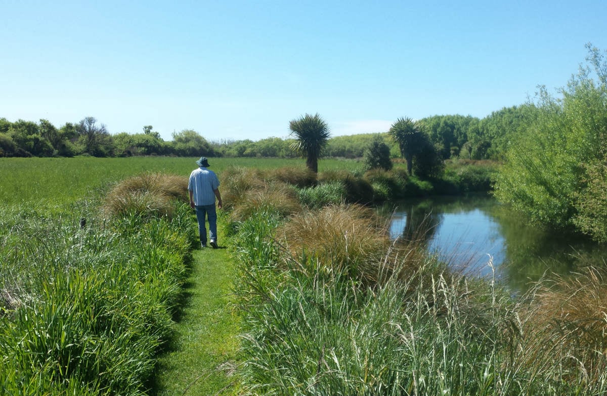
This is an easy track that follows Harts Creek. Wildlife viewing opportunities make this a great walk for children and families.
This DOC directory entry covers Harts Creek Track in Canterbury, within Christchurch area / Lake Ellesmere (Te Waihora) area. Where DOC groups several walks, times and grades refer to the listed options rather than a single continuous itinerary.
Distance, time and grade
- Distance: 2.7 km return via same track
- Walking time: 1 hr 20 minutes return
- DOC grade: Easiest
Access and alerts
Source checked 2026-10-08. This page is a dated snapshot, not a live track-status report. Check current DOC route information immediately before travelling. An absence of listed alerts does not establish that a route is open.
- Harts Creek Walkway partial closure; First published on 16 March 2026. Last reviewed on 30 June 2026.
Dog access
No dogs. Other pets on conservation land rules.
Description
Start at the reserve car park. The flat track passes through native trees then runs along a stop bank beside grassy paddocks for 1.2 km - about 10 to 15 minutes.
It leads into Harts Creek Wildlife Management Reserve, a densely wooded swamp area with swans, ducks and trout. The reserve entrance has a pleasant and sheltered spot for picnics.
The last 200 m onto the final boardwalk and viewing platform is closed until further notice due to safety concerns. Do not climb the barrier.
Predator traps
There are predator traps located in the area, which can be seen from the walkway. Do not touch these traps. They are here to help reduce the predation of bird species that nest in the area.
Getting there
Starting in Leeston, head down Leeston And Lake Road for 4.8 km.
Turn left onto Harts Road and continue down this road for 1 km until an intersection.
Head straight at the intersection. At this point, Harts Road becomes Lower Lake Road.
Continue down Lower Lake Road for 300 m.
At the turn off onto Timber Yard Road, there is a shingle road to your left. There is an orange bird hide sign pointing down the shingle road.
Turn onto this shingle road and cross the bridge.
Know before you go
Keep to the track as access crosses private land.
As this is a wildlife area, no dogs, even on leashes, are allowed.
Remain on the boardwalks or marked tracks at all times.
Dress for the weather. Hats and sunscreen are recommended.
As the walk crosses areas of water and a stream is nearby young children must be supervised at all times.
Be cautious around the native stinging swamp nettle (urtica perconfusa).
No drinking water available on site.
No toilets on site.
Nature and conservation
Harts Creek Wildlife Management Reserve lies on the western margins of Te Waihora/Lake Ellesmere. The reserve provides an excellent habitat for wildlife and is also a wildlife refuge.
Birdlife includes: white swans, black swans, pukeko, parekareka/spotted shag, Canada geese, several species of duck, kōtuku/white heron, kakī/pied stilts, kamana/crested grebe and more, with possible sightings of the elusive Australasian bittern/matuku-hūrepo.
Read about the Harts Creek restoration.
Sources and reuse
Route descriptions and practical information reproduced from the Department of Conservation, Crown copyright, under CC BY 4.0, subject to DOC's copyright policy. Formatting has been adapted, including flattening page sections; follow the original DOC page for maps, section-specific layout, current notices and linked documents. Outdoor Next is independent and is not endorsed by DOC.
The accompanying photograph is published in DOC's official route gallery with an explicit reuse licence. Its original caption and credit are retained; it does not establish current track conditions.
