Match the recorded access details to your own requirements before booking. An accessibility note may describe a barrier or only one facility; it does not establish an accessible journey or wheelchair-friendly site.
Planning checklist & guides
Before you choose
Confirm gradients, surfaces, steps and distances with the operator.
Ask about the specific toilet, shower and parking arrangements you need.
Check the route between facilities, your pitch and transport.
Only sourced accessibility detail facts with recorded status qualify. Notes describing restrictions remain included. No accessibility is inferred from a short distance, easy grade or missing information.
All 648 published campsite records, 1589 walking-track records and 26 trip plans are considered against the relevant criteria. Campsites with a closed notice are excluded. Seasonal and access notices remain visible; inclusion does not confirm that a place is open.
Each page shows up to 12 matches per group in name order (A-Z), not a ranking. Use the page links to browse every match. Groups share a page number; shorter groups finish earlier. Full finders also include records outside this topic. Source wording and check dates are retained here and on record pages, not live availability checks.
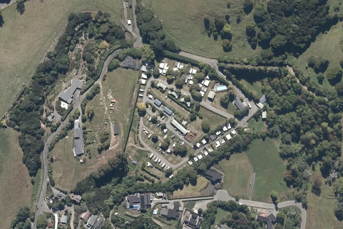
The terraced camping lanes and accommodation at Akaroa TOP 10 on the hillside above the town. Historical aerial imagery includes adjacent land; it is not a current pitch plan or surveyed park boundary. Cropped and converted to WebP from LINZ Basemaps.
This is not a whole-site accessibility assessment. Confirm the specific bathroom, path and accommodation requirements before booking. Directory label: Access Facilities.
Alexandra Holiday Park's camping lanes and accommodation beside the tree-lined river corridor. Historical aerial imagery includes adjacent land; it is not a current pitch plan or surveyed park boundary. Cropped and converted to WebP from LINZ Basemaps.
This is not a whole-site accessibility assessment. Confirm the specific bathroom, path and accommodation requirements before booking. Directory label: Access Facilities.
All Seasons' curved camping lanes, accommodation buildings and lawns beside the residential street. Historical aerial imagery includes adjacent land; it is not a current pitch plan or surveyed park boundary. Cropped and converted to WebP from LINZ Basemaps.
This is not a whole-site accessibility assessment. Confirm the specific bathroom, path and accommodation requirements before booking. Directory label: Access Facilities.
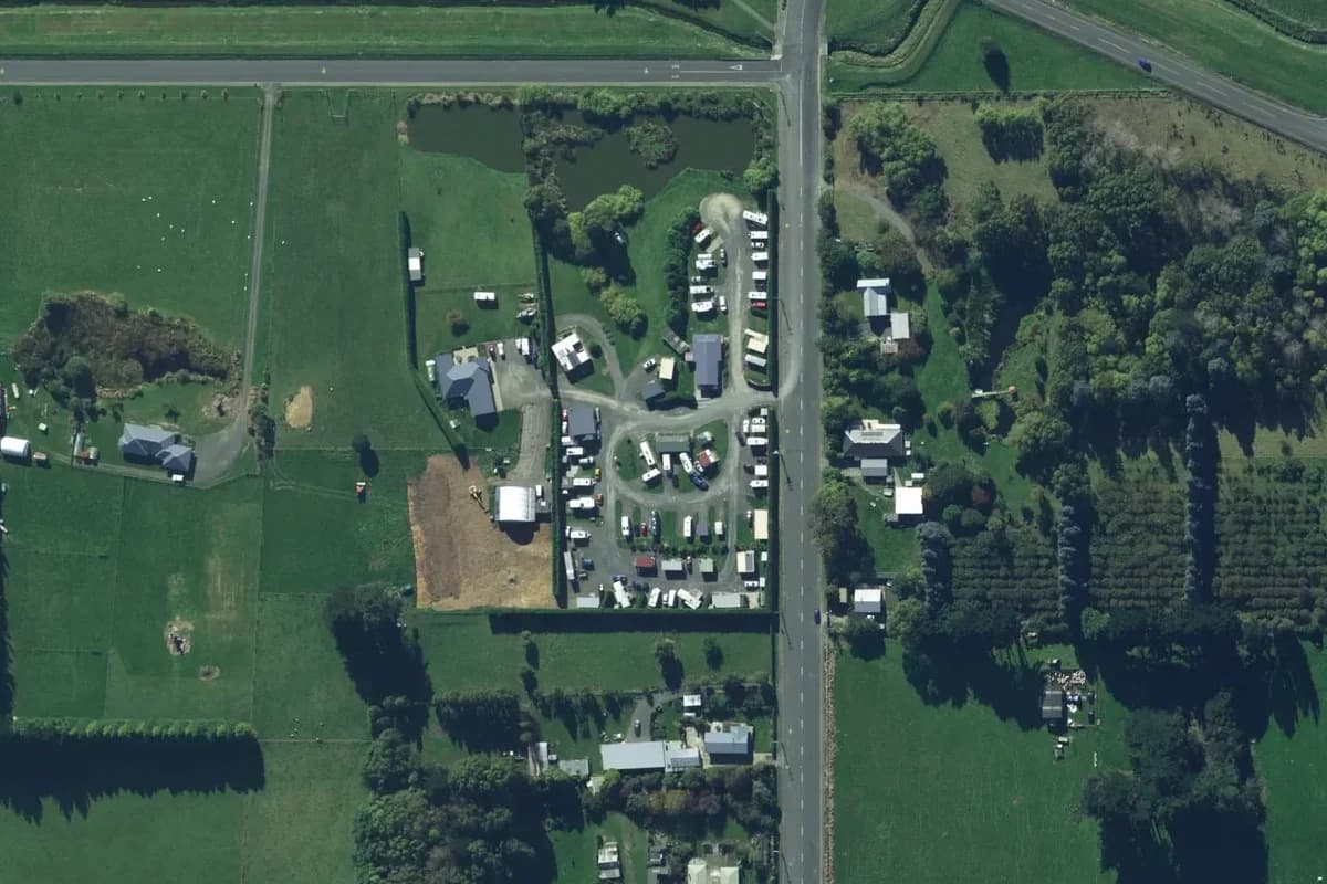
White caravans and small roofs line curved lanes in a sheltered grassy compound beside a straight road. Historical aerial imagery includes adjacent land; it is not a current pitch plan or surveyed park boundary. Cropped and converted to WebP from LINZ Basemaps.
This is not a whole-site accessibility assessment. Confirm the specific bathroom, path and accommodation requirements before booking. Directory label: Access Facilities.
A developed section of Ashley Rakahuri Gorge Holiday Park sits among trees inside the river bend, with caravan rows, lawns and the nearby road bridge visible. Historical aerial imagery includes adjacent land; it is not a current pitch plan or surveyed park boundary. Cropped and converted to WebP from LINZ Basemaps.
This is not a whole-site accessibility assessment. Confirm the specific bathroom, path and accommodation requirements before booking. Directory label: Access Facilities.
Parallel caravan rows and internal lanes occupy a wooded roadside compound, with buildings and a smaller grassy camping area below. Historical aerial imagery includes adjacent land; it is not a current pitch plan or surveyed park boundary. Cropped and converted to WebP from LINZ Basemaps.
This is not a whole-site accessibility assessment. Confirm the specific bathroom, path and accommodation requirements before booking. Directory label: Access Facilities.
Partial coastal holiday park view with caravans and small buildings along a curved lane above the shoreline. Historical aerial imagery includes adjacent land; it is not a current pitch plan or surveyed park boundary. Cropped and converted to WebP from LINZ Basemaps.
This is not a whole-site accessibility assessment. Confirm the specific bathroom, path and accommodation requirements before booking. Directory label: Access Facilities.
This is not a whole-site accessibility assessment. Confirm the specific bathroom, path and accommodation requirements before booking. Directory label: Access Facilities.
Cabin rows, caravans, a looping drive and blue pools form a compact urban holiday park beside sports courts and residential streets. Historical aerial imagery includes adjacent land; it is not a current pitch plan or surveyed park boundary. Cropped and converted to WebP from LINZ Basemaps.
This is not a whole-site accessibility assessment. Confirm the specific bathroom, path and accommodation requirements before booking. Directory label: Access Facilities.
Caravans, low roofs and grassy lanes sit just inland of a beach road, with the shore across a broad green strip. Historical aerial imagery includes adjacent land; it is not a current pitch plan or surveyed park boundary. Cropped and converted to WebP from LINZ Basemaps.
This is not a whole-site accessibility assessment. Confirm the specific bathroom, path and accommodation requirements before booking. Directory label: Access Facilities.
This is not a whole-site accessibility assessment. Confirm the specific bathroom, path and accommodation requirements before booking. Directory label: Access Facilities.
Compact peninsula campground with dense caravan rows and internal lanes, bordered by shoreline and a golf course. Historical aerial imagery includes adjacent land; it is not a current pitch plan or surveyed park boundary. Cropped and converted to WebP from LINZ Basemaps.
This is not a whole-site accessibility assessment. Confirm the specific bathroom, path and accommodation requirements before booking. Directory label: Access Facilities.
Historic Cape Foulwind lighthouse. Published in DOC's Cape Foulwind Walkway guide. Photograph date not supplied; this is route-area context, not a verified trailhead or current-condition photograph.
A diagonal indicative trace follows the edge of dense woodland beside scattered houses and fields, below a large terraced quarry-like excavation. Historical aerial imagery with indicative DOC mapped geometry; it may be incomplete or out of date and is not for navigation. This is not a guarantee of the complete or current walk. Not a navigation map or confirmation of access. Cropped, overlaid and converted to WebP.
A pale irregular route outline sits in dense woodland beside a blue-green river and broad white-grey gravel bars. Historical aerial imagery with indicative DOC mapped geometry; it may be incomplete or out of date and is not for navigation. This is not a guarantee of the complete or current walk. Not a navigation map or confirmation of access. Cropped, overlaid and converted to WebP.
A long pale loop and narrow upper spur lie in woodland below a large tan field, with small buildings near the right edge. Historical aerial imagery with indicative DOC mapped geometry; it may be incomplete or out of date and is not for navigation. This is not a guarantee of the complete or current walk. Not a navigation map or confirmation of access. Cropped, overlaid and converted to WebP.
A small irregular dark lake enclosed by forest above open pasture, with an indicative perimeter loop and a narrow southern approach. Historical aerial imagery with indicative DOC mapped geometry; it may be incomplete or out of date and is not for navigation. This is not a guarantee of the complete or current walk. Not a navigation map or confirmation of access. Cropped, overlaid and converted to WebP.
Milford Sound foreshore and Mitre Peak. Photograph of the named location or its documented route feature. Capture date not supplied; not a live view of current conditions.
Brown wetland with small dark pools, dense trees and a straight road on the right. Historical aerial imagery with indicative DOC mapped geometry; it may be incomplete or out of date and is not for navigation. This is not a guarantee of the complete or current walk. Not a navigation map or confirmation of access. Cropped, overlaid and converted to WebP.
Short bent overlay above a rocky shoreline, beside a building, parking rows and a road junction. Historical aerial imagery with indicative DOC mapped geometry; it may be incomplete or out of date and is not for navigation. This is not a guarantee of the complete or current walk. Not a navigation map or confirmation of access. Cropped, overlaid and converted to WebP.
Short nearly vertical overlay beside a road above a rocky coastal platform and turquoise inlet. Historical aerial imagery with indicative DOC mapped geometry; it may be incomplete or out of date and is not for navigation. This is not a guarantee of the complete or current walk. Not a navigation map or confirmation of access. Cropped, overlaid and converted to WebP.
Rimu Walk in the Tongariro National Park. Photograph of the named location or its documented route feature. Capture date not supplied; not a live view of current conditions.
Long narrow branching overlay follows a green ridge between pasture and wooded gullies. Historical aerial imagery with indicative DOC mapped geometry; it may be incomplete or out of date and is not for navigation. This is not a guarantee of the complete or current walk. Not a navigation map or confirmation of access. Cropped, overlaid and converted to WebP.
Tall narrow loop crosses textured rocky grassland below straight roads and rectangular fields. Historical aerial imagery with indicative DOC mapped geometry; it may be incomplete or out of date and is not for navigation. This is not a guarantee of the complete or current walk. Not a navigation map or confirmation of access. Cropped, overlaid and converted to WebP.