By Outdoor Next Editorial standards
On this page
Key facts
- Distance
- Not confirmed on the checked DOC page; see individual route sections
- Walking time
- Not specified in the checked DOC directory
- Track grade
- Easiest; Easy; Advanced
- Location
- Whareroa Farm
- Dog access
- No dogs. Other pets on conservation land rules.
Checked against official sources on 8 October 2026. Rules and conditions are set by Department of Conservation — confirm with them before you go.
Route overview
Enjoy regenerating shrubland, coastal views and kohekohe forest on these walks that are suitable for children.
This DOC directory entry covers Whareroa Farm tracks in Wellington, within Whareroa Farm. Where DOC groups several walks, times and grades refer to the listed options rather than a single continuous itinerary.
Distance, time and grade
- Distance: Not confirmed on the checked DOC page; see individual route sections
- Walking time: Not specified in the checked DOC directory
- DOC grade: Easiest; Easy; Advanced
Access and alerts
Source checked 2026-10-08. This page is a dated snapshot, not a live track-status report. Check current DOC route information immediately before travelling. An absence of listed alerts does not establish that a route is open.
Individual walk guides
Dog access
No dogs. Other pets on conservation land rules.
Description
Walks
Stream Loop Track
Time: 12 min returnDistance: 355 m Category: Short walk
A short walk through regenerating shrubland. Suitable for wheelchairs.
Coastal lookout walk
Time: 15 minDistance: 500 mCategory: Walking track
Panoramic coastal views to the Marlborough Sounds, Kapiti Island and the Kapiti coast.
Forest loop walk
Time: 45 minDistance: 1.6 kmCategory: Walking track
Walk through a remnant of the kohekohe forest that once covered much of the Kapiti coast, return along the farm race.
Cairn view track
Time: 40 minDistance: 1.2 kmCategory: Tramping track
Climb to a lookout over the farm and coast. From the lookout you can view the site of Camp McKay and the old water reservoir.
Campbell's Mill Road round trip
Distance: 13.4 kmCategory: Tramping track
Walk the uphill mountain bike track or the horse riding track to Campbell's Mill Road. Follow Campbell’s Mill Road into Maungakotukutuku Valley Road, Waterfall Road and Emerald Glen Road back to Whareroa Farm.
Mountain biking
Downhill mountain bike track
Distance: 2 kmCategory: Grade 3 / Intermediate
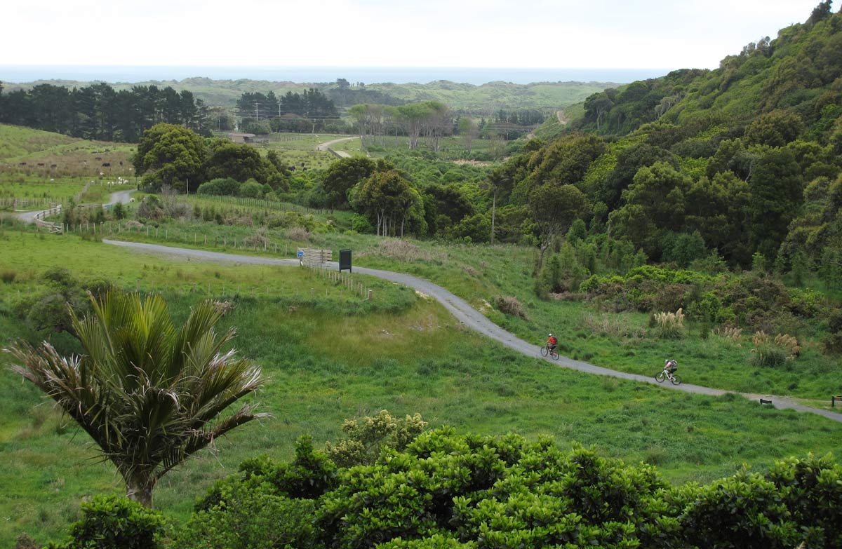
This track offers spectacular views of the Kapiti coast and Kapiti Island as it winds down through regenerating bush to the carpark. From there bikers can access Queen Elizabeth Park in 2 minutes via the highway underpass.
Uphill mountain bike track
Distance: 4.1 kmCategory: Grade: 2 / Easy
Follow the track Campbell’s Mill Road.
These are shared-use tracks. Follow the mountain bikers code: respect others, respect the rules, respect the track.
Horse riding
Carpark to Campbell's Mill Road
Distance: 2.5 km
This track starts at Campbell's Mill Road and is an easy uphill ride through the farm.
Gate access: Equestrian access through Whareroa Farm and along Campbell’s Mill Road is controlled by locked gates. To rent a key contact Kapiti Coast District Council, Phone: +64 4 296 4700. Leave gates as you find them.
This is shared-use track. Watch for walkers.
Getting there
The main entrance to Whareroa Farm is via the Queen Elizabeth Park off-ramp about 3.5 km north of Paekakariki on SH1.
When leaving Whareroa Farm, a section of Campbell’s Mill Road has been closed by the private landowner, preventing access into Akatarawas. Access into Akatarawas is now via Maungakotukutuku Road/Perhams Road until further notice. Road and area closures map (PDF, 179K).
Know before you go
Get more information about Whareroa Farm tracks - Wellington Regional Trails website.
Toilets
The main toilets at the Whareroa Farm carpark are closed.
Public toilets can be found at the nearby Queen Elizabeth Park Visitor Centre. There is also toilets at the Hub. The Hub is 1.3 km or 30 min walk up the Farm Race Track.
Sources and reuse
Route descriptions and practical information reproduced from the Department of Conservation, Crown copyright, under CC BY 4.0, subject to DOC's copyright policy. Formatting has been adapted, including flattening page sections; follow the original DOC page for maps, section-specific layout, current notices and linked documents. Outdoor Next is independent and is not endorsed by DOC.
The accompanying photograph is published in DOC's official route gallery with an explicit reuse licence. Its original caption and credit are retained; it does not establish current track conditions.
