By Outdoor Next Editorial standards
On this page
Key facts
- Distance
- 20.2 km one way
- Time
- Nov–Apr: 7–8 hr; May–Oct: 9 hr
- Elevation
- Change in elevation +/- 1,196 m; highest point Red Crater, 1,886 m
- Difficulty
- Intermediate tramping track (Labour weekend–30 April); expert route (May–October); high fitness required
- Start and finish
- Mangatepōpō Road end (1,120 m) to Ketetahi Road (760 m)
- Dogs allowed?
- No, not anywhere in Tongariro National Park, including inside vehicles
- Managed by
- Department of Conservation, in partnership with Ngāti Hikairo ki Tongariro
Checked against official sources on 24 September 2026. Rules and conditions are set by Department of Conservation — confirm with them before you go.
The Tongariro Alpine Crossing is a 20.2 km one-way track that takes 7–8 hours from November to April and about 9 hours from May to October. It starts at Mangatepōpō Road end and finishes at Ketetahi Road, so you need to sort transport before you go, and the Department of Conservation (DOC) recommends a free track booking for everyone. It's a long, exposed alpine day through active volcanic country, and not suitable for all walkers.
October is still winter-season planning
Checked on 1 October 2026: DOC's Crossing guidance still includes October in its winter preparation period. Alpine skills and equipment are essential; DOC advises going with a guide. It does not issue its summer hazardous-weather advisory from May to October, so no advisory is not an all-clear.
This is a partial seasonal review, not a live access, weather, avalanche or volcanic assessment. Other retained facts were not fully rechecked; the wider factual check remains dated 24 September 2026. Check current conditions before deciding whether to go.
Tongariro Alpine Crossing at a glance
| Detail | What DOC says |
|---|---|
| Distance | 20.2 km one way |
| Time | 7–8 hr (Nov–Apr); 9 hr (May–Oct) |
| Start | Mangatepōpō, 1,120 m |
| Highest point | Red Crater, 1,886 m |
| Finish | Ketetahi Road, 760 m |
| Elevation change | +/- 1,196 m |
| Track category | Intermediate tramping track from Labour weekend (late October) to 30 April; expert route May–October |
| Fitness | High; steep and undulating |
| Children | Not recommended for children under 10 |
Parking and shuttles
Because the Crossing is one way, parking is the first thing to plan. From Labour weekend to 30 April, parking at the road-ends is limited to a 4-hour maximum, so DOC suggests booking a shuttle. DOC's page also says:
- In summer there is no parking for Crossing walkers at Mangatepōpō car park.
- There is a private car park near the end of the hike at Ketetahi.
- For safety reasons, DOC doesn't recommend parking on the side of state highways.
DOC says the best way to get to the Crossing is by shuttle. Shuttles run from local towns, and you can arrange one through:
| Town | Where to arrange a shuttle | Phone |
|---|---|---|
| Ohakune | Ohakune isite | 0800 647 483 |
| Taumarunui | Taumarunui isite | +64 7 895 7494 |
| Tūrangi | Tūrangi Customer and Visitor Information Centre | 0800 288 726 |
| Taupō | Taupō Customer and Visitor Information Centre | 0800 525 382 |
DOC lists Taupō as 86.5 km away and Tūrangi as 36.7 km. If you're basing yourself in Taupō with a campervan, see our guide to freedom camping in Taupō.
Track bookings
Track bookings are free and recommended for everyone, and you need one to use a shuttle or guided walk service. DOC introduced the system in October 2023. How it works:
- One booking covers your whole group. You'll need a contact phone number, email address and the group leader's name.
- Book online with DOC, at a visitor centre or isite, or through your shuttle or guiding operator if they offer it.
- Save the receipt email. Your group needs to show a digital or paper copy to rangers at the car park.
- Plans changed? Fill in the form again and choose the rebooked option. You don't need to cancel.
- People who arrive without a booking won't be penalised, and there's no cap on bookings.
- If you have a Tongariro Northern Circuit hut or campsite booking, you're exempt. (The Northern Circuit is a Great Walk; see our Great Walks booking guide.)
What the track is like
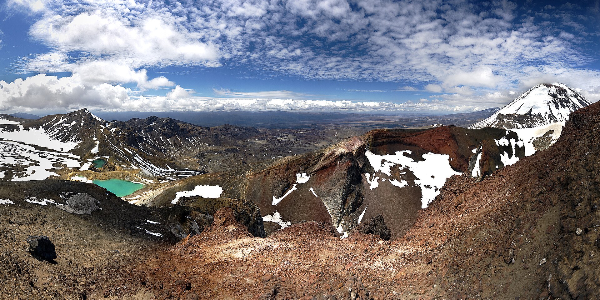
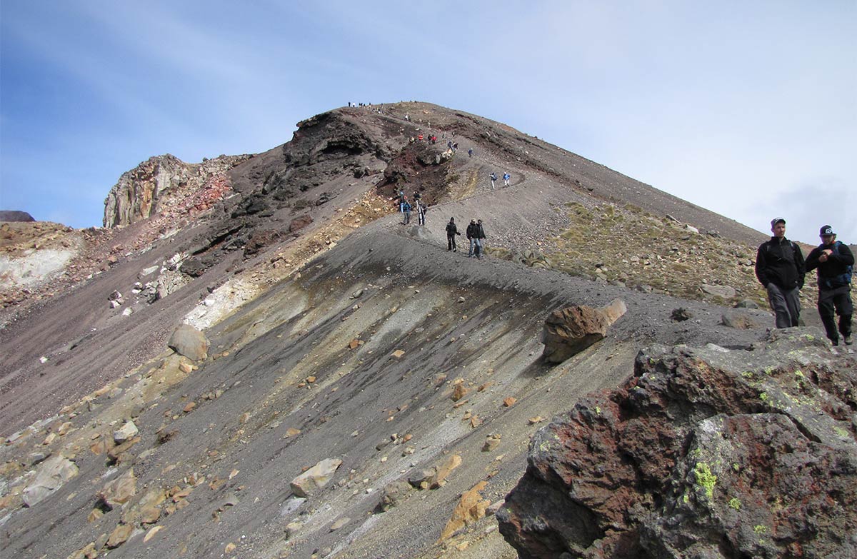
The Crossing starts on a boardwalk through the Mangatepōpō Valley; the first 5.4 km is shared with the Soda Springs Walk, an easy 2-hour return option. A staircase then climbs around 350 m to South Crater before the ascent to Red Crater. Loose rock on the steep scree descent to Ngā Rotopounamu/Emerald Lakes is a major slip hazard, DOC warns. The track passes Blue Lake and zig-zags down many steps to forest and Ketetahi Road.
In late 2025, two fires burned significant areas around the start of the track. Ngāti Hikairo ki Tongariro have placed a 10-year restorative rāhui over the affected area, so stay on the track, clean your shoes and gear before you visit, and take your rubbish home.
Summer weather and "Not Recommended Today"
Snow can fall at any time of year, and very cold temperatures, strong wind, heavy rain and poor visibility are common even in summer. In the summer season, DOC applies a "Not Recommended Today" advisory when the NIWA Red Crater forecast exceeds set limits, such as wind gusts of 70 km/h or more. It's assessed at 6 am and signposted at Mangatepōpō Road end. There are no advisories from May to October.
Winter: May to October
From May to October the Crossing is an expert route with snow, ice, avalanche risk and sub-zero temperatures, and DOC says it's best to go with a guide. DOC says you must be able to navigate when snow hides the marker poles, recognise avalanche terrain and rescue someone, and stop a slide on ice. Essentials include crampons, an ice axe and a helmet, plus an avalanche transceiver, probe and shovel. Allow 9 hours, leave early (there are 9–11 hours of daylight in winter) and always take a head torch.
Shuttle buses generally don't operate during winter, but guided trips include transport. Find operators on DOC's list of Tongariro guiding companies, and check the avalanche forecast.
Volcanic and geothermal hazards
The Crossing passes through volcanic hazard zones, and DOC says volcanic risk is present even when the track is open. Te Maari, Red Crater and Ngāuruhoe have all been active in the last 100 years; the most recent eruption was from Te Maari in 2012. This guide does not display a live alert level. Check GeoNet and DOC's volcanic risk page before you go.
If an eruption happens, DOC's advice is to move away from the eruption site and out of valleys to higher ground, and to shelter behind a bank or ridge and cover your head with your pack if rocks or an ash cloud come towards you. Near Emerald Lakes, keep away from steam vents, and don't touch or enter any of the lakes, which are sacred to Ngāti Hikairo ki Tongariro.
Facilities, water and rules
- Toilets are every 1–2 hours along the track. If there's a queue at Mangatepōpō, the next toilets are 1 km (20 minutes) away.
- Carry 2–3 litres of water; water along the track isn't suitable for drinking.
- No dogs anywhere in Tongariro National Park, including inside vehicles.
- No drones without a permit, and no mountain biking.
Before you go
- Make a free track booking and save the receipt.
- Book a shuttle, or plan your return from Ketetahi.
- Check the NIWA forecast, GeoNet and the DOC track page.
- Pack 2–3 litres of water, warm waterproof layers, food and a head torch, using DOC's day hikes gear list.
- May to October: go with a guide unless you have alpine skills and gear.
- Share your plans using Plan My Walk.
Prepare with the day-hike packing guide, check official conditions, or browse all walks. A day-hike checklist does not replace the additional alpine equipment and competence needed for a winter crossing.
More photographs
Frequently asked questions
How long is the Tongariro Alpine Crossing?
DOC lists the Tongariro Alpine Crossing as 20.2 km one way. It takes 7–8 hours from November to April and about 9 hours from May to October, the winter season.
Do I need a shuttle for the Tongariro Alpine Crossing?
It's the easiest option. The track starts and finishes at different road ends, parking is limited to a 4-hour maximum from Labour weekend to 30 April, and DOC says the best way to get there is by shuttle. You need a free track booking to use a shuttle. Shuttles run from local towns and can be arranged through isites and information centres in Ohakune, Taumarunui, Tūrangi and Taupō.
Do I have to book the Tongariro Alpine Crossing?
Bookings are recommended for everyone and there's no cost. DOC says visitors who arrive without a booking won't be penalised, but you do need a booking to use a shuttle or guided walk service. People with a Tongariro Northern Circuit hut or campsite booking are exempt.
Can you do the Tongariro Alpine Crossing in winter?
From May to October the Crossing is an expert route with snow, ice, avalanche risk and sub-zero temperatures. DOC says you need alpine skills and equipment, including a helmet, crampons and an ice axe, and that it's best to go with a guide. Shuttles generally don't operate in winter, but guided trips include transport.
Is the Tongariro Alpine Crossing safe with the volcanoes?
DOC says the track passes through volcanic hazard zones and volcanic risk is present even when the track is open. Monitoring reduces the risk but can't ensure your safety. Check the volcanic alert level on GeoNet and DOC's volcanic risk page before you go, and choose another track if you're not comfortable with the risk.
Sources & official links
- 1.Tongariro Alpine Crossing— Department of Conservation
- 2.Tongariro Alpine Crossing booking system— Department of Conservation
- 3.Sustainable visitor management for Tongariro— Department of Conservation
- 4.Tongariro National Park— Department of Conservation
- 5.Volcanic risk in Tongariro National Park— Department of Conservation
- 6.Plan My Walk— NZ Mountain Safety Council