Start with the children's needs, then check the actual campsite layout. A playground listing is a useful question to follow up, not evidence that a campsite is safe for every family.
Planning checklist & guides
Before you choose
Ask about roads, water edges and supervision around the pitch.
Confirm toilets, drinking water and the sleeping layout for your group.
Keep a wet-weather alternative and enough time for setup.
Campsites qualify when their detail facts contain a sourced, recorded playground note, including limitations. This is not a family-safety assessment. Missing playground information does not mean there is no playground.
All 648 published campsite records, 1589 walking-track records and 26 trip plans are considered against the relevant criteria. Campsites with a closed notice are excluded. Seasonal and access notices remain visible; inclusion does not confirm that a place is open.
Each page shows up to 12 matches per group in name order (A-Z), not a ranking. Use the page links to browse every match. Groups share a page number; shorter groups finish earlier. Full finders also include records outside this topic. Source wording and check dates are retained here and on record pages, not live availability checks.
Shelly Beach's camping lawns, accommodation and internal loops between the tidal shore and wooded hillside. Historical aerial imagery includes adjacent land; it is not a current pitch plan or surveyed park boundary. Cropped and converted to WebP from LINZ Basemaps.
A compact tree-lined camping area with cabins, caravans and an internal lane adjoins a large grass recreation field and rectangular blue pool. Historical aerial imagery includes adjacent land; it is not a current pitch plan or surveyed park boundary. Cropped and converted to WebP from LINZ Basemaps.
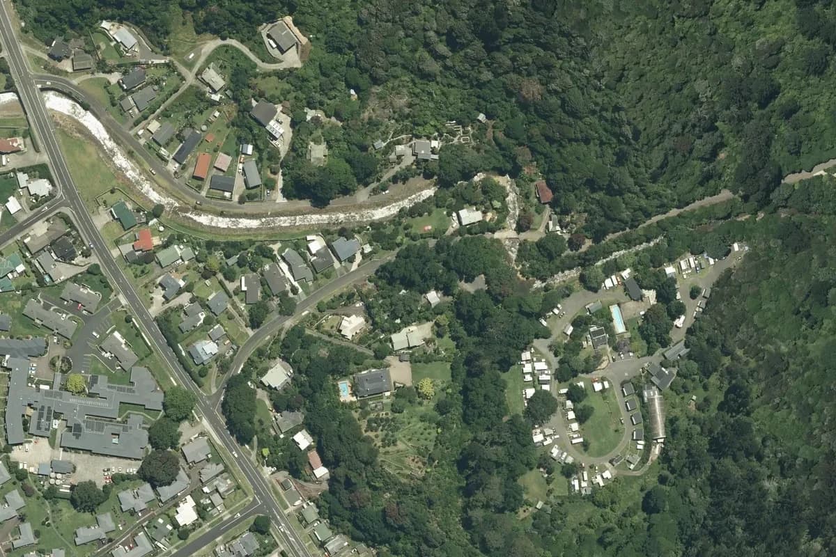
Leafy campground with a looping caravan lane, grass areas and a pool in a wooded valley beside a stream. Historical aerial imagery includes adjacent land; it is not a current pitch plan or surveyed park boundary. Cropped and converted to WebP from LINZ Basemaps.
Rows of white caravans, curved lanes, red-roofed buildings and a broad grass camping field occupy a waterfront site beside tidal flats. Historical aerial imagery includes adjacent land; it is not a current pitch plan or surveyed park boundary. Cropped and converted to WebP from LINZ Basemaps.
Fox Glacier's holiday-park pitches, accommodation buildings and internal roads south of the access road. Historical aerial imagery includes adjacent land; it is not a current pitch plan or surveyed park boundary. Cropped and converted to WebP from LINZ Basemaps.
The Franz Josef holiday park's camping lanes and accommodation on the west side of the main road. Historical aerial imagery includes adjacent land; it is not a current pitch plan or surveyed park boundary. Cropped and converted to WebP from LINZ Basemaps.
The Geraldine holiday park's camping rows and tree-lined grounds beside the town's recreation area. Historical aerial imagery includes adjacent land; it is not a current pitch plan or surveyed park boundary. Cropped and converted to WebP from LINZ Basemaps.
White-roofed courtyard buildings and a treed internal loop between two roads, with the beach on the left. Historical aerial imagery includes adjacent land; it is not a current pitch plan or surveyed park boundary. Cropped and converted to WebP from LINZ Basemaps.
Greymouth Seaside holiday park between the beach and neighbouring land, immediately south of the runway. Historical aerial imagery includes adjacent land; it is not a current pitch plan or surveyed park boundary. Cropped and converted to WebP from LINZ Basemaps.
Caravans and small tent-like shapes in a tree-fringed clearing beside a pool, playing field and blue courts. Historical aerial imagery includes adjacent land; it is not a current pitch plan or surveyed park boundary. Cropped and converted to WebP from LINZ Basemaps.
Rows of small roofs, a square courtyard and marked grass clearings above a curving road through forest. Historical aerial imagery includes adjacent land; it is not a current pitch plan or surveyed park boundary. Cropped and converted to WebP from LINZ Basemaps.