By Outdoor Next Editorial standards
On this page
Key facts
- Distance
- 3.3 km for the mapped Akl Paths itinerary; summit-only variant not measured here
- Walking time
- 40 min for the mapped itinerary; add stops
- Track grade
- Gravel paths, steps and uphill sections; formal grade not verified
- Approaches
- Coronation Road by the education centre, or Domain Road visitor car park
- Dogs
- On leash on the maunga; prohibited in Whānau Ātea
- Cultural restrictions
- Stay out of both craters and do not climb the central plug
Checked against official sources on 12 October 2026. Rules and conditions are set by Tūpuna Maunga Authority — confirm with them before you go.
Te Pane o Mataoho / Te Ara Pueru / Māngere Mountain is a volcanic maunga overlooking Manukau Harbour, with walking paths through a significant cultural landscape. Akl Paths lists 3.3 km and 40 minutes for its mapped Māngere Mountain itinerary. A dog walk needs a more specific plan because part of the wider visitor area prohibits dogs.
Choose a start and finish
| Approach | Planning distinction |
|---|---|
| Coronation Road | Council's mapped start near Māngere Mountain Education Centre |
| Domain Road | Main visitor car-park approach beside the war memorial hall |
| Summit-path-only visit | Different from the complete mapped park itinerary; no separately verified distance here |
The council map starts by the education centre off Coronation Road; Domain Road is another approach. Council's route description includes gravel paths, steps and a short road section. Use the route board to choose the return to your actual start, not simply whichever downhill path appears convenient.
The official Auckland visitor page identifies Domain Road visitor access and explains the surrounding cultural features. If combining the walk with an education-centre visit or a guided walk, confirm those arrangements separately. An independently accessible maunga path does not establish opening hours or availability for a hosted activity.
Stay on the permitted paths
Do not enter either sacred crater or climb the central volcanic plug. Council describes viewing those features from the crater-rim path. The prohibition is not relaxed for photography, a shortcut or an apparently easy descent.
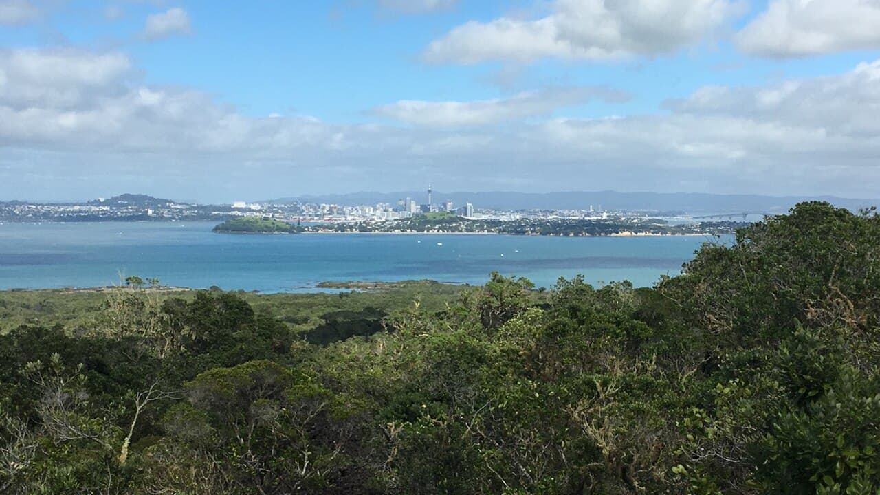
Keep the group on formal paths around earthworks and storage pits, and leave the landscape as found. Views over the harbour are part of the outing, but so is respecting the place itself. A route being urban and relatively short does not make it appropriate to run across every grassy slope.
Dogs: summit paths, not Whānau Ātea
Dogs must be on a leash on the maunga and are prohibited in Whānau Ātea. The authority's published conditions state both the specific exclusion and the leash rule elsewhere. The council park page also lists an on-leash rule for the maunga.
Choose the permitted summit paths and leave the play, sports and gathering areas out of the dog outing. Do not take the complete Akl Paths distance as a measurement of a separately checked dog-safe variant. If the access you intended goes through an excluded area, use a permitted signed approach or choose another walk; do not cross the exclusion to reach the hill.
Bring waste bags and keep the dog close when passing people. The neighbouring education centre has its own park rules, which are not a substitute for the maunga rule. For another verified on-leash summit option, compare Maungarei.
Effort and preparation
Allow time for climbing, steps and stops rather than treating the council's 40 minutes as a deadline. This guide does not supply a formal walking grade or promise a continuously accessible surface. Assess the chosen route against the least confident walker, and make a shorter return if footing or weather does not suit.
Take water, sun protection and a weather layer. Read current entrance signs for access works or closures and keep a legal parking or public-transport plan separate from the walk itself.
Before you go
- Identify Coronation Road or Domain Road as your actual start.
- Check current authority and council notices.
- Keep dogs on leash and outside Whānau Ātea and play/sports areas.
- Stay out of the craters and off the central plug.
- Allow time for steps, views and the return to your entrance.
- Keep overnight parking separate from the walking visit.
Frequently asked questions
Can I take my dog up Māngere Mountain?
Use the permitted summit paths with the dog on a leash. Dogs are prohibited in Whānau Ātea, so a dog walk must exclude that play and gathering space. Do not read a dog-friendly label as permission for every part of the mapped park itinerary.
How long is the summit walk?
Council's mapped Akl Paths itinerary is 3.3 km and 40 minutes, starting near the education centre on Coronation Road. A shorter Domain Road summit return is not independently measured here; identify your entrance and return before relying on a time.
Can I walk inside the crater?
No. Council says both craters are sacred and must not be entered, and the central plug must not be climbed. View these features from the permitted crater-rim path.
Sources & official links
- 1.Te Pane o Mataoho / Te Ara Pueru / Māngere Mountain Path— Auckland Council
- 2.Māngere Mountain: park and dog rules— Auckland Council
- 3.Whānau Ātea hire conditions: animals and wider maunga leash rule— Tūpuna Maunga Authority
- 4.Te Pane o Mataoho / Te Ara Pueru Māngere Mountain— Discover Auckland / Tātaki Auckland Unlimited