By Outdoor Next Editorial standards
On this page
Key facts
- Distance
- 5.6 km circuit in Tekapo Trails' current description
- Walking time
- 2 hr 30 min for the regional tourism shoreline/road circuit
- Track grade
- Easy, undulating terrain in regional tourism guidance; not a DOC grade
- Start
- Small car park off Godley Peaks Road; confirm the signed circuit
- Seasonal closure
- Mid-October to mid-December for lambing; confirm exact dates locally
- Dogs and facilities
- No dogs; regional tourism lists no facilities on the track
Checked against official sources on 12 October 2026. Rules and conditions are set by Community trail; Tekapo Trails and Mackenzie visitor guidance — confirm with them before you go.
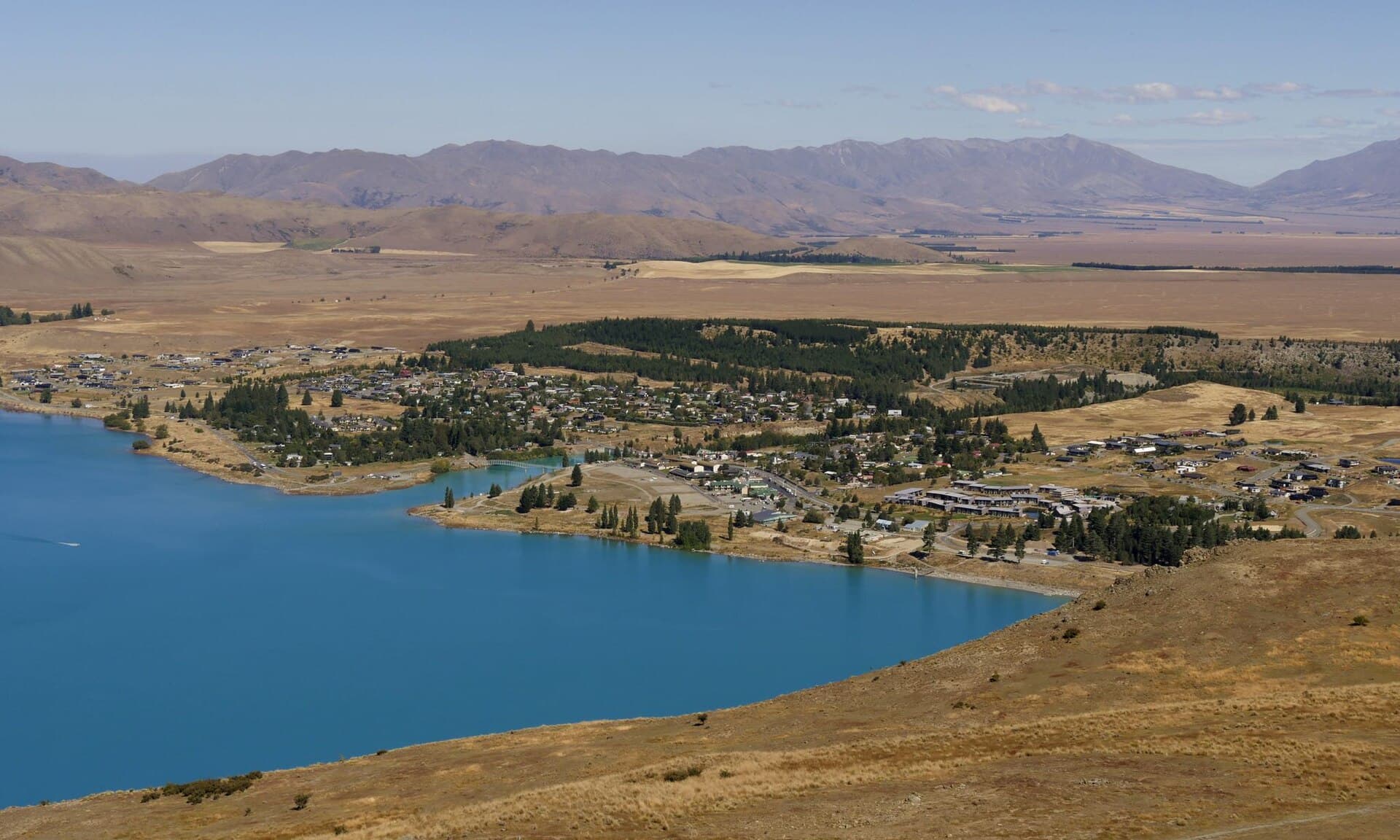
Lake Tekapo Peninsula Walkway is a lakeside circuit off Godley Peaks Road, with views across the open lake rather than a climb to the Mt John observatory. Tekapo Trails publishes a mid-October to mid-December lambing closure for the Peninsula Trail. Check that restriction before planning a spring visit; this is not an assured year-round alternative to a mountain walk.
Seasonal access comes first
The local trail trust's description includes both general open-trail wording and the specific lambing restriction. Use the specific restriction when planning. The checked page does not establish exact opening and closing dates for every year, so ask locally and follow the signs at the entrance.
Do not cross a closed section because a mapping app still displays the circuit. Have another independently checked walk ready. A closed farmland route is not made available by starting at the other end or walking only part of it.
Distance and time: different published circuits
| Source | Published figure | Planning limitation |
|---|---|---|
| Tekapo Trails | 5.6 km | Local Peninsula Trail circuit description |
| Mackenzie Region Tourism | 2 hr 30 min | Shoreline circuit returning by Godley Peaks Road |
| Older DOC walking brochure | 4 km / 1 hr 30 min | Historic shorter listing; not used as the current longer-circuit timetable |
The local trail trust describes a 5.6 km circuit; regional tourism allows two and a half hours. These give useful planning context but do not independently prove that every source measures the same line. Do not pair the older brochure's shorter time with the longer local circuit and call it an official pace estimate.
Use the signposted route at the car park to settle the day's itinerary. Allow additional time for stops, variable footing and any slower members of the group. A short out-and-back, where access permits, is a different plan and has no separately verified distance in this guide.
Getting to Godley Peaks Road
This is a Godley Peaks Road lakeside outing, not the Mt John summit walk from Tekapo Springs. Regional tourism directions describe travelling west from township on SH8, turning onto Godley Peaks Road and locating the car park near Lake McGregor. Tekapo Trails gives its own small-car-park approach on that road. Confirm the signed peninsula entrance rather than choosing a generic lake map pin.
Arrange the road journey separately from the walking time. No shuttle timetable, parking capacity, road-surface guarantee or verified trailhead coordinate is supplied here. If your visit depends on a pickup, agree the actual road entrance and a return deadline before starting.
Walking the peninsula
Regional tourism describes undulating lakeshore terrain with a gravel-road return and views of Lake Tekapo, Mt John and surrounding mountains. Read the local signs and stay with the marked circuit. The trail trust notes that vegetation can make the line harder to find in places, so take a map rather than relying only on footprints.
This guide does not recommend an unmarked descent to the water or a scramble to a photo spot. The route is worthwhile without approaching a steep bank. Where the return uses the road, remain alert to vehicles and keep the group together without spreading across the carriageway.
Dogs, facilities and exposure
Dogs are not allowed on the peninsula route. That restriction is stated by both the trail trust and regional tourism; permission elsewhere in the Tekapo area does not transfer here.
Regional tourism lists no facilities on the track. Use township toilets beforehand and carry water, food and rubbish storage. Do not assume lake water is safe drinking water or that a holiday park's facilities are public walking amenities.
DOC's area guidance warns of changeable weather and cold wind in the Mackenzie Basin. Bring sun protection and warm weatherproof layers together. Lake views are not an indication that conditions will remain mild for the full circuit.
Before you go
- Confirm the lambing restriction and any other current access notice.
- Check the signed circuit, its road return and your transport plan.
- Leave dogs at home.
- Use township toilets and carry drinking water.
- Pack sun and wind protection, food and a saved map.
- Keep overnight plans separate using Lake Tekapo camping guidance.
Frequently asked questions
Is Lake Tekapo Peninsula Walkway open in spring?
Do not assume it is. Tekapo Trails publishes a mid-October to mid-December lambing closure. It does not give exact annual dates in the checked description; confirm those and obey closure signs. A general open-trail sentence does not override the seasonal restriction.
How long is the peninsula circuit?
Tekapo Trails describes 5.6 km and Mackenzie Region Tourism gives two and a half hours for its shoreline/road circuit. An older DOC brochure lists 4 km and one and a half hours. These are not treated as interchangeable measured itineraries; check the signed local route before starting.
Are dogs allowed on Lake Tekapo Peninsula Walkway?
No. Both the local trail trust and regional tourism guidance prohibit dogs on this route. Do not apply a dog rule from another Lake Tekapo walk.
Does it start at Tekapo Springs?
No. The peninsula circuit starts off Godley Peaks Road. Tekapo Springs is associated with the separate Mt John walk; it is not the trailhead for this circuit.
Sources & official links
- 1.Peninsula Trail: local trails, lambing closure and dogs— Tekapo Trails
- 2.Short Walks at Lake Tekapo: Peninsula Walkway— Mackenzie Region Tourism
- 3.Walks near Lake Tekapo: older Peninsula Walkway description— Department of Conservation
- 4.Lake Tekapo area: weather and preparation— Department of Conservation
- 5.Be prepared with the Land Safety Code— Department of Conservation