Choose a pitch that accepts your vehicle and check its services separately. These campsites list campervan stays and power, but that does not confirm a dump station, drinking-water connection or availability for your dates.
Planning checklist & guides
Before you choose
Confirm vehicle length, access road and the correct powered-site booking.
Arrange drinking-water refills and lawful waste disposal separately.
Check connection requirements, arrival times and seasonal access.
Campsites must explicitly list campervan stays and a sourced power fact with status yes. Waste-disposal notes, when recorded, retain their exact wording; rubbish disposal is not relabelled as a dump station.
All 648 published campsite records, 1589 walking-track records and 26 trip plans are considered against the relevant criteria. Campsites with a closed notice are excluded. Seasonal and access notices remain visible; inclusion does not confirm that a place is open.
Each page shows up to 12 matches per group in name order (A-Z), not a ranking. Use the page links to browse every match. Groups share a page number; shorter groups finish earlier. Full finders also include records outside this topic. Source wording and check dates are retained here and on record pages, not live availability checks.
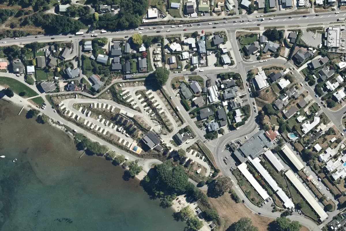
Long grassy camping lanes and rows of caravans sit behind lakeside buildings and a small pool, bordered by residential streets and a stream. Historical aerial imagery includes adjacent land; it is not a current pitch plan or surveyed park boundary. Cropped and converted to WebP from LINZ Basemaps.
Driftaway Queenstown's terraced campervan rows and shared facilities line the lakefront below Lake Avenue, with the surrounding Frankton neighbourhood behind. Historical aerial imagery includes adjacent land; it is not a current pitch plan or surveyed park boundary. Cropped and converted to WebP from LINZ Basemaps.
A northern lakeshore grass strip with a row of white vehicles, small roofs and connecting lanes below broad fields. Historical aerial imagery includes adjacent land; it is not a current pitch plan or surveyed park boundary. Cropped and converted to WebP from LINZ Basemaps.
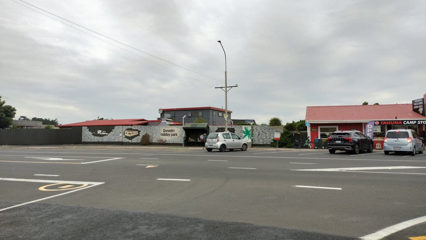
Dunedin Holiday Park frontage and adjacent Tahuna Camp Store on Victoria Road, 3 April 2026. This is the actual Dunedin property, not Nelson's Tahuna Beach Holiday Park; camping pitches are not shown.
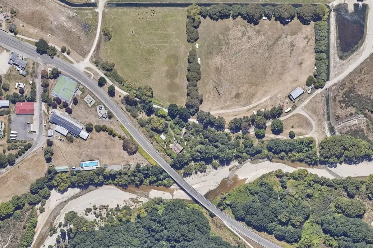
Camping vehicles around tree-bordered grass, with a roofed building and curving access lane beside a river and road bridge. Historical aerial imagery includes adjacent land; it is not a current pitch plan or surveyed park boundary. Cropped and converted to WebP from LINZ Basemaps.
Caravans on grass strips beside branching gravel lanes and buildings, with neighbouring paddocks and houses. Historical aerial imagery includes adjacent land; it is not a current pitch plan or surveyed park boundary. Cropped and converted to WebP from LINZ Basemaps.
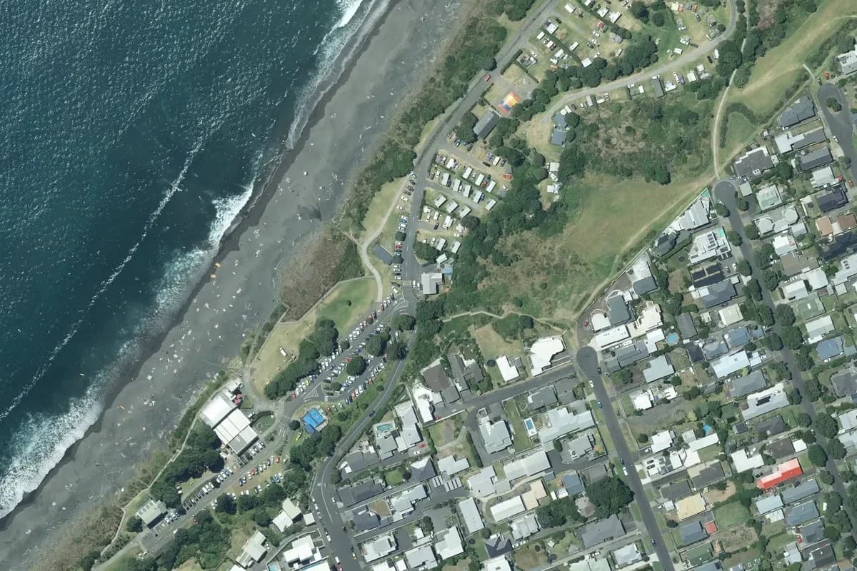
Partial view of an elongated coastal campground, with caravan plots and curving lanes beside the beach and walkway. Historical aerial imagery includes adjacent land; it is not a current pitch plan or surveyed park boundary. Cropped and converted to WebP from LINZ Basemaps.
A roadside tourist-park layout with a plot grid, small units, a pond and a square maze among open fields. Historical aerial imagery includes adjacent land; it is not a current pitch plan or surveyed park boundary. Cropped and converted to WebP from LINZ Basemaps.
Fox Glacier's holiday-park pitches, accommodation buildings and internal roads south of the access road. Historical aerial imagery includes adjacent land; it is not a current pitch plan or surveyed park boundary. Cropped and converted to WebP from LINZ Basemaps.
The entrance and reception at Foxton Beach Holiday Park, photographed on 3 March 2025 according to the camera metadata. The source uses the earlier TOP 10 name. This is a dated view of the actual property, not current availability.
The Franz Josef holiday park's camping lanes and accommodation on the west side of the main road. Historical aerial imagery includes adjacent land; it is not a current pitch plan or surveyed park boundary. Cropped and converted to WebP from LINZ Basemaps.
The Geraldine holiday park's camping rows and tree-lined grounds beside the town's recreation area. Historical aerial imagery includes adjacent land; it is not a current pitch plan or surveyed park boundary. Cropped and converted to WebP from LINZ Basemaps.