By Outdoor Next Editorial standards
On this page
Key facts
- Distance
- Not confirmed on the checked DOC page; see individual route sections
- Walking time
- 7 - 10 hr
- Track grade
- Expert
- Location
- Mount Aspiring National Park
- Dog access
- No dogs. Other pets on conservation land rules.
Checked against official sources on 8 October 2026. Rules and conditions are set by Department of Conservation — confirm with them before you go.
Route overview
This route crosses Rabbit Pass to connect with the East branch of the Matukituki River. It is suitable for experienced alpine trampers. Only attempt in good conditions – even then extreme care is required.
This DOC directory entry covers Wilkin Valley - East Matukituki Traverse in Otago, within Mount Aspiring National Park. Where DOC groups several walks, times and grades refer to the listed options rather than a single continuous itinerary.
Distance, time and grade
- Distance: Not confirmed on the checked DOC page; see individual route sections
- Walking time: 7 - 10 hr
- DOC grade: Expert
Access and alerts
Source checked 2026-10-08. This page is a dated snapshot, not a live track-status report. Check current DOC route information immediately before travelling. An absence of listed alerts does not establish that a route is open.
Predator control for Mt Aspiring National Park; First published on 16 September 2025. Last reviewed on 6 October 2026.
East Matukituki 3-wire bridge closed; First published on 1 May 2026. Last reviewed on 31 July 2026.
Dog access
No dogs. Other pets on conservation land rules.
Description
This route is only suitable for experienced alpine trampers. It should only be attemped in good conditions – even then extreme care is required.
Significant hazards exist all year round on this route and on some sections people choose to use mountaineering techniques. Don't hesitate to turn back if conditions are unfavourable, you have doubts about your ability or you are concerned for your safety.
Top Forks Hut to Ruth Flat
Time: 8 - 10 hr
Follow the track behind the hut and climb, before sidling around above the gorge to the open flats of the south branch. A major slip in the gorge can be difficult to negotiate - take extreme care crossing this section. Follow the flats until you reach the waterfall face 3 to 4 hours from the hut.
Waterfall Face is very steep and exposed, with significant fall hazard; snow grass is slippery even when dry. It is extremely dangerous when wet, windy or under snow and should not be attempted if any of these conditions exist. Take care, hazards exist on this route in all conditions.
The route starts on the western side of the face, well to the right of the falls. Go up a snow grass fan to the ledges above and to the right. Do this until you reach a narrow sloping ledge and follow it back across to the left to reach the ridge about 150 m above the waterfall. Follow the valley through the alpine herb fields for about an hour, to reach Rabbit Pass (1430 metres), to follow the obvious shelf east, and climb towards Mt Lois for about 30 minutes until a narrow rock slide leading down through the bluffs. The first 30 m of this slide is steep, and dangerous, especially if wet. Beware of falling rock until well clear of the slide and follow the snow grass slopes to the valley floor.
It’s an easy 1 to 2 hours to Ruth Flat.
Ruth Flat to Cameron Flat
Time: 7 - 9 hr
The track down Bledisloe Gorge starts on the true left, at the bottom of the bush spur, about 20 minutes from Ruth Flat. It climbs to the bushline, sidles through snow grass, and re-enters the bush just before Hester Pinney Creek. Here it descends to the river and Junction Flat, 4 - 5 hours from Ruth Flat. Cross the two 3-wire bridges to the track on the true right bank of the East Matukituki River down to the Glacier Burn (2 hours). From here follow the flats to the West Matukituki River, ford the river to Cameron Flat or, if the river is too high to cross safely, use the bridge an hour upstream.
Getting there
We recommend NZTopo50 series: BZ11 Mount Pollux, BZ12 Makarora, CA11 Aspiring Flats.
Know before you go
Bad weather
The weather can change rapidly in New Zealand. Hypothermia is a real risk even in summer. Be prepared by having warm, waterproof, windproof clothing and the appropriate footwear. Whiteout conditions caused by snow or low cloud may be present. Check the Mount Aspiring National Park weather forecast – NIWA website.
Stay safe when crossing rivers and streams
If you plan to cross unbridged rivers or side streams, know how to cross safely and be prepared for if you cannot cross.
Do not cross if the river or stream is flooded, you cannot find safe entry and exit points or are unsure it’s safe. Turn back or wait for the river to drop. If in doubt, stay out.
How to cross rivers safely
NIWA river flow forecasts: View a video of national followed by regional river flows
Be avalanche alert
Avalanches can occur in any season. Any time that snow and steep slopes are combined there is potential for an avalanche. You need to understand the risks before you visit avalanche-prone country.
This area has terrain that can produce avalanches that cross the track, usually from May into November. View avalanche information and the terrain rating for this track.
No visitor centre in Makarora
Contact the Awarua/Haast or Tititea/Mount Aspiring National Park visitor centres instead.
Sources and reuse
Route descriptions and practical information reproduced from the Department of Conservation, Crown copyright, under CC BY 4.0, subject to DOC's copyright policy. Formatting has been adapted, including flattening page sections; follow the original DOC page for maps, section-specific layout, current notices and linked documents. Outdoor Next is independent and is not endorsed by DOC.
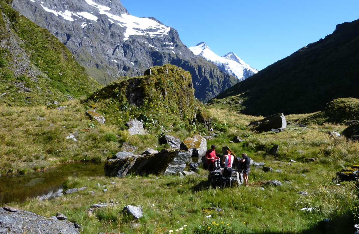
The accompanying photograph is published in DOC's official route gallery with an explicit reuse licence. Its original caption and credit are retained; it does not establish current track conditions.
