By Outdoor Next Editorial standards
On this page
Location & access
DOC track reference point, not a verified trailhead, entrance or the whole route. Check the official route directions before travel.
Official location informationLocation source
DOC track reference point, not a verified trailhead, entrance or the whole route.
Reference point: -46.65970, 168.84909. WGS84 coordinates retained at the official service's returned precision; decimal resolution is not survey accuracy. Source positional accuracy is not specified.
DOC Maps walking and tramping reference point (WGS84), exact official-page GUID / Department of Conservation. Checked 2026-10-12.
Key facts
- Distance
- 700 m return via same track
- Walking time
- 30 m return
- Track grade
- Easiest
- Location
- Catlins coastal area
- Dog access
- No dogs. Other pets on conservation land rules.
Checked against official sources on 8 October 2026. Rules and conditions are set by Department of Conservation — confirm with them before you go.
Route overview
This short easy access track on the Southern Scenic Route takes you to a lighthouse, and has beautiful vistas of the coastline with sea birds and marine mammals.
This DOC directory entry covers Waipapa Point Coastal walk in Otago, within Catlins coastal area. Where DOC groups several walks, times and grades refer to the listed options rather than a single continuous itinerary.
Distance, time and grade
- Distance: 700 m return via same track
- Walking time: 30 m return
- DOC grade: Easiest
Access and alerts
Source checked 2026-10-08. This page is a dated snapshot, not a live track-status report. Check current DOC route information immediately before travelling. An absence of listed alerts does not establish that a route is open.
Dog access
No dogs. Other pets on conservation land rules.
Description
From the carpark, a loop track takes you to the lighthouse. It follows the coast before returning slightly inland.
The track is suitable for families of all ages including wheelchairs
A side track takes you a view of where the light house keepers house once stood. This deviation is only 50 m long so is worth a visit. Return back along the same track to continue your journey.
Getting there
From Invercargill follow signs indicating the Southern Scenic Route head east towards Gorge Road on The Gorge Road Invercargill highway. Follow this to Fortrose.
Where signposted turn right at Fortrose and follow the Fortrose Otara road for approximagely 20 minutes. Where signposted, turn right onto Waipapa Otara Road and follow this to the end.
At the road end you will reach a carpark. Park considerately as space is limited.
Know before you go
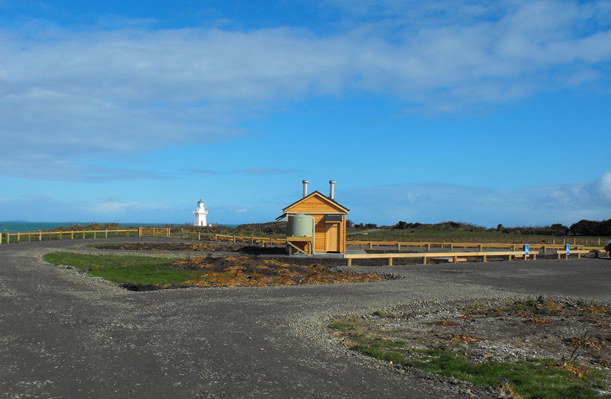
There are toilets, an information kiosk, and seating to shelter or each your lunch (take your rubbish away).
Parking also caters for larger vehicles and a small number of buses.
Sea lions/whakahao can be aggressive if provoked. Keep a minimum 10 m distance between you and whakahao.
Nature and conservation
Sea lions/whakahao can be found on the beach near the lighthouse or further inland amongst the coastal tussock.
History and culture
Shortened from the original Maori name of Waipapapa, meaning shallow waters, this is the site of New Zealand’s worst civilian shipwreck. In 1881 the SS Tararua ran aground on Waipapa Reef and 131 of 151 passengers and crew died.
The lighthouse, built after the disaster, stands as a poignant reminder.
Sources and reuse
Route descriptions and practical information reproduced from the Department of Conservation, Crown copyright, under CC BY 4.0, subject to DOC's copyright policy. Formatting has been adapted, including flattening page sections; follow the original DOC page for maps, section-specific layout, current notices and linked documents. Outdoor Next is independent and is not endorsed by DOC.
The accompanying photograph is published in DOC's official route gallery with an explicit reuse licence. Its original caption and credit are retained; it does not establish current track conditions.
