By Outdoor Next Editorial standards
On this page
Location & access
DOC track reference point, not a verified trailhead, entrance or the whole route. Check the official route directions before travel.
Official location informationLocation source
DOC track reference point, not a verified trailhead, entrance or the whole route.
Reference point: -39.00413, 175.81272. WGS84 coordinates retained at the official service's returned precision; decimal resolution is not survey accuracy. Source positional accuracy is not specified.
DOC Maps walking and tramping reference point (WGS84), exact official-page GUID / Department of Conservation. Checked 2026-10-12.
Key facts
- Distance
- 13.2 km loop
- Walking time
- 2 - 3 hours
- Track grade
- Easy
- Location
- Tūrangi area
- Dog access
- Dogs on a leash only. Other pets on conservation land rules.
Checked against official sources on 8 October 2026. Rules and conditions are set by Department of Conservation — confirm with them before you go.
Route overview
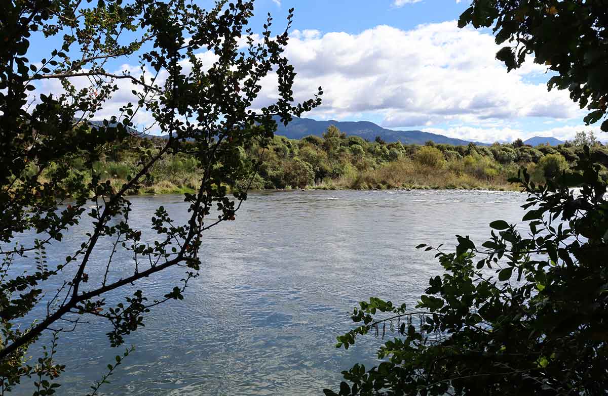
Follow the banks of the Tongariro River alongside farmland, through native bush and urban areas, enjoying magnificent river views. An easy, mainly flat track with multiple entry points - a great family friendly option.
This DOC directory entry covers Tongariro River Trail in Central North Island, within Tūrangi area. Where DOC groups several walks, times and grades refer to the listed options rather than a single continuous itinerary.
Distance, time and grade
- Distance: 13.2 km loop
- Walking time: 2 - 3 hours
- DOC grade: Easy
Access and alerts
Source checked 2026-10-08. This page is a dated snapshot, not a live track-status report. Check current DOC route information immediately before travelling. An absence of listed alerts does not establish that a route is open.
- Bridge replacement on Tongariro River Trail; First published on 10 April 2026. Last reviewed on 30 September 2026.
Dog access
Dogs on a leash only. Other pets on conservation land rules.
Description
An easy, mainly flat track suitable for families and casual riders. The track can be enjoyed in any direction, and started at a number of different points. This means shorter routes can be tailored to suit your particular needs.
There is only one major climb on the trail, up to the Tongariro River Lookout at the northern end of the loop – well worth the effort when you reach the top and take in the view of the river set against the backdrop of the mountains in the Tongariro National Park.
High banks provide excellent views of the calm pools and rippling rapids of the river. Explore angler access tracks off the main path to get closer views.
Keep an eye out for trout or watch the fly fishing action - the Tongariro River is a world renowned fishery. Learn more about fishing the Tongariro River.
Popular option
To complete the full 13.2 km loop without needing to cross busy SH1, start the trail at the Tūrangi isite and use the underpass under the road – you'll join the trail at Taupahi Reserve.
Heading south you'll pass the Major Jones Bridge, then on through the Waikari Reserve and past the Tongariro National Trout Centre, before reaching the southern end of the trail at Red Hut Bridge.
Cross the bridge and come back along the Tongariro River Walkway on the far side of the river, towards the Lookout track and the SH1 bridge. Here there is another underpass to take, before following the mosaic pathway back to the isite.
Shorter walks
There are many shorter options within the trail including the Waikari Reserve loop and the Taupahi Reserve track on the town side of the river, and the Lookout track and Tongariro Walkway on the far side.
The Tongariro National Trout Centre is also on route, which is a destination in itself. Take a walk along the river’s edge, learn about the fishery, or visit the whio creche and freshwater aquarium.
Mountain biking
Major Jones Bridge to State Highway 1 on the true right is the only Grade 3 section of the track.
Getting there
The trail is on the banks of the Tongariro River, which runs past the township of Tūrangi on SH1. There are many different parking options off SH1, at the end of Koura Street or at the Tongariro National Trout Centre.
Know before you go
This is a shared track popular with anglers, dog walkers and mountain bikers. Bikers give way to walkers. Angler access tracks may end abruptly at the river edge, use caution when exploring these.
The track was completed as a loop with help from a local community group, see Advocates for the Tongariro River website.
Hazards
The riverbanks next to the track are undercut and may give way resulting in a fall into the river. Stay on the formed track and away from the edge. Children should be supervised at all times.
No horses and keep dogs under control
Horse riding is not permitted on this track.
The river is home to the endangered whio; keep dogs under control at all times, and on a leash during whio nesting season (August to October).
Sources and reuse
Route descriptions and practical information reproduced from the Department of Conservation, Crown copyright, under CC BY 4.0, subject to DOC's copyright policy. Formatting has been adapted, including flattening page sections; follow the original DOC page for maps, section-specific layout, current notices and linked documents. Outdoor Next is independent and is not endorsed by DOC.
The accompanying photograph is published in DOC's official route gallery with an explicit reuse licence. Its original caption and credit are retained; it does not establish current track conditions.
