By Outdoor Next Editorial standards
On this page
Location & access
DOC track reference point, not a verified trailhead, entrance or the whole route. Check the official route directions before travel.
Official location informationLocation source
DOC track reference point, not a verified trailhead, entrance or the whole route.
Reference point: -44.53515, 169.37499. WGS84 coordinates retained at the official service's returned precision; decimal resolution is not survey accuracy. Source positional accuracy is not specified.
DOC Maps walking and tramping reference point (WGS84), exact official-page GUID / Department of Conservation. Checked 2026-10-12.
Key facts
- Distance
- 10.3 km one way
- Walking time
- 3 hr
- Track grade
- Advanced
- Location
- Hāwea Conservation Park
- Dog access
- No dogs. Other pets on conservation land rules.
Checked against official sources on 8 October 2026. Rules and conditions are set by Department of Conservation — confirm with them before you go.
Route overview
These tracks follow the lower section of Tīmaru River. They can be walked as a day loop or to access the upper Tīmaru River and Breast Hill Track.
This DOC directory entry covers Tīmaru River Tracks in Otago, within Hāwea Conservation Park. Where DOC groups several walks, times and grades refer to the listed options rather than a single continuous itinerary.
Distance, time and grade
- Distance: 10.3 km one way
- Walking time: 3 hr
- DOC grade: Advanced
Access and alerts
Source checked 2026-10-08. This page is a dated snapshot, not a live track-status report. Check current DOC route information immediately before travelling. An absence of listed alerts does not establish that a route is open.
- Lower Tīmaru River Track damage; First published on 12 November 2025. Last reviewed on 2 June 2026.
Dog access
No dogs. Other pets on conservation land rules.
Description
Lower Tīmaru River Track
Distance:10.3 km one way
Time: 3 hr
Lower Tīmaru River Track to Deer Spur Creek involves numerous river crossings that should not be attempted if the river is high. There are several steep sidles which require care, other sections are rough and uneven.
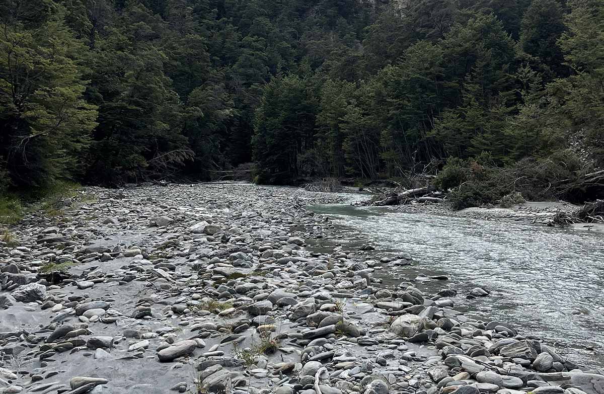
The marked track starts on the Tīmaru River's true left and crosses it several times during the first hour.
It then crosses open flats near Junction Hut (private). The going becomes more awkward, but the track is clearly marked. It progresses through heavily gorged sections around side streams, and along scree slopes. A slip on a section of track 50 m downstream from the Tīmaru River/Breast Hill track junction requires care when crossing, as it is a bluffy section with a vertical drop on one side.
Lower Tīmaru River Track ends at the junction with the Breast Hill Track (part of Te Araroa).
Tīmaru High River Track
Distance: 7.3 km one way
Tīmaru High River Track is signposted 50 m along the road. It goes through forest for around 500 m and then joins a 4WD track above the Tīmaru River. Follow this undulating track, passing the turnoff to Corner Peak Route. For the last 900 m of the track, descend to Deer Spur Creek near Junction Hut (1.5 km). This final section of the track is steep and slippery.
From here you can return back the way you came, or cross the river and join the Lower Tīmaru River Track.
Tīmaru High River Track is wider than Lower Tīmaru River Track, and if used as a there-and-back track has no crossings of the Tīmaru River.
Timaru River Loop
Time: 4 – 5 hr
You can combine these two tracks into a day hike, walking the Tīmaru High River Track then crossing Tīmaru River and returning back to the car park via Lower Tīmaru River Track.
Getting there
The carpark at the start of the Lower Tīmaru River Track is 10 km from Lake Hāwea Township, on the unsealed Tīmaru River Road. The High River Track is signposted 50 m further along the road.
Know before you go
What to expect
Pick the track that fits your skills and the current weather and river conditions.
Many unbridged river and stream crossings. These should not be attempted if the river is high.
Narrow and uneven, including crossing sections of scree (loose gravel) and places with a steep drop of the side of the track.
A marked tramping track.
Mostly a 4WD track.
A steep and slippery descent to Deer Spur Creek.
No river crossings unless you choose to cross the river to join Lower Tīmaru River Track.
Bad weather
The weather can change rapidly in New Zealand. Hypothermia is a real risk even in summer. Be prepared by having warm, waterproof, windproof clothing and the appropriate footwear. Whiteout conditions caused by snow or low cloud may be present.
Check the Breast Hill forecast: Southern Lakes Forecast | MetService
Pack well for this tramp
You need to be well-equipped, even on a day walk. Pack plenty of warm and waterproof clothing and carry a distress beacon.
Check our Day Hikes gear list and DOC multi-day tramping packing list
Access through high country stations
These tracks cross working high country stations. Respect livestock and property and stay on the marked track. Dogs are not allowed on these tracks.
Hunting
Hunters may carry unloaded firearms on these tracks, if they have a current hunting permit for lands administered by DOC. Under no circumstances should hunters discharge firearms before entering permitted hunting areas.
Stay safe when crossing rivers and streams
If you plan to cross unbridged rivers or side streams, know how to cross safely and be prepared for if you cannot cross.
Do not cross if the river or stream is flooded, you cannot find safe entry and exit points or are unsure it’s safe. Turn back or wait for the river to drop. If in doubt, stay out.
How to cross rivers safely
NIWA river flow forecasts: View a video of national followed by regional river flows
Sources and reuse
Route descriptions and practical information reproduced from the Department of Conservation, Crown copyright, under CC BY 4.0, subject to DOC's copyright policy. Formatting has been adapted, including flattening page sections; follow the original DOC page for maps, section-specific layout, current notices and linked documents. Outdoor Next is independent and is not endorsed by DOC.
The accompanying photograph is published in DOC's official route gallery with an explicit reuse licence. Its original caption and credit are retained; it does not establish current track conditions.
