By Outdoor Next Editorial standards
On this page
Location & access
DOC track reference point, not a verified trailhead, entrance or the whole route. Check the official route directions before travel.
Official location informationLocation source
DOC track reference point, not a verified trailhead, entrance or the whole route.
Reference point: -44.72238, 167.94866. WGS84 coordinates retained at the official service's returned precision; decimal resolution is not survey accuracy. Source positional accuracy is not specified.
DOC Maps walking and tramping reference point (WGS84), exact official-page GUID / Department of Conservation. Checked 2026-10-12.
Key facts
- Distance
- 400 m return via same track
- Walking time
- 20 min
- Track grade
- Easiest
- Location
- Fiordland National Park / Milford Road/Milford Sound area
- Dog access
- No dogs. Other pets on conservation land rules.
Checked against official sources on 8 October 2026. Rules and conditions are set by Department of Conservation — confirm with them before you go.
Route overview
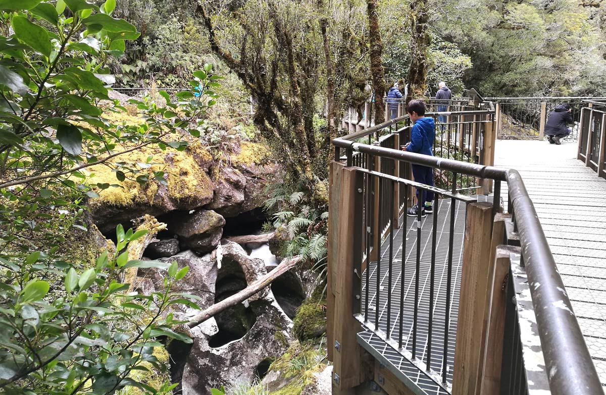
This short walk passes through native bush and ends at the edge of the Cleddau River with views of flowing water over and through the water-sculpted rock formations.
This DOC directory entry covers The Chasm Walk in Fiordland, within Fiordland National Park / Milford Road/Milford Sound area. Where DOC groups several walks, times and grades refer to the listed options rather than a single continuous itinerary.
Distance, time and grade
- Distance: 400 m return via same track
- Walking time: 20 min
- DOC grade: Easiest
Access and alerts
Source checked 2026-10-08. This page is a dated snapshot, not a live track-status report. Check current DOC route information immediately before travelling. An absence of listed alerts does not establish that a route is open.
- Chasm Walk closed for construction; First published on 16 January 2025. Last reviewed on 21 September 2026.
Dog access
No dogs. Other pets on conservation land rules.
Description
Walk through the native forest to the edge of the Cleddau River. You will be rewarded with views of the river flowing through the water-sculpted rocks and sounds of the water falling through the Chasm.
Thousands of years of swirling water have sculpted shapes and basins in the rock. The sheer velocity of water gives an appreciation of how much rainfall the Milford Sound area receives each year.
You can see the concrete foundations and metal remnants of the viewing gallery bridges washed away during the February 2020 storm – and appreciate the force and volume of water that demolished the two bridges off their footings.
Getting there
This walk is off the Milford Road, about halfway between Milford Sound and the Homer Tunnel.
The large, well signposted carpark is about 109 km along the Milford Road from Te Anau.
Know before you go
The project work continues to reinstate sections of the storm-damaged Chasm Walk. The plan has two stages:
Stage one part one: Re-opening the Chasm Walk on 24 April 2023 as a modified experience, allowing visitors to walk through the native forest to view the Chasm from the edge of the Cleddau River only. It won’t be possible to cross the river. This is completed.Stage one part two: New viewing bridges will be installed over the Cleddau River returning the Chasm Walk back to its pre-storm status. Completion expected by summer 2023/24.
Stage two: Installing flood protection below the car park and a substantial upgrade of the car park itself. Improving access onto and off SH94 and enhanced traffic and pedestrian flow within the parking area. The completion schedule to be finalised, likely during 2024.
For more information, email floodrecovery@doc.govt.nz
Sources and reuse
Route descriptions and practical information reproduced from the Department of Conservation, Crown copyright, under CC BY 4.0, subject to DOC's copyright policy. Formatting has been adapted, including flattening page sections; follow the original DOC page for maps, section-specific layout, current notices and linked documents. Outdoor Next is independent and is not endorsed by DOC.
The accompanying photograph is published in DOC's official route gallery with an explicit reuse licence. Its original caption and credit are retained; it does not establish current track conditions.
