By Outdoor Next Editorial standards
On this page
Location & access
DOC track reference point, not a verified trailhead, entrance or the whole route. Check the official route directions before travel.
Official location informationLocation source
DOC track reference point, not a verified trailhead, entrance or the whole route.
Reference point: -35.60851, 173.53268. WGS84 coordinates retained at the official service's returned precision; decimal resolution is not survey accuracy. Source positional accuracy is not specified.
DOC Maps walking and tramping reference point (WGS84), exact official-page GUID / Department of Conservation. Checked 2026-10-12.
Key facts
- Distance
- Not confirmed on the checked DOC page; see individual route sections
- Walking time
- 20 min one way
- Track grade
- Easiest
- Location
- Waipoua Forest
- Dog access
- Dogs with a DOC permit for recreational hunting or management purposes only. Other pets on conservation land rules.
Checked against official sources on 8 October 2026. Rules and conditions are set by Department of Conservation — confirm with them before you go.
Route overview
View the second largest living kauri in New Zealand, Te Matua Ngahere - it's a good option for kids. It is open 9 am to 4 pm daily.
This DOC directory entry covers Te Matua Ngahere Walk in Northland, within Waipoua Forest. Where DOC groups several walks, times and grades refer to the listed options rather than a single continuous itinerary.
Distance, time and grade
- Distance: Not confirmed on the checked DOC page; see individual route sections
- Walking time: 20 min one way
- DOC grade: Easiest
Access and alerts
Source checked 2026-10-08. This page is a dated snapshot, not a live track-status report. Check current DOC route information immediately before travelling. An absence of listed alerts does not establish that a route is open.
- Te Matua Ngahere Walk closure; First published on 30 January 2026. Last reviewed on 18 September 2026.
Dog access
Dogs with a DOC permit for recreational hunting or management purposes only. Other pets on conservation land rules.
Description
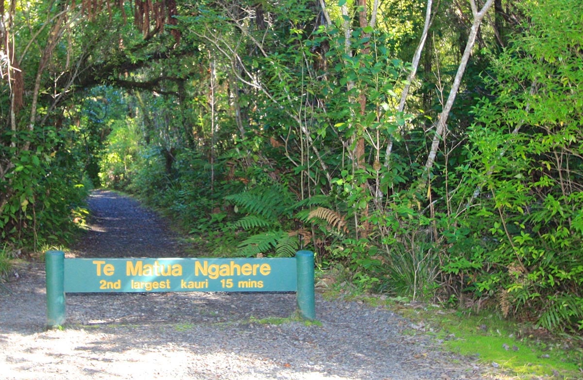
A 20-minute walk leads you to 'Te Matua Ngahere' (Father of the Forest) – the second largest living kauri tree in New Zealand.
You can admire the tree on a viewing platform without damaging its sensitive root systems. It is very important that you keep to the walking track at all times. Kauri trees have very sensitive surface roots, and foot traffic around the trees endangers their life span.
Open 9 am to 4 pm
The gate to the track is locked when the track is closed.
Te Matua Ngahere
Te Matua Ngahere is the oldest out of the two largest living kauri trees and is estimated to exceed 2,000 years. He was discovered by Nicholas Yakas in 1928 when he and other men were working to build the road that is now known as SH12.
Measurements:
trunk girth: 16.41 m
trunk height: 10.21 m
total height: 29.9 m
trunk volume: 208.1 m³.
Getting there
Te Matua Ngahere Walk is located in Waipoua Forest on SH12. It is accessed from the Kauri walks car park. It is 4 km / 3 min drive from the Tane Mahuta car park. The southern township of Dargaville is 61 km away and the northern township of Omapere is 21 km.
From the car park, you will see a sign for the three walks 'Te Matua Ngahere', 'Four Sisters', and 'Yakas Kauri'. Note: Four Sisters and Yakas Kauri walks are currently closed.
A track meanders through native bush and brings you to a central point from which you can access Te Matua Ngahere Walk. From here is very well sign posted and located directly in the middle of this open space.
Know before you go
Keep to the track at all times.
In strong winds, beware of falling branches.
Nature and conservation
Te Matua Ngahere is situated in the Waipoua Forest reserve. It is the largest remnant of the extensive kauri forests of northern New Zealand.
The forest type varies from almost pure kauri stands to mixed podocarp/hardwood, with kauri grass, kiekie, neinei and ferns in the understorey.
Sources and reuse
Route descriptions and practical information reproduced from the Department of Conservation, Crown copyright, under CC BY 4.0, subject to DOC's copyright policy. Formatting has been adapted, including flattening page sections; follow the original DOC page for maps, section-specific layout, current notices and linked documents. Outdoor Next is independent and is not endorsed by DOC.
The accompanying photograph is published in DOC's official route gallery with an explicit reuse licence. Its original caption and credit are retained; it does not establish current track conditions.
