By Outdoor Next Editorial standards
On this page
Location & access
DOC track reference point, not a verified trailhead, entrance or the whole route. Check the official route directions before travel.
Official location informationLocation source
DOC track reference point, not a verified trailhead, entrance or the whole route.
Reference point: -43.70343, 170.16757. WGS84 coordinates retained at the official service's returned precision; decimal resolution is not survey accuracy. Source positional accuracy is not specified.
DOC Maps walking and tramping reference point (WGS84), exact official-page GUID / Department of Conservation. Checked 2026-10-12.
Key facts
- Distance
- 2.6 km return via same track
- Walking time
- 50 min return
- Track grade
- Easy
- Location
- Aoraki/Mount Cook National Park
- Dog access
- No dogs. Other pets on conservation land rules.
Checked against official sources on 8 October 2026. Rules and conditions are set by Department of Conservation — confirm with them before you go.
Route overview
View New Zealand's longest glacier, the mighty Haupapa/Tasman Glacier on one of our best short walks.
This DOC directory entry covers Tasman Lake and River Track in Canterbury, within Aoraki/Mount Cook National Park. Where DOC groups several walks, times and grades refer to the listed options rather than a single continuous itinerary.
Distance, time and grade
- Distance: 2.6 km return via same track
- Walking time: 50 min return
- DOC grade: Easy
Access and alerts
Source checked 2026-10-08. This page is a dated snapshot, not a live track-status report. Check current DOC route information immediately before travelling. An absence of listed alerts does not establish that a route is open.
- Predator control for Aoraki Mt Cook National Park; First published on 27 February 2026. Last reviewed on 13 April 2026.
Dog access
No dogs. Other pets on conservation land rules.
Description
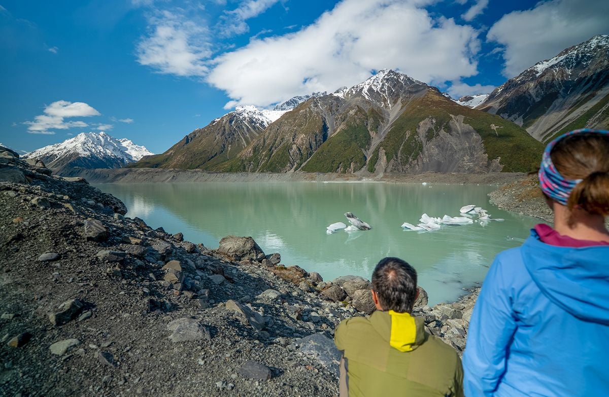
This track also start from the Blue Lake car park. It branches to the right off the Blue Lakes Track just past the Blue Lakes shelter and leads to a viewpoint of the Haupapa/Tasman Glacier terminal lake. A further track branches to the right off this track leading to the source of the Tasman River.
Icebergs can usually be seen floating in the lake in summer, and the lake freezes over in winter. The track leads through the old terminal moraines of the glacier, and you can see good examples of plant succession along the route.
Getting there
Turn off SH80 onto Tasman Valley Road just before Aoraki/Mount Cook Village. Follow this for about 7 km to the car park at the end.
Know before you go
What to expect
Track surface: Rock steps
Change in elevation: +/- 86 m
Expect rapidly changing weather – this walk is in an alpine region.
Ensure you take sturdy footwear.
Do not go in the water or on the ice
Stay out of the cold water of Hooker or Tasman lakes, which is typically about 3 degrees and can quickly cause hypothermia.
Stay off the lakes when they are frozen over, as the ice can be thin and could give way at any time. Do not climb icebergs in the lakes as these are unstable and can tip unexpectedly.
You could put your life at risk by walking on the ice. If it gave way, you could drown or develop hypothermia.
Nature and conservation
Tasman Lake is a relatively recent addition to the scene, starting its formation in 1974 and growing steadily since then. It is now large enough to take commercial boat and kayak tours. The large terminal moraines mark the foot of the Haupapa/Tasman Glacier at the time of the lake’s formation and are a sobering reminder of the glacier’s retreat.
Sources and reuse
Route descriptions and practical information reproduced from the Department of Conservation, Crown copyright, under CC BY 4.0, subject to DOC's copyright policy. Formatting has been adapted, including flattening page sections; follow the original DOC page for maps, section-specific layout, current notices and linked documents. Outdoor Next is independent and is not endorsed by DOC.
The accompanying photograph is published in DOC's official route gallery with an explicit reuse licence. Its original caption and credit are retained; it does not establish current track conditions.
