By Outdoor Next Editorial standards
On this page
Location & access
DOC track reference point, not a verified trailhead, entrance or the whole route. Check the official route directions before travel.
Official location informationLocation source
DOC track reference point, not a verified trailhead, entrance or the whole route.
Reference point: -39.19701, 175.58727. WGS84 coordinates retained at the official service's returned precision; decimal resolution is not survey accuracy. Source positional accuracy is not specified.
DOC Maps walking and tramping reference point (WGS84), exact official-page GUID / Department of Conservation. Checked 2026-10-12.
Key facts
- Distance
- 17. 6 km return via same track
- Walking time
- 5-6 hr (to Lower Tama Lake)
- Track grade
- Intermediate
- Location
- Tongariro National Park / Whakapapa Village area
- Seasonal restrictions
- Winter alpine skills and equipment needed for the side trip to the Upper Tama Lake lookout when snow and ice are present.
- Dog access
- No dogs. Other pets on conservation land rules.
Checked against official sources on 8 October 2026. Rules and conditions are set by Department of Conservation — confirm with them before you go.
Route overview
A great day hike with views of Lower Tama Lake, Taranaki Falls, Mt Ruapehu and Mt Ngauruhoe.
This DOC directory entry covers Tama Lakes Track in Central North Island, within Tongariro National Park / Whakapapa Village area. Where DOC groups several walks, times and grades refer to the listed options rather than a single continuous itinerary.
Distance, time and grade
- Distance: 17. 6 km return via same track
- Walking time: 5-6 hr (to Lower Tama Lake)
- DOC grade: Intermediate
Access and alerts
Source checked 2026-10-08. This page is a dated snapshot, not a live track-status report. Check current DOC route information immediately before travelling. An absence of listed alerts does not establish that a route is open.
Seasonal restrictions
Winter alpine skills and equipment needed for the side trip to the Upper Tama Lake lookout when snow and ice are present.
Dog access
No dogs. Other pets on conservation land rules.
Description
Start this track from Whakapapa Village, on the Taranaki Falls Walking Track.
After reaching Taranaki Falls, the track crosses undulating tussock country and alpine herb fields on a well-formed and marked track.
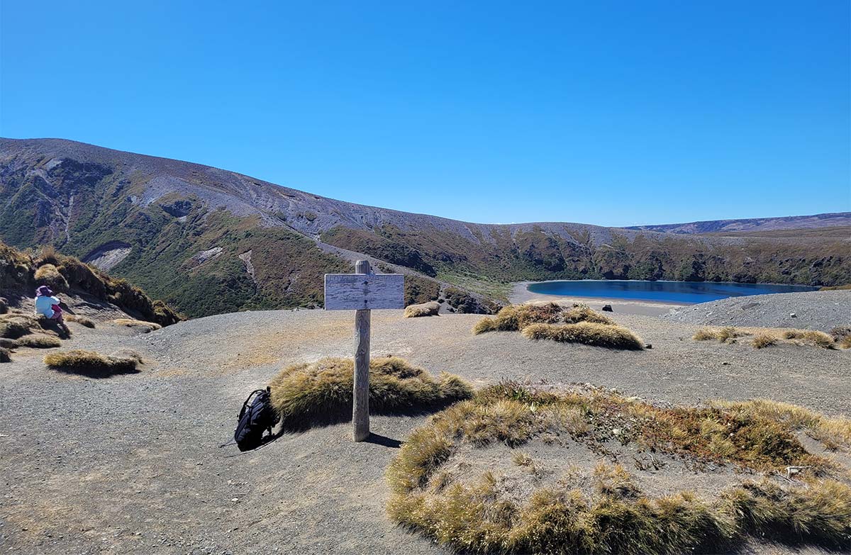
The track ends at a wide, flat clearing on Tama Saddle, with spectacular views of Lower Tama Lake, Mt Ngauruhoe and Mt Ruapehu. There is a toilet 10 minutes back down the track, near the junction with the Tongariro Northern Circuit Great Walk.
This track requires less uphill walking and exposure to alpine weather than the Tongariro Alpine Crossing. It can be a great alternative. However, it is still an alpine environment and can be difficult in bad weather. Talk to the Tongariro National Park Visitor Centre about the current conditions.
There are no formed tracks down to Lower or Upper Tama Lakes, as the gullies leading down to them are steep and unstable. To ensure these pristine alpine lakes are kept free of weeds, do not touch or swim in the water.
Side trip to Upper Tama Lake viewpoint
Steep and challenging terrain on the side track to Upper Tama Lake viewpoint.Image: Theo Chapman | DOC
Steep and challenging terrain on the side track to Upper Tama Lake viewpoint.Image: Theo Chapman | DOC
Time: 35 minutes (one way)Distance: 1.4 kmTrack grade: Advanced tramping track
There is a rough, unformed route from the end of the Tama Lakes Track to Upper Tama Lake viewpoint. This is an advanced tramping track and is much more challenging than the main Tama Lakes Track.
The route climbs steeply up a ridge to a viewpoint of Upper Tama Lake. The track is not formed and is made of loose and uneven rock. It is unstable and slippery.
There is no shelter, the weather changes fast and the wind is often very strong. Low cloud can make it hard to follow the route. In winter, you may need winter alpine skills and equipment due to snow, ice and avalanche risk.
Getting there
The walk starts at Whakapapa Village on SH48. Start on the Taranaki Falls Walking Track, 100 m below the Tongariro National Park Visitor Centre on Ngauruhoe Place.
Know before you go
Be ready for alpine weather
Strong wind, heavy rainfall and rapid changes in temperature are common in Tongariro National Park, even in summer. Check the weather forecast before heading out. Always carry warm, waterproof and windproof clothing.
Packing list for day hikes
Weather forecast
Upper Tama Lake weather forecast – NIWA website
The side trip to Upper Tama Lake viewpoint is much more difficult than the main track
The route beyond Lower Tama Lake is unformed and follows the natural ridgeline. It is much rougher and more exposed than the main Tama Lakes Track and is only suitable for fit and confident hikers.
Only attempt this track if you are confident walking on loose rocks and descending back down the ridge on an unstable, slippery surface.
Do not hike this side track if the weather is bad or there is low cloud. Low cloud decreases visibility, making navigation difficult and increasing the chance that you will get lost. This area is very exposed and there is no shelter from the weather.
Winter alpine skills may be needed on the side trip to Upper Tama Lake viewpoint
Do not hike the side trip to Upper Tama Lake viewpoint when snow and ice are present unless you have winter alpine skills and equipment.
You must:
know how to navigate if cloud or snow covers the marker poles and you cannot see them
have the equipment and skills to prevent a slide on icy terrain
have the clothing for sub-zero temperatures and be able to survive if the weather gets worse
know where avalanches are a risk and be able to rescue someone if an avalanche occurs. There is challenging avalanche terrain between Upper and Lower Tama Lakes. Crampons, an ice axe and avalanche rescue equipment are essential, as well as the skills to use them. For the current avalanche danger rating, check the New Zealand Avalanche Advisory forecast for the Tongariro area
No drones
Flying a drone without a permit is strictly prohibited.
Drone use on conservation land
Nature and conservation
There was an explosive eruption period around 10,000 years ago in Tongariro National Park. It created craters, several of which later filled with water and became Tama Lakes.
Some of the oldest lava flows on the slopes of Ruapehu and Tongariro can be found at the Tama Saddle. Some are up to 275,000 years old and can be seen in the cliffs near Lower Tama Lake.
Sources and reuse
Route descriptions and practical information reproduced from the Department of Conservation, Crown copyright, under CC BY 4.0, subject to DOC's copyright policy. Formatting has been adapted, including flattening page sections; follow the original DOC page for maps, section-specific layout, current notices and linked documents. Outdoor Next is independent and is not endorsed by DOC.
The accompanying photograph is published in DOC's official route gallery with an explicit reuse licence. Its original caption and credit are retained; it does not establish current track conditions.
