By Outdoor Next Editorial standards
On this page
Location & access
DOC track reference point, not a verified trailhead, entrance or the whole route. Check the official route directions before travel.
Official location informationLocation source
DOC track reference point, not a verified trailhead, entrance or the whole route.
Reference point: -46.23989, 167.24961. WGS84 coordinates retained at the official service's returned precision; decimal resolution is not survey accuracy. Source positional accuracy is not specified.
DOC Maps walking and tramping reference point (WGS84), exact official-page GUID / Department of Conservation. Checked 2026-10-12.
Key facts
- Distance
- Not confirmed on the checked DOC page; see individual route sections
- Walking time
- 7 hr to Port Craig, 4 days to Big River
- Track grade
- Intermediate; Advanced; Expert
- Location
- Fiordland National Park / Tuatapere area
- Dog access
- No dogs. Other pets on conservation land rules.
Checked against official sources on 8 October 2026. Rules and conditions are set by Department of Conservation — confirm with them before you go.
Route overview
This track of varying difficulty leads along rugged southern Fiordland coast to Port Craig (easy overnight) and beyond to the more remote Big River (4 days one way).
This DOC directory entry covers South Coast Track in Fiordland, within Fiordland National Park / Tuatapere area. Where DOC groups several walks, times and grades refer to the listed options rather than a single continuous itinerary.
Distance, time and grade
- Distance: Not confirmed on the checked DOC page; see individual route sections
- Walking time: 7 hr to Port Craig, 4 days to Big River
- DOC grade: Intermediate; Advanced; Expert
Access and alerts
Source checked 2026-10-08. This page is a dated snapshot, not a live track-status report. Check current DOC route information immediately before travelling. An absence of listed alerts does not establish that a route is open.
- Francis Burn Viaduct closed; First published on 7 February 2026. Last reviewed on 28 July 2026.
Dog access
No dogs. Other pets on conservation land rules.
Description
The first section, an easy, family-friendly walk to Port Craig School Hut, can be done as an overnight trip with beautiful coastal views and a taste of history.
This track can be combined with Teal Bay to South Coast Track and Hump Ridge Track and more (see Moirs Guide South).
Rarakau carpark to Port Craig School Hut
Track category: Great Walk/Easier tramping track Time: 7 hoursDistance: 20 km
From the Rarakau carpark, the track follows an old road over several suspension bridges and past beachside baches. Passing the Hump Ridge Track Okaka Lodge turnoff, the track skirts several beaches and headlands before arriving at the magnificent Blowholes Beach.
Hectors dolphins are often seen all along this coastline (look for the round, ‘mickey mouse’ shaped fin in the shallows).
From here the track climbs over another headland to Breakneck Creek, where it re-enters the forest before arriving at the historic Port Craig School Hut (DOC) and Port Craig Lodge (private). Interpretive panels and a short walk around the site may help you learn about the timber milling history of the area.
Port Craig School Hut to Wairaurahiri Hut
Track category: Tramping trackTime: 6 hoursDistance: 16 kmThe track follows an old logging tramline for 15 km through regenerating native forest. The Sandhill and Percy Burn viaducts are reached after 2 hours walk from Port Craig. The Tuatapere Port Craig Viaducts Trust hut is sited at Percy Burn.
The track continues and crosses both the Edwin Burn and Francis Burn viaducts. At the end of the tramline the track enters mature bush and descends through three river terraces to a clearing on the banks of the Wairaurahiri River, and the Wairaurahiri Hut.
The privately owned Waitutu Lodge is located on the opposite side of the river, approximately 600 m off the track towards the coast.
Wairaurahiri Hut to Waitutu Hut
Track category: Tramping trackTime: 6 hoursDistance: 13 kmCross the Wairaurahiri River over the bridge next to the hut. This track winds through private Māori land and bush clad coastal terraces until meeting the Waitutu River, where a suspension bridge gives access to the Waitutu Hut (200 m upstream on the true right bank).
Waitutu Hut to Big River
Track category: RouteTime: 5+ hoursDistance: 12 kmFrom the Waitutu Hut, the track is a marked route and is recommended for experienced trampers only. Westies Hut is located in a sea cave at Prices Harbour, signposted from the track about 2 km east of Big River.
Getting there
This track starts from the Rarakau carpark, Bluecliffs Beach in Te Waewae Bay, southern Fiordland.
To get there from Tuatapere, go south on Papatotara Road and drive about 28 km following signs to Bluecliffs Beach and the Rarakau carpark. 7 km of this road is unsealed.
The carpark is signposted in front of the Rarakau Station homestead, 150 m past the track entrance (cars are left at the owner's risk).
Know before you go
Track conditions can be muddy, with un-bridged streams and rivers. Please take extremely good care with tides whenever attempting to travel along the coast.
The sections beyond Port Craig are tramping tracks and routes, so you will need good to above average fitness and high level backcountry (remote areas) skills and experience, including navigation and survival skills.
Port Craig Lodge
Is located 500 m from the Port Craig School Hut. It is a backcountry lodge operated by Tuatapere Hump Ridge Track and sleeps up to 40 people. Booking and prior payment is essential; via the Tuatapere Hump Ridge Track office.
Sources and reuse
Route descriptions and practical information reproduced from the Department of Conservation, Crown copyright, under CC BY 4.0, subject to DOC's copyright policy. Formatting has been adapted, including flattening page sections; follow the original DOC page for maps, section-specific layout, current notices and linked documents. Outdoor Next is independent and is not endorsed by DOC.
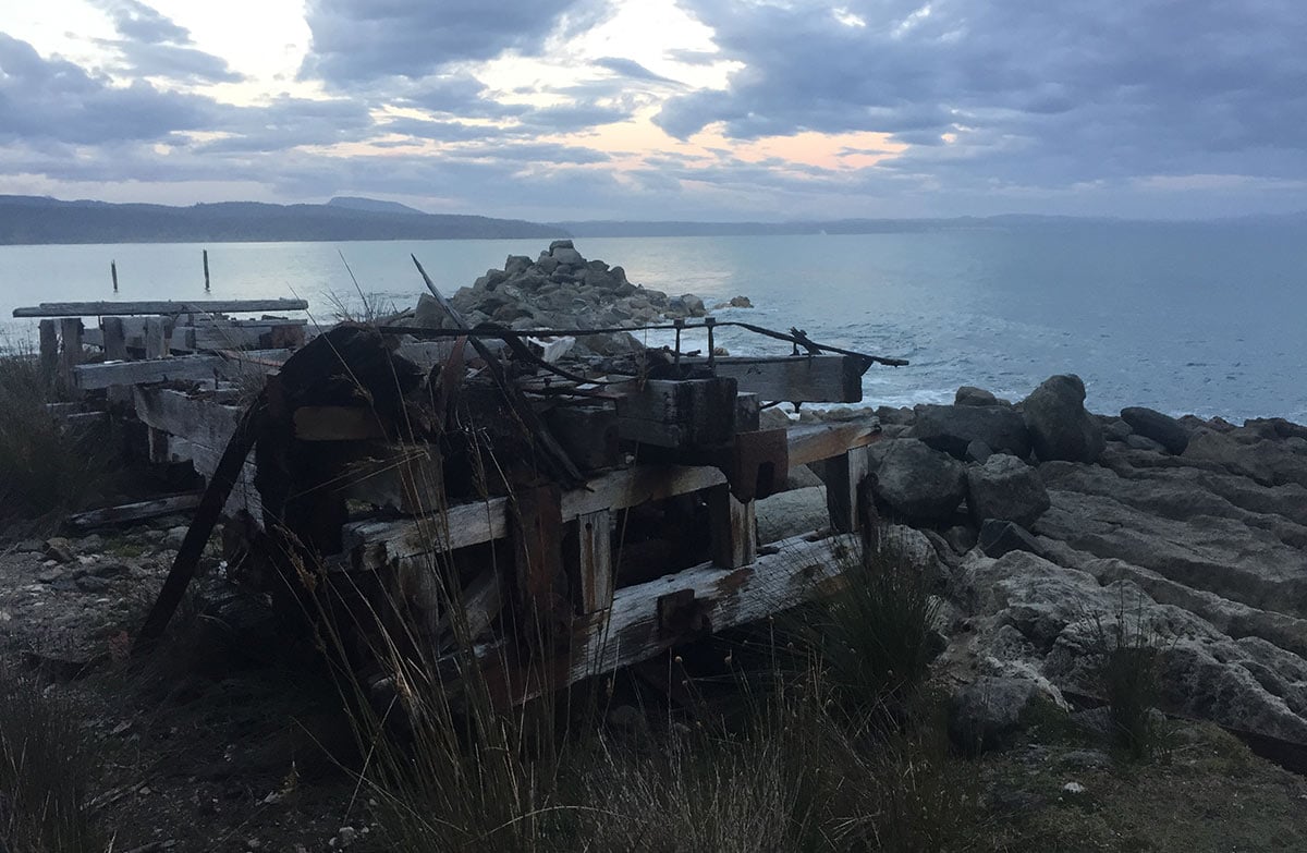
The accompanying photograph is published in DOC's official route gallery with an explicit reuse licence. Its original caption and credit are retained; it does not establish current track conditions.
