By Outdoor Next Editorial standards
On this page
Location & access
DOC track reference point, not a verified trailhead, entrance or the whole route. Check the official route directions before travel.
Official location informationLocation source
DOC track reference point, not a verified trailhead, entrance or the whole route.
Reference point: -35.53553, 173.36912. WGS84 coordinates retained at the official service's returned precision; decimal resolution is not survey accuracy. Source positional accuracy is not specified.
DOC Maps walking and tramping reference point (WGS84), exact official-page GUID / Department of Conservation. Checked 2026-10-12.
Key facts
- Distance
- Not confirmed on the checked DOC page; see individual route sections
- Walking time
- 15 min one way
- Track grade
- Easiest
- Location
- Hokianga Heads area
- Dog access
- Dogs with a DOC permit for recreational hunting or management purposes only. Other pets on conservation land rules.
Checked against official sources on 8 October 2026. Rules and conditions are set by Department of Conservation — confirm with them before you go.
Route overview
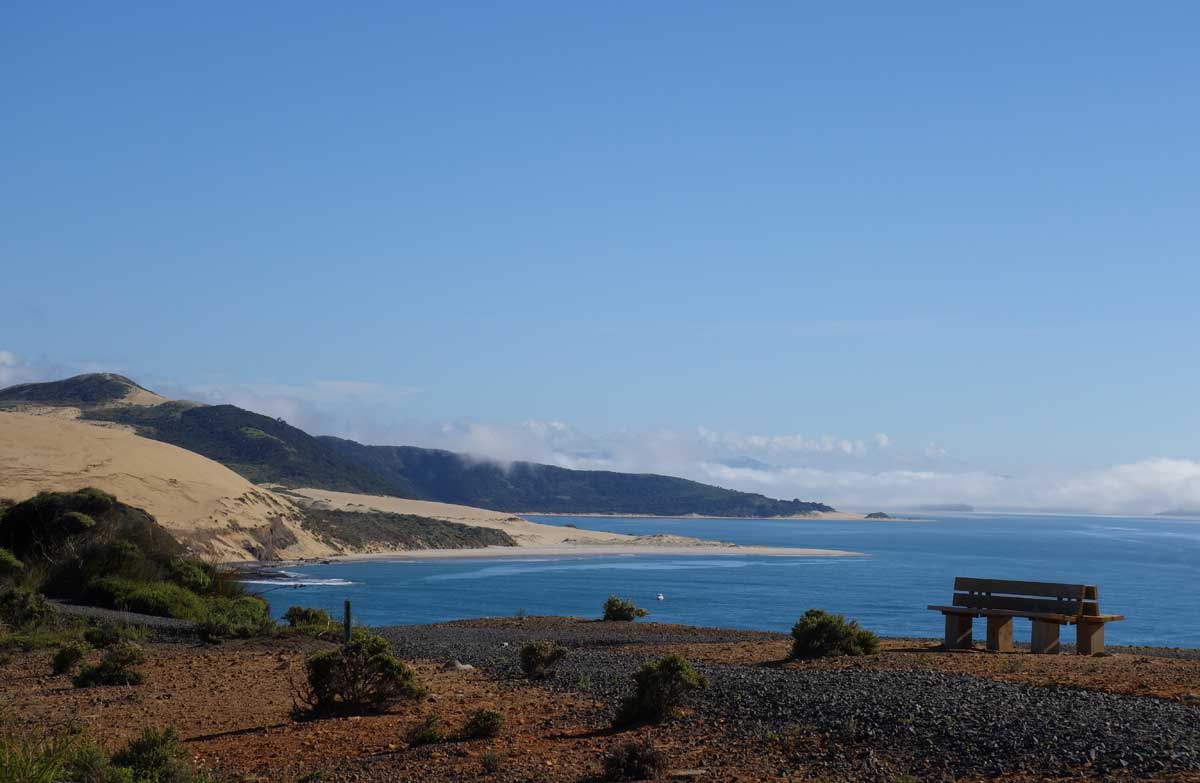
Enjoy spectacular views of the harbour and coastline on this short easy walk that’s suitable for children.
This DOC directory entry covers Signal Station Track in Northland, within Hokianga Heads area. Where DOC groups several walks, times and grades refer to the listed options rather than a single continuous itinerary.
Distance, time and grade
- Distance: Not confirmed on the checked DOC page; see individual route sections
- Walking time: 15 min one way
- DOC grade: Easiest
Access and alerts
Source checked 2026-10-08. This page is a dated snapshot, not a live track-status report. Check current DOC route information immediately before travelling. An absence of listed alerts does not establish that a route is open.
Dog access
Dogs with a DOC permit for recreational hunting or management purposes only. Other pets on conservation land rules.
Description
The track follows the top of the cliffs, then enters tall manuka and suddenly opens out at the headland and grassed lookout.
The grassy terraces provide sheltered picnic sites and wonderful views up the harbour away from the prevailing westerly winds.
There is access to the harbour via the Martins Bay track.
The track is not suitable for wheelchairs but it’s possible for buggies and strollers to access the headland – however there’s no access for buggies to Martins Bay.
Getting there
Signal Station Track starts from the Arai Te Uru Recreational Reserve carpark.
Arai Te Uru Recreational Reserve is at Hokianga Heads, 56 km west of Kaikohe. From Kaikohe, travel west along SH12 through Omapere. Take a right into Signal Station Rd. The reserve and carpark is at the end of the road.
Know before you go
There are steep drop-offs on the reserve.
Children should be supervised at all times.
Nearest toilets are at Omapere.
Nature and conservation
Vegetation is predominantly flax, manuka, bracken and cabbage trees.
History and culture
The Signal Station was in operation from 1838–1951 to guide ships over through the treacherous harbour entrance until being replaced by an automated lighthouse. Today all that remains is a few upright timbers and a horizontal beam.
The Hokianga Society's brochure on this area features excellent historical information and details on each of the numbered sites. You can purchase the brochure from the Hokianga Visitor Center.
The area holds great significance to Maori and should be treated with respect at all times.
Sources and reuse
Route descriptions and practical information reproduced from the Department of Conservation, Crown copyright, under CC BY 4.0, subject to DOC's copyright policy. Formatting has been adapted, including flattening page sections; follow the original DOC page for maps, section-specific layout, current notices and linked documents. Outdoor Next is independent and is not endorsed by DOC.
The accompanying photograph is published in DOC's official route gallery with an explicit reuse licence. Its original caption and credit are retained; it does not establish current track conditions.
