By Outdoor Next Editorial standards
On this page
Location & access
DOC track reference point, not a verified trailhead, entrance or the whole route. Check the official route directions before travel.
Official location informationLocation source
DOC track reference point, not a verified trailhead, entrance or the whole route.
Reference point: -45.89350, 170.63948. WGS84 coordinates retained at the official service's returned precision; decimal resolution is not survey accuracy. Source positional accuracy is not specified.
DOC Maps walking and tramping reference point (WGS84), exact official-page GUID / Department of Conservation. Checked 2026-10-12.
Key facts
- Distance
- 560 m return via same track
- Walking time
- 15 min (one way)
- Track grade
- Easy
- Location
- Dunedin area / Otago Peninsula area
- Seasonal restrictions
- Part of Sandfly Bay Wildlife Refuge is closed from 1 November to 28 February inclusive to protect wildlife in the area. From the viewing platform, follow the signs to access the beach.
- Dog access
- No dogs. Other pets on conservation land rules.
Checked against official sources on 8 October 2026. Rules and conditions are set by Department of Conservation — confirm with them before you go.
Route overview
Walk to Sandfly Bay and enjoy beautiful coastal views.
This DOC directory entry covers Sandfly Bay Track in Otago, within Dunedin area / Otago Peninsula area. Where DOC groups several walks, times and grades refer to the listed options rather than a single continuous itinerary.
Distance, time and grade
- Distance: 560 m return via same track
- Walking time: 15 min (one way)
- DOC grade: Easy
Access and alerts
Source checked 2026-10-08. This page is a dated snapshot, not a live track-status report. Check current DOC route information immediately before travelling. An absence of listed alerts does not establish that a route is open.
Seasonal restrictions
Part of Sandfly Bay Wildlife Refuge is closed from 1 November to 28 February inclusive to protect wildlife in the area. From the viewing platform, follow the signs to access the beach.
Dog access
No dogs. Other pets on conservation land rules.
Description
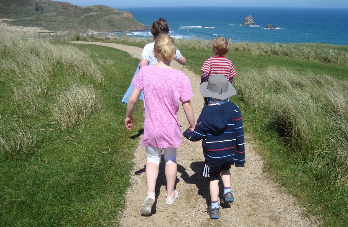
Take a stroll down the path through farmland to the viewing platform. Enjoy the views of Sandfly Bay, the coastline and the wild ocean.
Past the platform, the track to the beach follows a sandhill and is steep. It is maintained to a tramping track standard only, due to sand movement and erosion. Follow the orange marker poles and signs to stay on the track.
A good level of fitness is required on this track.
Take care as erosion can damage the sandhill making some parts difficult to walk.
See the Dunedin Wildlife Care Code for information about wildlife interactions in the Know before you go section.
Getting there
Turn off Highcliff Road onto Seal Point Road. The track begins at the Sandfly Bay carpark at the end of this road.
Know before you go
Don't leave valuables in your car – there have been break-ins.
Swimming can be dangerous where there are strong winds and currents.
Track crosses private land – stay on formed track.
There may be stock – do not disturb and keep your distance.
This area was used as a firing range during World War II, and unexploded ordinance has been found on occasion in the sand dunes. Keep to the tracks and beach area.
Tsunami risk
This track is susceptible to tsunami. If a siren sounds or a tsunami alert is received move to higher ground and stay away from the coast until the risk or alert period is over.
Dunedin Wildlife Care Code
Dunedin is home to rare and special wildlife. Do not disturb, touch, feed or go too close to wildlife.
Sea lions and other seals
View all seal and sea lions from a safe distance of at least 20 m and do not disturb them. If you must pass sea lions on the beach, keep as much distance as possible and do not loiter.
Penguins
Stay at least 50 m away from penguins. Never approach them. Do not block their entry and exit from the water as this prevents them from returning to feed chicks. Do not use flash photography.
Red-billed gulls
Do not feed or harass gulls. Don’t let dogs chase them. They are endangered and vulnerable to human disturbance.
Drones and wildlife
It is an offence to fly drones within 150 m of marine mammals or 300 m vertically above. The use of drones is prohibited in many sensitive areas and can require a permit elsewhere.
Find more information on recreational drone use on conservation land.
Nature and conservation
New Zealand fur seals/kekeno and New Zealand sea lions/pakake haul out on the rocks and beach and wallow in the sand. Seals and sea lions may look placid but they are powerful, wild predators and can be very dangerous if they are approached too closely.
Other seabirds such as spotted shags, sooty shearwaters and variable oystercatchers are also based in the area.
Sources and reuse
Route descriptions and practical information reproduced from the Department of Conservation, Crown copyright, under CC BY 4.0, subject to DOC's copyright policy. Formatting has been adapted, including flattening page sections; follow the original DOC page for maps, section-specific layout, current notices and linked documents. Outdoor Next is independent and is not endorsed by DOC.
The accompanying photograph is published in DOC's official route gallery with an explicit reuse licence. Its original caption and credit are retained; it does not establish current track conditions.
