By Outdoor Next Editorial standards
On this page
Location & access
DOC track reference point, not a verified trailhead, entrance or the whole route. Check the official route directions before travel.
Official location informationLocation source
DOC track reference point, not a verified trailhead, entrance or the whole route.
Reference point: -43.43350, 172.64335. WGS84 coordinates retained at the official service's returned precision; decimal resolution is not survey accuracy. Source positional accuracy is not specified.
DOC Maps walking and tramping reference point (WGS84), exact official-page GUID / Department of Conservation. Checked 2026-10-12.
Key facts
- Distance
- 1.2 km loop
- Walking time
- 30 min
- Track grade
- Easiest
- Location
- Christchurch area / Ōtūkaikino Wildlife Management Reserve
- Dog access
- No dogs. Other pets on conservation land rules.
Checked against official sources on 8 October 2026. Rules and conditions are set by Department of Conservation — confirm with them before you go.
Route overview
This short, easy track loops around a wetland. Interpretive panels provide information about the wetland and it's inhabitants.
This DOC directory entry covers Ōtūkaikino Walk in Canterbury, within Christchurch area / Ōtūkaikino Wildlife Management Reserve. Where DOC groups several walks, times and grades refer to the listed options rather than a single continuous itinerary.
Distance, time and grade
- Distance: 1.2 km loop
- Walking time: 30 min
- DOC grade: Easiest
Access and alerts
Source checked 2026-10-08. This page is a dated snapshot, not a live track-status report. Check current DOC route information immediately before travelling. An absence of listed alerts does not establish that a route is open.
Dog access
No dogs. Other pets on conservation land rules.
Description
Ōtūkaikino is a 13 ha freshwater wetland reserve within Christchurch that is being restored as a living memorial since 1992. This long term project is a joint venture with Lamb and Hayward. See the Ōtūkaikino Living Memorial web page for more information.
The flat track is suitable for strollers. Most of the track is gravelled, with 40% being grass. Depending on ground conditions, there may be wet and muddy patches.
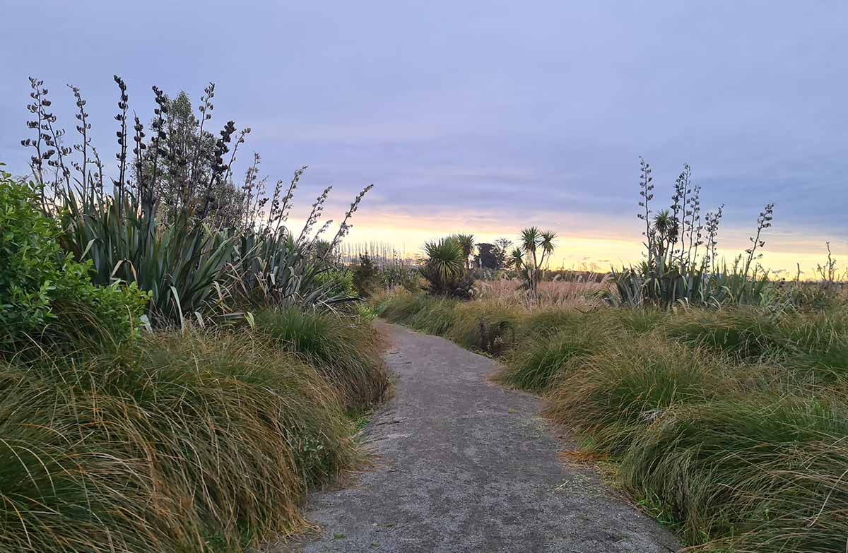
From the car park the track crosses a bridge over a stream, which is a great spot to look for water life, such as eels/tuna. From there the track loops around the outside of the wetland, with interpretation panels to look at and pleasant places to sit along the way. There is a raised lookout point for a view over the area.
The wetland is a 'Wai Tapu' site, therefore there is no eating in the wetland area (beyond the bridges) and no dogs are allowed. Picnicking is allowed only in the grass area next to the car park, where there is also a toilet. This area is suitable for wheelchairs.
Getting there
Ōtūkaikino wetland is on the outskirts of Christchurch City, by the northern suburb of Belfast. The entrance is off Main North Road, between Chaneys Corner and the Belfast end of the Northern Motorway. The address is 985 Main North Road, Belfast.
Car park closed from 6 pm
The gate to the reserve is closed each night from 6 pm. The site is still open, but visitors after hours will need to park on the roadside, and use the pedestrian assess around the gate.
Know before you go
As the track goes across ponds and there is a nearby stream. Young children must be supervised at all times.
The boardwalk is closed due to land changes caused by the 2011 Christchurch earthquakes. Use the available track instead.
Nature and conservation
There are lots of interesting things to see as you make your way along the track.
Wetland plant life is dominated by:
raupō
toetoe
tall tussock sedges (pukio)
blechnum fern (kiokio)
Birds sometimes seen in the reserve are:
pūkeko
mallard ducks
shoveller/kuruwhengu
grey teal/tētē
marsh crake/koitareke
Australasian bittern/matuku-hūrepo
fantails/pīwakawaka
scaup/pāpango
The spring fed waters of the wetland support a variety of aquatic life including common bullies, native snails (pūpū), short and long-finned eels (tuna), juvenile native fish and various aquatic insects.
Sources and reuse
Route descriptions and practical information reproduced from the Department of Conservation, Crown copyright, under CC BY 4.0, subject to DOC's copyright policy. Formatting has been adapted, including flattening page sections; follow the original DOC page for maps, section-specific layout, current notices and linked documents. Outdoor Next is independent and is not endorsed by DOC.
The accompanying photograph is published in DOC's official route gallery with an explicit reuse licence. Its original caption and credit are retained; it does not establish current track conditions.
