By Outdoor Next Editorial standards
On this page
Location & access
DOC track reference point, not a verified trailhead, entrance or the whole route. Check the official route directions before travel.
Official location informationLocation source
DOC track reference point, not a verified trailhead, entrance or the whole route.
Reference point: -41.14726, 172.18862. WGS84 coordinates retained at the official service's returned precision; decimal resolution is not survey accuracy. Source positional accuracy is not specified.
DOC Maps walking and tramping reference point (WGS84), exact official-page GUID / Department of Conservation. Checked 2026-10-12.
Key facts
- Distance
- 2 km return via same track
- Walking time
- 1 hr return
- Track grade
- Easy
- Location
- Kahurangi National Park / Karamea area
- Dog access
- No dogs. Other pets on conservation land rules.
Checked against official sources on 8 October 2026. Rules and conditions are set by Department of Conservation — confirm with them before you go.
Route overview
Explore 35-million-year-old limestone arch and ancient native forests. This is a true lost world experience that is easy, fascinating, and great for kids.
This DOC directory entry covers Ōpārara Arch in Tasman, within Kahurangi National Park / Karamea area. Where DOC groups several walks, times and grades refer to the listed options rather than a single continuous itinerary.
Distance, time and grade
- Distance: 2 km return via same track
- Walking time: 1 hr return
- DOC grade: Easy
Access and alerts
Source checked 2026-10-08. This page is a dated snapshot, not a live track-status report. Check current DOC route information immediately before travelling. An absence of listed alerts does not establish that a route is open.
Dog access
No dogs. Other pets on conservation land rules.
Description
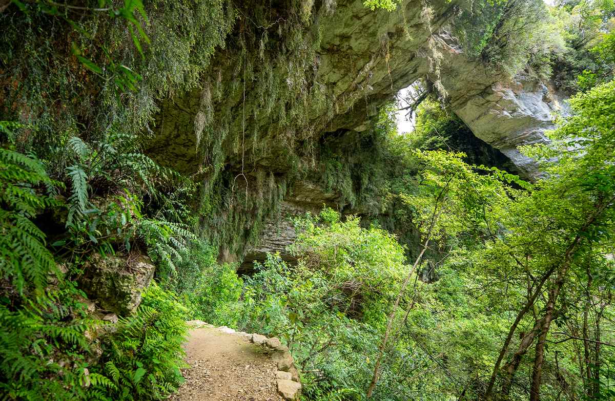
This is a 1.1 km easy family friendly walk through beech and podocarp forests, past limestone outcrops, to the Ōpārara Arch. It will take approximately 30 mins.
The well-formed track takes you firstly to a bridge over a small tributary stream before leading into Ōpārara River itself, then along to Ōpārara Arch. Once at the arch you can ascend a series of wooden steps to a viewpoint. You will now be standing inside the magnificent limestone arch which is reputed to be the largest one in Australasia.
The surface can be rough and uneven in places and has steep drop offs. Take care when walking this track.
Getting there
Ōpārara Arch is on McCallums Mill Road, north of Karamea. From Karamea, head north for about 10 km, then turn into McCallums Mill Road and follow this for about 14 km to a car park.
Note, McCallums Mill Road is a narrow and steep gravel road with a recommended speed limit of 30 km/hr. It is not suitable for large vehicles or campervans.
Know before you go
Always know what the weather is doing; it can change dramatically in a short time.
Call Paparoa National Park Visitor Centre for a weather update if required and the current track conditions.
Always take warm and waterproof clothing as the weather can change rapidly.
Carry and use insect repellent and sun protection at all times.
The track does become slippery when it is raining, take extra care.
Nature and conservation
The ecosystem in this area is fragile. Help preserve nature's creations by keeping to the track and resisting the temptation to touch the highly sensitive limestone cave formations
History and culture
The Ōpārara Basin itself was formed 350 million years ago and was part of the seabed. The actual limestone cave systems and arches were formed in the last million years.
The area was certainly known to our early mapmakers as the arches are marked on old Karamea maps dating back to the 1880s. It wasn’t until the late 1970s that Forest Service staff working in the area stumbled across the entrance to Honeyflow Stream and a series of magnificent arches that we see today.
Sources and reuse
Route descriptions and practical information reproduced from the Department of Conservation, Crown copyright, under CC BY 4.0, subject to DOC's copyright policy. Formatting has been adapted, including flattening page sections; follow the original DOC page for maps, section-specific layout, current notices and linked documents. Outdoor Next is independent and is not endorsed by DOC.
The accompanying photograph is published in DOC's official route gallery with an explicit reuse licence. Its original caption and credit are retained; it does not establish current track conditions.
