By Outdoor Next Editorial standards
On this page
Location & access
DOC track reference point, not a verified trailhead, entrance or the whole route. Check the official route directions before travel.
Official location informationLocation source
DOC track reference point, not a verified trailhead, entrance or the whole route.
Reference point: -38.17726, 176.46496. WGS84 coordinates retained at the official service's returned precision; decimal resolution is not survey accuracy. Source positional accuracy is not specified.
DOC Maps walking and tramping reference point (WGS84), exact official-page GUID / Department of Conservation. Checked 2026-10-12.
Key facts
- Distance
- 6 km one way
- Walking time
- 3 hr
- Track grade
- Advanced
- Location
- Lake Tarawera Scenic Reserve
- Dog access
- No dogs. Other pets on conservation land rules.
Checked against official sources on 8 October 2026. Rules and conditions are set by Department of Conservation — confirm with them before you go.
Route overview
This track starts at Tarawera Outlet and finishes at Humphries Bay. This area was extensively altered by the 1886 Tarawera eruption and the landscape is being slowly regenerated by native plant species.
This DOC directory entry covers Northern Tarawera Track in Bay of Plenty, within Lake Tarawera Scenic Reserve. Where DOC groups several walks, times and grades refer to the listed options rather than a single continuous itinerary.
Distance, time and grade
- Distance: 6 km one way
- Walking time: 3 hr
- DOC grade: Advanced
Access and alerts
Source checked 2026-10-08. This page is a dated snapshot, not a live track-status report. Check current DOC route information immediately before travelling. An absence of listed alerts does not establish that a route is open.
Dog access
No dogs. Other pets on conservation land rules.
Description
This track can be walked from either end and is accessible by boat or connecting tracks.
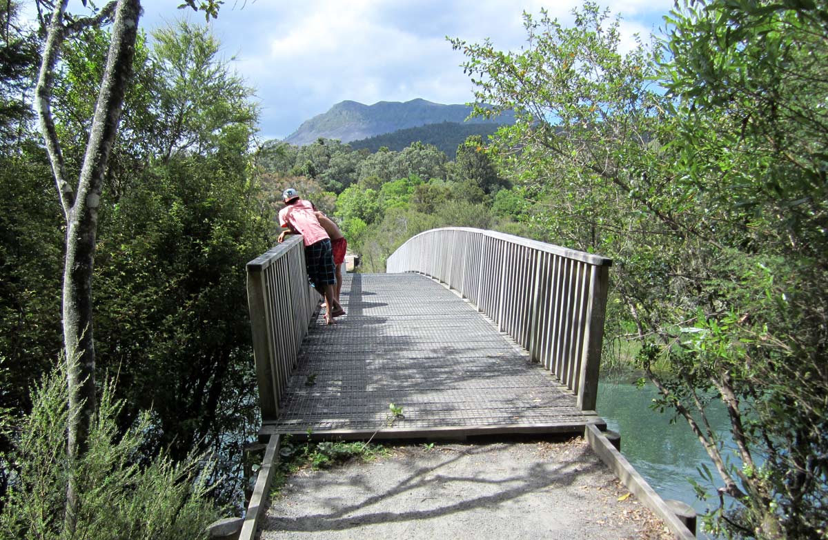
The track begins at the Tarawera Outlet swing bridge. Cross the bridge and take the left hand track at the junction. The track passes a jetty a short distance from the Outlet and progresses westward.
Views of the lake become less frequent as the track climbs inland. The track descends into Humphries Bay - a pleasant picnic and overnight camping area.
Camping facilities and toilets are provided at Lake Tarawera Outlet and Humphries Bay campsites.
Other options
Trampers can then take the Eastern Okataina Walkway northwards to access Otangimoana Bay on Lake Okataina (approximately 20 minutes one way) or onwards to complete the Walkway at the Okataina carpark (Tauranganui Bay - a further 2 hours 40 minutes walk).
Getting there
Access by walking is by DOC tracks that link to this area:
Tarawera Falls to Tarawera Outlet Track
Eastern Okataina Walkway to Humphries Bay
Or access by boat at either Humphries Bay or Te Tapahoro / The Outlet
There is no vehicle access to Te Tapahoro / The Outlet Campsite.
Overnight parking at the Tarawera Falls Carpark is not permitted.
Access permits
You'll need to get a permit to access Tarawera Falls Carpark. Overnight parking at the Tarawera Falls Carpark is not permitted.
Use of the private forestry roads in the forest is at the discretion of the forestry owners. Check the conditions of your forestry permit.
Access permits can be obtained from the Kawerau isite Visitor Information Centre.
Kawerau isite Visitor Information CentrePlunket Street, Kawerau 3127Phone: +64 7 323 6300Email: infocentre@kaweraudc.govt.nzOpening hours for Kawerau isite Visitor Information Centre
Know before you go
You need to be well prepared when tramping on conservation land, especially on longer day walks. Ensure you have warm clothes, strong, comfortable boots, a good raincoat, first aid kit, food and drink, a hat and sunscreen. It is also advisable to leave your tramping intentions with a responsible person, in case you get lost.
Sources and reuse
Route descriptions and practical information reproduced from the Department of Conservation, Crown copyright, under CC BY 4.0, subject to DOC's copyright policy. Formatting has been adapted, including flattening page sections; follow the original DOC page for maps, section-specific layout, current notices and linked documents. Outdoor Next is independent and is not endorsed by DOC.
The accompanying photograph is published in DOC's official route gallery with an explicit reuse licence. Its original caption and credit are retained; it does not establish current track conditions.
