By Outdoor Next Editorial standards
On this page
Location & access
DOC track reference point, not a verified trailhead, entrance or the whole route. Check the official route directions before travel.
Official location informationLocation source
DOC track reference point, not a verified trailhead, entrance or the whole route.
Reference point: -35.78708, 174.43645. WGS84 coordinates retained at the official service's returned precision; decimal resolution is not survey accuracy. Source positional accuracy is not specified.
DOC Maps walking and tramping reference point (WGS84), exact official-page GUID / Department of Conservation. Checked 2026-10-12.
Key facts
- Distance
- Not confirmed on the checked DOC page; see individual route sections
- Walking time
- 2hr 30 min
- Track grade
- Easy
- Location
- Whangārei area / Whangārei Heads area
- Dog access
- No dogs. Other pets on conservation land rules.
Checked against official sources on 8 October 2026. Rules and conditions are set by Department of Conservation — confirm with them before you go.
Route overview
This pleasant and easy walk takes you around the coastline across a causeway to Motukiore Island, and is a great summer family outing.
This DOC directory entry covers Motukiore Island Walk in Northland, within Whangārei area / Whangārei Heads area. Where DOC groups several walks, times and grades refer to the listed options rather than a single continuous itinerary.
Distance, time and grade
- Distance: Not confirmed on the checked DOC page; see individual route sections
- Walking time: 2hr 30 min
- DOC grade: Easy
Access and alerts
Source checked 2026-10-08. This page is a dated snapshot, not a live track-status report. Check current DOC route information immediately before travelling. An absence of listed alerts does not establish that a route is open.
Dog access
No dogs. Other pets on conservation land rules.
Description
Be prepared to get your feet wet as the track makes its way through the mangroves with the 'Pines' fairways on one side and the Whangārei Harbour on the other.
The sandspit out to the island is walkable at low tide only.
Crossing is only possible up to 2 hours either side of low tide.
Once out on the island you can roam as you like, from the prominent pā at the southern end of the island to the site of an historic homestead at the northern end. Motukiore Island is located in Parua Bay, 400 m east of the end of Manganese Point.
Getting there
Motukiore Island Walk is 13 km east of Whangārei. The track starts off Whangārei Heads Road just past the Pines Golf Course. There's a carpark 200 m beyond where the track starts.
Know before you go
The sandspit out to the island is walkable at low tide only.
Check tide times and plan your walk to be on the sandspit two hours either side of low tide.
Due to the coastal environment, track marking is limited but the island is visible all the way.
Stick to the coastline and respect private property.
Nature and conservation
Motukiore Island is a 5 ha recreation reserve. Mature pōhutukawa trees surround the shoreline and the birdlife is abundant around the Island. Terns and oystercatchers are frequent visitors.
The island features a well-preserved Māori pā. Its ancient terraces are still clearly visible.
In the late 1960s the island was purchased by the Northland Harbour Board in advance of the encroaching development of Whangārei Harbour, and was used as an island retreat. However the financial drain was too much and the island was purchased by the Crown for the Hauraki Gulf Maritime Park in 1974. Since 1987 Motukiore has been managed by the Department of Conservation.
History and culture
Motukiore Island has a fascinating history. It was both an important vantage point for Māori in prehistoric times, and a focus of early European industry in Whangārei Harbour.
Historic values
Māori occupation of the island is evidenced in the form of the impressive terraced Māori pā at the southern end.
The pā consists of a series of artificially levelled earthen terraces rising up the slope to a central tihi or platform at the summit. Typically, whare or houses would have been built on the terraces, along with associated structures like cook houses, drying racks for seafood and storage for fishing and gardening equipment.
The pā was defended by the slopes of the hill itself, probably augmented by wooden palisades and the two defensive ditch and bank features still visible on the ridge below the terraces.
Below the pā, the flats may have been gardened, and gardening may also have taken place on the nearby mainland. The gathering of fish and shellfish and the importance of marine resources to Māori is evident by the thick layer of midden or cooking refuse which rings the foreshore of the island.
European involvement
European involvement with the island began in 1839 when Gilbert Mair (Senior) landed men on the island to establish a pit-sawing venture to provide spars of native timber for ships plying New Zealand waters. The going was hard and circumstances lonely and difficult and the venture folded in less than six months. At about the same time the island was sold as part of a much larger block to Messrs Scott, Russell and Anderson by a group of local Māori chiefs, a sale confirmed by the Crown Native Land Commission in 1844.
For the next 130 years the island was farmed by a succession of local and absentee owners who left their own mark in the form of homestead gardens and windbreaks on the northern and western sides of the island, farm fences and stockyards.
Around 1900 a homestead was built at the northern end of the island and in the 1930s a farm managers residence was built on the western side of the island. A New Zealand Farmers Weekly article from 1941 extolled the small-farming practices used on the island along with its many other virtues.
Sources and reuse
Route descriptions and practical information reproduced from the Department of Conservation, Crown copyright, under CC BY 4.0, subject to DOC's copyright policy. Formatting has been adapted, including flattening page sections; follow the original DOC page for maps, section-specific layout, current notices and linked documents. Outdoor Next is independent and is not endorsed by DOC.
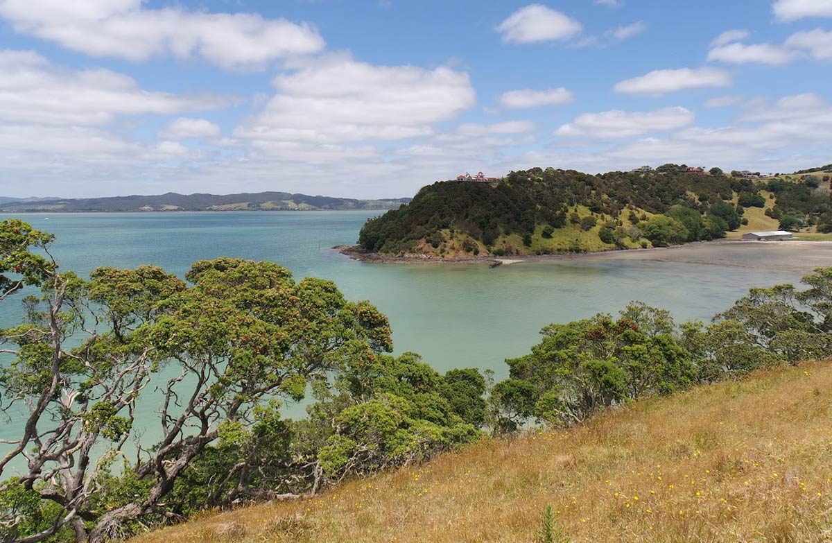
The accompanying photograph is published in DOC's official route gallery with an explicit reuse licence. Its original caption and credit are retained; it does not establish current track conditions.
