By Outdoor Next Editorial standards
On this page
Location & access
DOC track reference point, not a verified trailhead, entrance or the whole route. Check the official route directions before travel.
Official location informationLocation source
DOC track reference point, not a verified trailhead, entrance or the whole route.
Reference point: -42.89303, 173.30109. WGS84 coordinates retained at the official service's returned precision; decimal resolution is not survey accuracy. Source positional accuracy is not specified.
DOC Maps walking and tramping reference point (WGS84), exact official-page GUID / Department of Conservation. Checked 2026-10-12.
Key facts
- Distance
- 3 km return via same track
- Walking time
- 1 hr 45 min return
- Track grade
- Intermediate
- Location
- Cheviot area
- Seasonal restrictions
- Closed for lambing 15 August to 15 October each year.
- Dog access
- No dogs. Other pets on conservation land rules.
Checked against official sources on 8 October 2026. Rules and conditions are set by Department of Conservation — confirm with them before you go.
Route overview
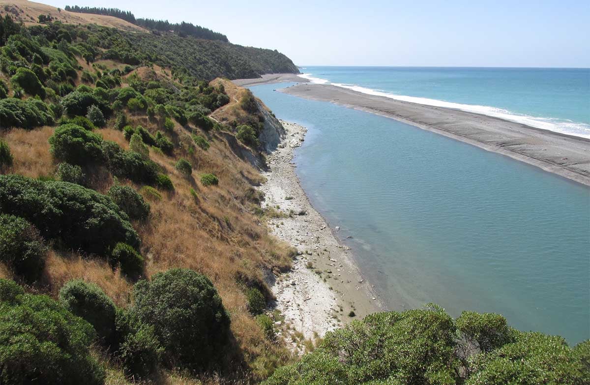
This track hugs the coastline and provides sea views, lush forest and a number of landscape features.
This DOC directory entry covers Manuka Bay Lookout Track in Canterbury, within Cheviot area. Where DOC groups several walks, times and grades refer to the listed options rather than a single continuous itinerary.
Distance, time and grade
- Distance: 3 km return via same track
- Walking time: 1 hr 45 min return
- DOC grade: Intermediate
Access and alerts
Source checked 2026-10-08. This page is a dated snapshot, not a live track-status report. Check current DOC route information immediately before travelling. An absence of listed alerts does not establish that a route is open.
Seasonal restrictions
Closed for lambing 15 August to 15 October each year.
Dog access
No dogs. Other pets on conservation land rules.
Description
The Manuka Bay Lookout Track cannot be accessed from the southern (Hurunui River mouth) end. See more information in the 'Getting there' section below.
The track crosses the open area then drops down to an area of regenerating mānuka and flax. There are good examples of tunnel and gulley 'badland' erosion in the banks alongside the track where rain has scoured out the soft clay.
It then passes through a stretch of mature coastal forest featuring plants such as whauwhaupaku or five-finger, small-leaved kōwhai, and a variety of ferns. There are glimpses of the sea as the track winds in and out of bush filled gullies.
Soon the track climbs again to give good views of the coastline and the nearby Hurunui lagoon. There is a headland atop 60 m cliffs where you can rest on a seat and admire the expansive ocean and coastal views.
Getting there
Drive on SH1 to Domett, then turn down the signposted Hurunui Mouth Road (126 km north of Christchurch).
Drive 4 km down the road before taking the Cathedral Road towards Gore Bay.
Follow the winding Cathedral Road for 7 km and turn down the unsealed Manuka Bay Road.
After 1 km you'll arrive at gate. The road is unsuitable for vehicles past this point.
Manuka Bay Lookout Track cannot be accessed from the southern (Hurunui River mouth) end. Significant slips and fall hazards exist and the southern end of Manuka Bay Track has been permanently closed.
Know before you go
Wasps may be present, particularly during summer and autumn. Consider carrying an antihistamine product and if you are allergic to stings, ensure you bring your medication.
No toilets or water are available on this track. The nearest public toilets are located in Gore Bay at the Old School Reserve, Cathedral Rd.
This track is slippery in places. Watch your step.
This track is prone to slips/landslides after heavy rainfall. Notify the visitor centre if there is a slip that requires our attention.
Check the weather forecast before you go.
Nature and conservation
The Port Robinson area lies at the southern and eastern limits of a number of bird and plant species. The area is known for its abundant bird life.
Sources and reuse
Route descriptions and practical information reproduced from the Department of Conservation, Crown copyright, under CC BY 4.0, subject to DOC's copyright policy. Formatting has been adapted, including flattening page sections; follow the original DOC page for maps, section-specific layout, current notices and linked documents. Outdoor Next is independent and is not endorsed by DOC.
The accompanying photograph is published in DOC's official route gallery with an explicit reuse licence. Its original caption and credit are retained; it does not establish current track conditions.
