By Outdoor Next Editorial standards
On this page
Location & access
DOC track reference point, not a verified trailhead, entrance or the whole route. Check the official route directions before travel.
Official location informationLocation source
DOC track reference point, not a verified trailhead, entrance or the whole route.
Reference point: -44.97961, 168.80146. WGS84 coordinates retained at the official service's returned precision; decimal resolution is not survey accuracy. Source positional accuracy is not specified.
DOC Maps walking and tramping reference point (WGS84), exact official-page GUID / Department of Conservation. Checked 2026-10-12.
Key facts
- Distance
- 8 km loop
- Walking time
- 2 - 3 hr
- Track grade
- Easy
- Location
- Arrowtown area
- Dog access
- Dogs on a leash only. Other pets on conservation land rules.
Checked against official sources on 8 October 2026. Rules and conditions are set by Department of Conservation — confirm with them before you go.
Route overview
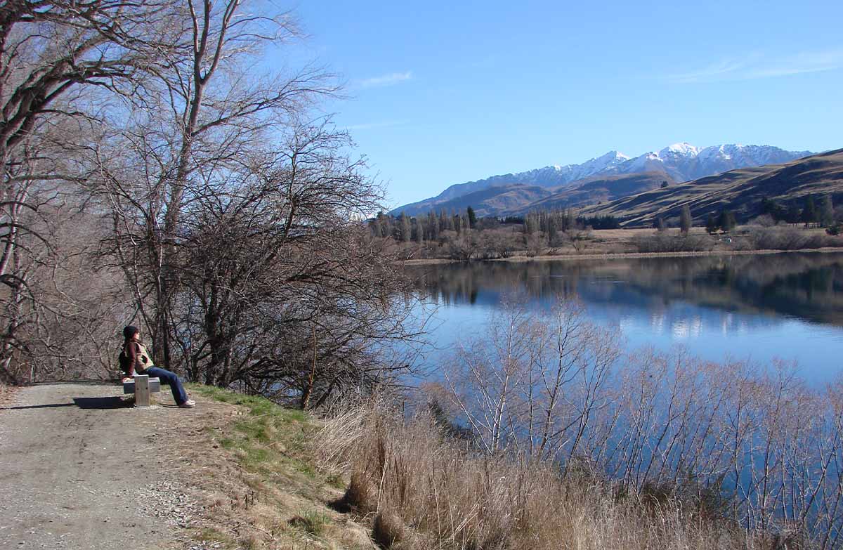
Stroll, walk, run or cycle around a lake surrounded by spectacular mountains. This track is part of Te Araroa Trail.
This DOC directory entry covers Lake Hayes Walkway in Otago, within Arrowtown area. Where DOC groups several walks, times and grades refer to the listed options rather than a single continuous itinerary.
Distance, time and grade
- Distance: 8 km loop
- Walking time: 2 - 3 hr
- DOC grade: Easy
Access and alerts
Source checked 2026-10-08. This page is a dated snapshot, not a live track-status report. Check current DOC route information immediately before travelling. An absence of listed alerts does not establish that a route is open.
- Track repairs for Lake Hayes Walkway; First published on 29 August 2026. Last reviewed on 7 October 2026.
Dog access
Dogs on a leash only. Other pets on conservation land rules.
Description
This track is part of Te Araroa Trail.
Stroll, walk, run or cycle around a lake surrounded by spectacular mountains; also home to a healthy population of Australasian crested grebe.
Getting there
The track has multiple access points:
North Lake Hayes picnic area – there is a lot of parking here
Lake Hayes Pavilion and show grounds on SH6
Bendemeer Bay
Arrowtown Road
Rutherford Road off Speargrass Flat Road.
Know before you go
What to expect
A well-maintained track with a smooth gravel surface
steep drops beside the track on the western side of the lake
good sign-posting and cell phone reception
walkers (including dog-walkers) and bikers sharing the track
a short section at the north-eastern end is shared with vehicles
hot and dry weather in summer, cold temperatures and a chance of ice in winter.
Skills/experience needed
Lake Hayes Walkway is a Grade 3: Intermediate mountain biking track. If you are not comfortable riding a Grade 3 trail, try walking it instead or riding one of the Grade 2 sections of the Queenstown Trail.
Plan and prepare
The track occasionally floods on the southern side. If there is water over the track, avoid this section. You might also encounter maintenance work on this section of the track. Signage will alert visitors to any flooding or track work.
Check the LAWA web page on water quality for you and your dog if planning to swim in the lake.
Watch children closely, as there are sections with steep drops by the track edge.
If you are riding the track, choose a mountain bike rather than a road bike. On the southern end the trail goes over a boardwalk – please reduce speed or dismount.
Pack water, sunscreen, sunglasses, and a sunhat (for walkers) or a helmet visor (for bikers) in summer. In winter, carry plenty of warm and waterproof clothing – it gets very cold.
You can combine this trail with other nearby bike trails for a longer ride. It is part of the Queenstown Trail Great Ride. Visit the Queenstown Trail website for more information and trail updates.
Sources and reuse
Route descriptions and practical information reproduced from the Department of Conservation, Crown copyright, under CC BY 4.0, subject to DOC's copyright policy. Formatting has been adapted, including flattening page sections; follow the original DOC page for maps, section-specific layout, current notices and linked documents. Outdoor Next is independent and is not endorsed by DOC.
The accompanying photograph is published in DOC's official route gallery with an explicit reuse licence. Its original caption and credit are retained; it does not establish current track conditions.
