By Outdoor Next Editorial standards
On this page
Location & access
DOC track reference point, not a verified trailhead, entrance or the whole route. Check the official route directions before travel.
Official location informationLocation source
DOC track reference point, not a verified trailhead, entrance or the whole route.
Reference point: -38.41404, 177.27789. WGS84 coordinates retained at the official service's returned precision; decimal resolution is not survey accuracy. Source positional accuracy is not specified.
DOC Maps walking and tramping reference point (WGS84), exact official-page GUID / Department of Conservation. Checked 2026-10-12.
Key facts
- Distance
- Not confirmed on the checked DOC page; see individual route sections
- Walking time
- 2 - 3 days
- Track grade
- Advanced
- Location
- Waioweka Conservation Area
- Dog access
- Dogs with a DOC permit for recreational hunting or management purposes only. Other pets on conservation land rules.
Checked against official sources on 8 October 2026. Rules and conditions are set by Department of Conservation — confirm with them before you go.
Route overview
This loop track provides options for an overnight tramp with children or a multi-day tramp with river walking sections.
This DOC directory entry covers Koranga Tawa Loop Track in Gisborne, within Waioweka Conservation Area. Where DOC groups several walks, times and grades refer to the listed options rather than a single continuous itinerary.
Distance, time and grade
- Distance: Not confirmed on the checked DOC page; see individual route sections
- Walking time: 2 - 3 days
- DOC grade: Advanced
Access and alerts
Source checked 2026-10-08. This page is a dated snapshot, not a live track-status report. Check current DOC route information immediately before travelling. An absence of listed alerts does not establish that a route is open.
Dog access
Dogs with a DOC permit for recreational hunting or management purposes only. Other pets on conservation land rules.
Description
Walk this loop in either direction or visit each of the two huts on separate return trips. The river level should be low if you want to complete the entire trip. The tracks are well marked but you should be fully equipped with a good level of backcountry experience. Follow the yellow marker poles in farmland sections.
Moanui Road to Koranga Forks Hut
Time: 2–3 hr
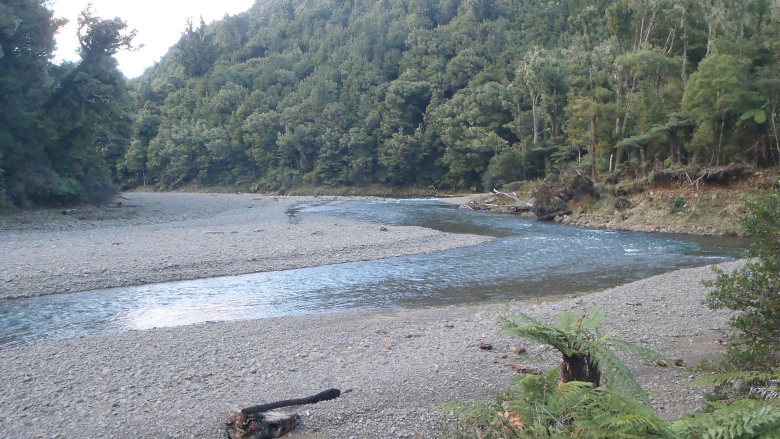
The track to the Koranga Forks Hut runs alongside the Koranga River with opportunities for swimming. It's a good overnight tramp for families with children. The hut is situated in the fork of the Koranga and Kahunui streams. A swing bridge crosses the Koranga River 5 minutes from the hut.
Koranga Forks Hut to Tawa Hut
Time: 6–7 hr
The trip between the Koranga Forks Hut and the Tawa Hut is along the Kahunui Stream bed. The majority of the track is in the river, a large orange track marker on the true right indicates exit from the river onto the benched track that takes approximately 30 minutes to get to the Tawa Hut.
The route between the two huts should not be attempted when river levels are high.
Side trip: Tawa Hut - Kahunui Hut
Time: 5 -7 hr
It's mainly river walking to the historic Kahunui Hut.
Tawa Hut to Moanui Road
Time: 4–5 hr
The benched track starts at the hut and continues upstream beside the Kahunui Stream. Continue up the Kahunui and into the Kahuiti Stream. There is a well formed benched track most of the way up through the bush to the farm land. A steep descent down through farmland (known as "the burn" if you're going up) takes you back to the Koranga River and Moanui swing bridge. From this point the well marked track takes 30 minutes to the Moanui Road end and carpark.
Getting there
Halfway between Opotiki and Gisborne on SH2, turn into Te Wera Road at the Motu River Bridge, then right into Moanui Road - a gravel road with some narrow sections.
Know before you go
There are three track washouts within the first km of track from the Moanui road end carpark. These are passable but take care.
Be aware this area is popular with hunters.
Stay safe when crossing rivers and streams
If you plan to cross unbridged rivers or side streams, know how to cross safely and be prepared for if you cannot cross.
Do not cross if the river or stream is flooded, you cannot find safe entry and exit points or are unsure it’s safe. Turn back or wait for the river to drop. If in doubt, stay out.
How to cross rivers safely
NIWA river flow forecasts: View a video of national followed by regional river flows
Sources and reuse
Route descriptions and practical information reproduced from the Department of Conservation, Crown copyright, under CC BY 4.0, subject to DOC's copyright policy. Formatting has been adapted, including flattening page sections; follow the original DOC page for maps, section-specific layout, current notices and linked documents. Outdoor Next is independent and is not endorsed by DOC.
The accompanying photograph is published in DOC's official route gallery with an explicit reuse licence. Its original caption and credit are retained; it does not establish current track conditions.
