By Outdoor Next Editorial standards
On this page
Location & access
DOC track reference point, not a verified trailhead, entrance or the whole route. Check the official route directions before travel.
Official location informationLocation source
DOC track reference point, not a verified trailhead, entrance or the whole route.
Reference point: -37.77316, 175.07965. WGS84 coordinates retained at the official service's returned precision; decimal resolution is not survey accuracy. Source positional accuracy is not specified.
DOC Maps walking and tramping reference point (WGS84), exact official-page GUID / Department of Conservation. Checked 2026-10-12.
Key facts
- Distance
- Not confirmed on the checked DOC page; see individual route sections
- Walking time
- 20 and 45 mins one way
- Track grade
- Advanced
- Location
- Karakariki Scenic Reserve
- Dog access
- No dogs. Other pets on conservation land rules.
Checked against official sources on 8 October 2026. Rules and conditions are set by Department of Conservation — confirm with them before you go.
Route overview
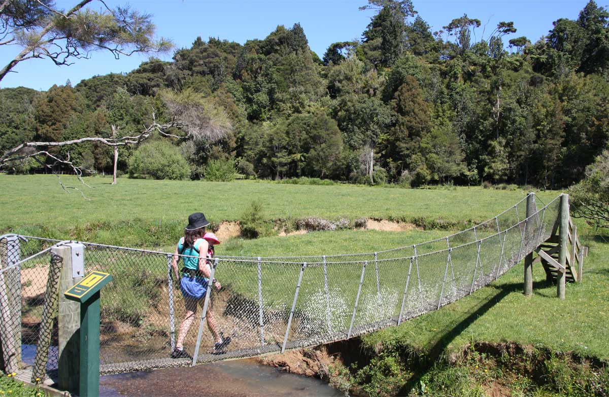
With suspension bridges, a stream, a waterfall and a nice spot for a picnic, this track has plenty to keep kids entertained.
This DOC directory entry covers Karakariki Track in Waikato, within Karakariki Scenic Reserve. Where DOC groups several walks, times and grades refer to the listed options rather than a single continuous itinerary.
Distance, time and grade
- Distance: Not confirmed on the checked DOC page; see individual route sections
- Walking time: 20 and 45 mins one way
- DOC grade: Advanced
Access and alerts
Source checked 2026-10-08. This page is a dated snapshot, not a live track-status report. Check current DOC route information immediately before travelling. An absence of listed alerts does not establish that a route is open.
Dog access
No dogs. Other pets on conservation land rules.
Description
Carpark to waterfall: 20 mins one wayWaterfall to fenceline: 45 mins one way
The first part of the track starts and ends with suspension bridges.
After the first bridge head to the left and follow the stream through a small bush remnant and open grassy areas.
After the second bridge it doesn't take long to reach the small waterfall - a good spot for a family picnic and a paddle in the stream (cross the ford on true right of the stream for a nice picnic spot).
You can explore upstream beyond the waterfall and look for fossils in the rocks and water.
On the true left, beyond the second suspension bridge and five minutes further along the track, you can cross the unbridged stream and follow a steep climb up to a bush-covered ridge. The track ends at the boundary fence - there is no view from this point; do not climb the fence.
A good track for children (though be aware it can be muddy, especially in winter), picnicking and looking for fossils in the stream below the waterfall. It is a good track for summer walking.
Getting there
Turn off the Hamilton/Raglan Highway (SH23) into Karakariki Rd, then turn left into Karakariki Valley Rd to the car park at the road end.
Know before you go
The first part of the track crosses private farmland. Respect the owner's rights and do not disturb stock.
The track can become very muddy, especially in winter, due to pugging by stock; be mindful of this and wear appropriate footwear.
Pet dogs are not allowed in the reserve.
Hunting dogs must have a permit and are only permitted in the reserve between 1 October and 30 June.
A restricted hunting permit issued by DOC covers only the 486 hectares of the reserve and not the adjoining bush blocks. No hunting is allowed in the reserve during lambing season, between 1 July and 30 September.
Sources and reuse
Route descriptions and practical information reproduced from the Department of Conservation, Crown copyright, under CC BY 4.0, subject to DOC's copyright policy. Formatting has been adapted, including flattening page sections; follow the original DOC page for maps, section-specific layout, current notices and linked documents. Outdoor Next is independent and is not endorsed by DOC.
The accompanying photograph is published in DOC's official route gallery with an explicit reuse licence. Its original caption and credit are retained; it does not establish current track conditions.
