By Outdoor Next Editorial standards
On this page
Location & access
DOC track reference point, not a verified trailhead, entrance or the whole route. Check the official route directions before travel.
Official location informationLocation source
DOC track reference point, not a verified trailhead, entrance or the whole route.
Reference point: -37.94870, 176.29912. WGS84 coordinates retained at the official service's returned precision; decimal resolution is not survey accuracy. Source positional accuracy is not specified.
DOC Maps walking and tramping reference point (WGS84), exact official-page GUID / Department of Conservation. Checked 2026-10-12.
Key facts
- Distance
- 1.2 km return via same track
- Walking time
- 45 min one way
- Track grade
- Advanced
- Location
- Kaharoa Conservation Area
- Dog access
- No dogs. Other pets on conservation land rules.
Checked against official sources on 8 October 2026. Rules and conditions are set by Department of Conservation — confirm with them before you go.
Route overview
Walk downhill through lush native forest to Onaia Stream. Keep your eyes and ears peeled for kōkako hopping through the forest canopy feeding or singing.
This DOC directory entry covers Kaharoa Kōkako Track in Bay of Plenty, within Kaharoa Conservation Area. Where DOC groups several walks, times and grades refer to the listed options rather than a single continuous itinerary.
Distance, time and grade
- Distance: 1.2 km return via same track
- Walking time: 45 min one way
- DOC grade: Advanced
Access and alerts
Source checked 2026-10-08. This page is a dated snapshot, not a live track-status report. Check current DOC route information immediately before travelling. An absence of listed alerts does not establish that a route is open.
Dog access
No dogs. Other pets on conservation land rules.
Description
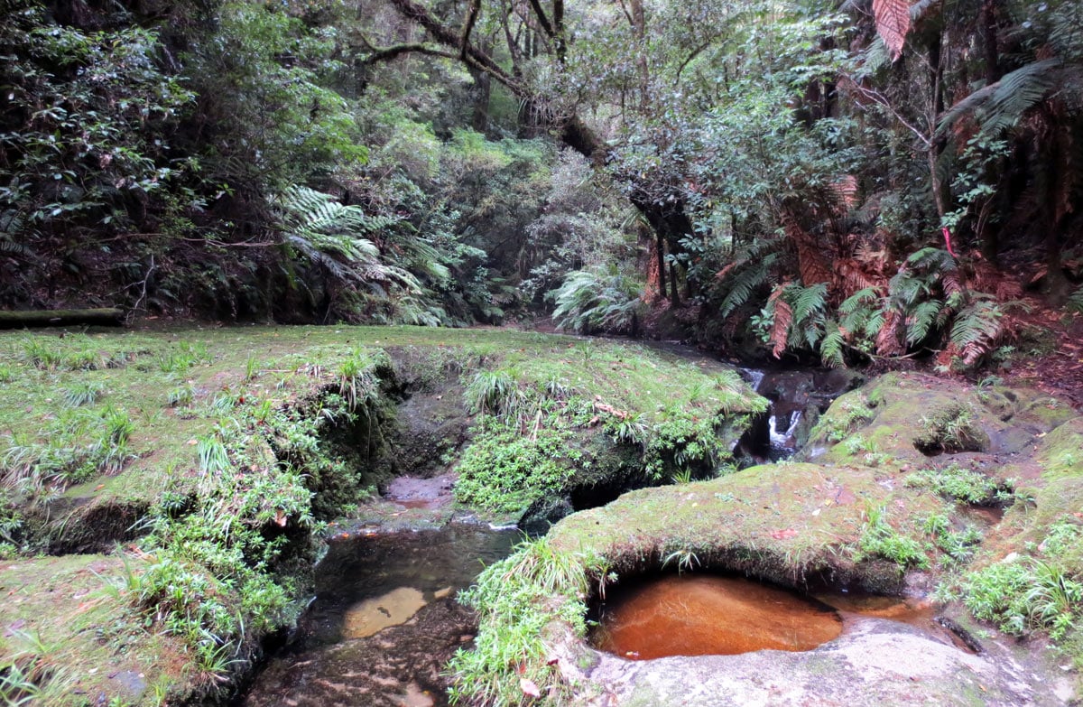
The track is approximately 45-minutes. It's a gradual walk downhill through lush native forest to Onaia Stream. This is a gentle coursing stream with minor waterfalls, that flows through a steep incised narrow gorge.
Keep your eyes and ears peeled for kōkako hopping through the forest canopy feeding or singing. At dawn, their haunting song can be heard through the entire forest and is well worth the early rise to experience.
The return journey is back along the same track.
Getting there
36 km north of Rotorua, from Rotorua access is via Hamurana road, then the Tauranga Direct Road, Kaharoa Road and finally Kapukapu Road.
Vehicle parking
There are two carparks along Kapukapu Road. The first carpark is a picnicking area with a shelter. It parks about 10 cars. There's also information about the recent history of the reserve and efforts to restore this local kōkako population by Kaharoa Kōkako Trust, a volunteer-based community conservation group.
The second carpark is approximately 500 m north of the first and it's located at the entrance of the track. Parks three cars only.
Know before you go
The Kaharoa Kōkako Track is suitable for a variety of ages and fitness levels. It is downhill to the stream. The walk back up to the carpark requires a medium level of fitness to return. There's some steep terrain and a flight of steps near the end of the track.
If you are bringing children, keep in mind that the stream is an open waterway. After heavy rainfall can be fast flowing and at a higher level than usual. There are a few areas with steep drop-offs as well.
No dogs allowed and there are no toilet facilities or rubbish bins, so plan ahead.
Nature and conservation
Kaharoa forest is home to one of New Zealand’s remaining populations of North Island kōkako, as well as an abundance of other native birdlife.
Sources and reuse
Route descriptions and practical information reproduced from the Department of Conservation, Crown copyright, under CC BY 4.0, subject to DOC's copyright policy. Formatting has been adapted, including flattening page sections; follow the original DOC page for maps, section-specific layout, current notices and linked documents. Outdoor Next is independent and is not endorsed by DOC.
The accompanying photograph is published in DOC's official route gallery with an explicit reuse licence. Its original caption and credit are retained; it does not establish current track conditions.
