By Outdoor Next Editorial standards
On this page
Location & access
DOC track reference point, not a verified trailhead, entrance or the whole route. Check the official route directions before travel.
Official location informationLocation source
DOC track reference point, not a verified trailhead, entrance or the whole route.
Reference point: -36.84268, 175.81645. WGS84 coordinates retained at the official service's returned precision; decimal resolution is not survey accuracy. Source positional accuracy is not specified.
DOC Maps walking and tramping reference point (WGS84), exact official-page GUID / Department of Conservation. Checked 2026-10-12.
Key facts
- Distance
- 550 m one way
- Walking time
- 20 min one way
- Track grade
- Easiest
- Location
- Hahei area / Te Whanganui-o-Hei/Cathedral Cove Marine Reserve
- Dog access
- No dogs. Other pets on conservation land rules.
Checked against official sources on 8 October 2026. Rules and conditions are set by Department of Conservation — confirm with them before you go.
Route overview
A short walk from Hahei beach or the end of Pa Road. The track leads into Te Pare Point Historic Reserve where you can visit the remains of two pā sites.
This DOC directory entry covers Hereheretaura Pā Short Walk in Waikato, within Hahei area / Te Whanganui-o-Hei/Cathedral Cove Marine Reserve. Where DOC groups several walks, times and grades refer to the listed options rather than a single continuous itinerary.
Distance, time and grade
- Distance: 550 m one way
- Walking time: 20 min one way
- DOC grade: Easiest
Access and alerts
Source checked 2026-10-08. This page is a dated snapshot, not a live track-status report. Check current DOC route information immediately before travelling. An absence of listed alerts does not establish that a route is open.
Dog access
No dogs. Other pets on conservation land rules.
Description
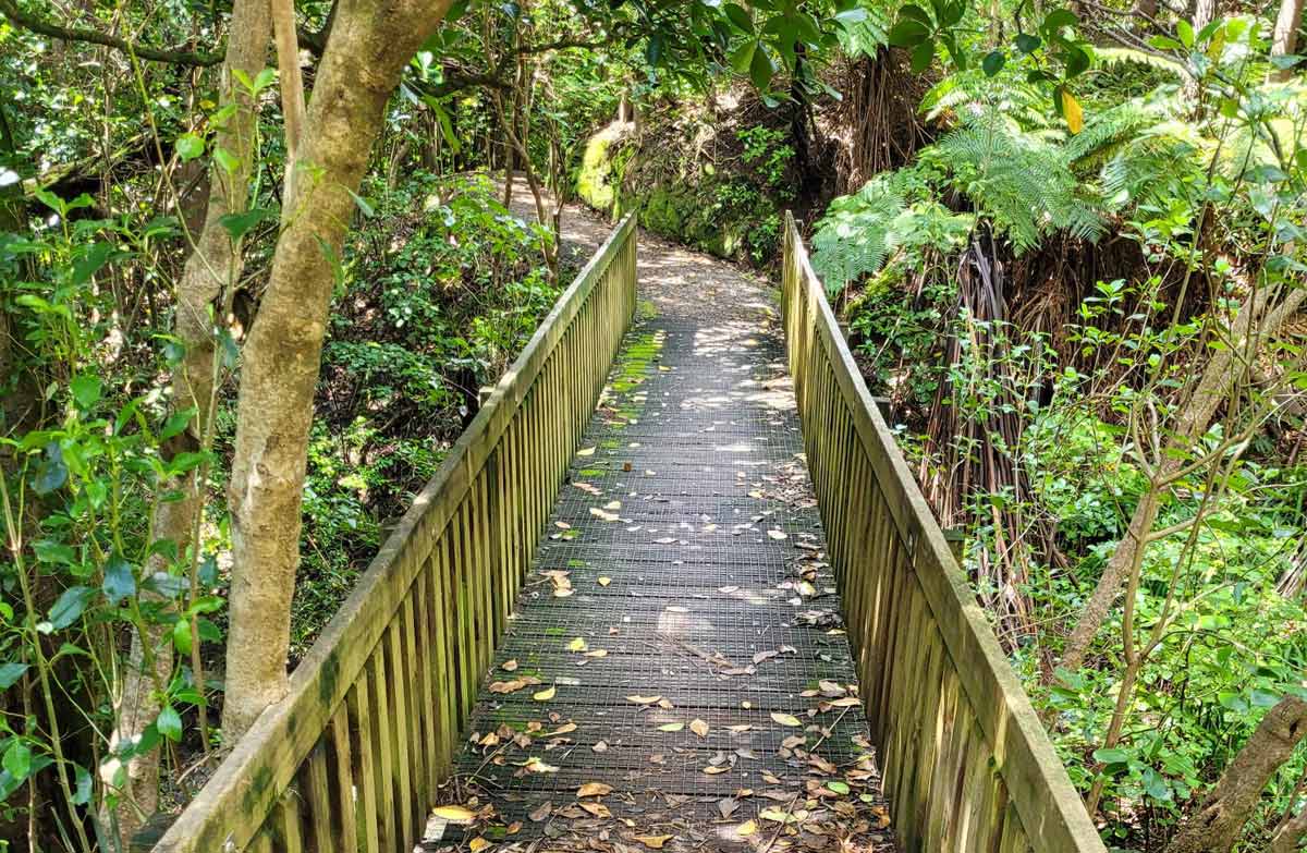
This walk will take you from the stunning white sands of Hahei Beach or through the coastal bush from the end of Pa Rd. Follow the track out to the Te Pare Point. From the point you will have uninterrupted views across the Te Whanganui-o-Hei/Cathedral Cove Marine Reserve and back to Hahei Beach.
Getting there
The walk is located at the southern end of Hahei Beach. Turn off SH25 between Coroglen and Whenuakite. Before entering Hahei, turn right onto Pa Road. The start of the track is signposted at the end of the road.
There is no parking at the start of the walk. Park at Hahei Beach and walk south along the beach or get dropped off at the end of Pa Road.
History and culture
At the southern end of Hahei Beach Te Pare Point Historic Reserve encompasses the remains of two prominent Ngāti Hei pā sites. A nearby spring and the remains of several midden suggest the site was a good location for both freshwater and shellfish.
The two pā offered protection to the Ngāti Hei people against frequent attacks from Ngāti Whanaunga, Ngāti Tamatera and Ngāpuhi. However, many of these attacks led to considerable loss of life and enslavement.
Hereheretaura Pā
Hereheretaura Pā is perched on the tip of the headland and surrounded by steep cliffs. The cliffs, coupled with a ditch and bank on the landward side, created a very good defensive position. You can still see the remains of the ditch and bank, several terraces, storage pits, and the living platforms.
DOC has repaired the outer earthworks bank, and formed a staircase on to the pā to prevent damage to the midden deposits on the slopes below the terraces.
Hahei Pā
Hahei Pā is on the ridge above the track leading to Hereheretaura Pā. Steep cliffs on the south drop down to a bay, while on the north side seven terraces fan out around the main platform. Unlike Hereheretaura Pā defensive earthworks appear to have been minimal.
Sources and reuse
Route descriptions and practical information reproduced from the Department of Conservation, Crown copyright, under CC BY 4.0, subject to DOC's copyright policy. Formatting has been adapted, including flattening page sections; follow the original DOC page for maps, section-specific layout, current notices and linked documents. Outdoor Next is independent and is not endorsed by DOC.
The accompanying photograph is published in DOC's official route gallery with an explicit reuse licence. Its original caption and credit are retained; it does not establish current track conditions.
