By Outdoor Next Editorial standards
On this page
Location & access
DOC track reference point, not a verified trailhead or the whole route. Check the official route directions before travel.
Official location informationLocation source
DOC track reference point, not a verified trailhead or the whole route.
Reference point: -43.59069, 172.79442. Stored to 5 decimal places (roughly 1 m resolution), not a claim of survey accuracy. Source positional accuracy is not specified.
DOC Maps walking and tramping point (WGS84) / Department of Conservation. Checked 2026-09-24.
Key facts
- Route covered
- Taylors Mistake via Pilgrims Way; return via Breeze Bay and Black Rock
- Distance
- DOC's detailed legs: 4.1 km outward and 5.6 km back; its headline says 9.3 km loop
- Walking time
- DOC's detailed legs: 1 hr 45 min each; its headline says 3 hr loop
- DOC walking grade
- Easy to intermediate walking track
- Access limitation
- Rerouted section near gun emplacements; lighthouse remains inaccessible
- Dogs
- On a lead; separate summer restrictions apply on Taylors Mistake beach
Checked against official sources on 24 September 2026. Rules and conditions are set by Department of Conservation and Christchurch City Council — confirm with them before you go.
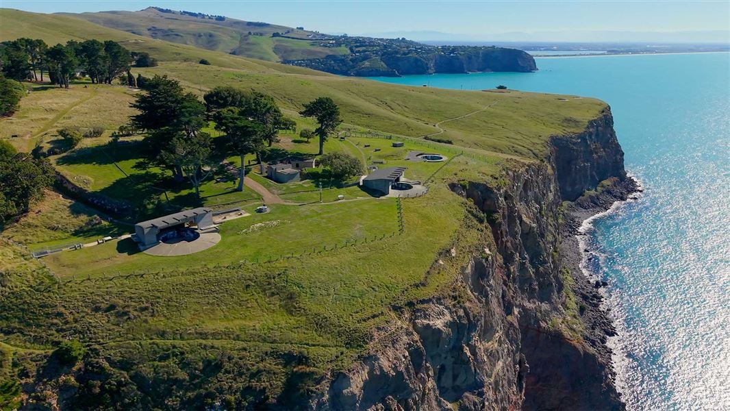
The Godley Head walk combines the coast above Taylors Mistake with the military heritage of Awaroa/Godley Head. Choose the signed walking loop via Pilgrims Way and Breeze Bay, not an unmarked shortcut through the heritage site. Check access before travelling: a loop description does not mean every old path or building is accessible.
12 October 2026 update: DOC's route description was reopened for the named walking legs, start points, facilities and safety reroute. The broader council/heritage review retains its 24 September date; this is not a live opening confirmation.
Access and partial restrictions
Rechecked on 12 October 2026: DOC says the track between the gun emplacements and Godley Head car park has been rerouted for safety. Follow the replacement route and closure signs in the current DOC track description.
DOC's August 2024 reopening announcement records completed contamination work, not today's access status. Its current area guidance says contaminated soil remains capped on site. Dogs must stay on a lead, and digging is prohibited where contaminated soil is capped.
The lighthouse remains have no public access. Do not interpret an open walking route as permission to explore closed structures. Recheck Canterbury alerts and local signs; this guide is not a live closure feed.
Distance, time and the route variants
The DOC route page gives these detailed legs:
| Named section | Distance | DOC walking time |
|---|---|---|
| Taylors Mistake to Godley Head via Pilgrims Way | 4.1 km | 1 hr 45 min |
| Godley Head to Taylors Mistake via Breeze Bay and Black Rock | 5.6 km | 1 hr 45 min |
Those figures total 9.7 km and 3 hours 30 minutes, whereas DOC's headline lists 9.3 km and 3 hours. Treat this as an unresolved source discrepancy, not two guaranteed measurements. Plan around the detailed legs, with additional time for breaks and heritage stops.
The council page lists 7 km and 3 hours, describing a return using part of Anaconda and a 4WD track. That is not the same return description as DOC's Black Rock route. This guide follows DOC's named walking legs; don't mix directions from different variants.
Choosing a start and finding parking
For the coastal circuit, start at Taylors Mistake car park. For a heritage-focused visit, Godley Head car park gives direct access to the defence site without first walking from the beach. DOC lists free parking for cars and campervans at both, plus toilets.
DOC also identifies Breeze Col as a third start, with a small car park labelled "Godley Head Loop Track Car Park" on Google Maps. That label is not the upper Godley Head heritage car park. Check which entrance your navigation destination represents before driving. On the Black Rock return, cross Summit Road at Breeze Col carefully and follow the Taylors Mistake signs; do not substitute a mountain-bike trail for the walking route.
Godley Head car park has a gate that DOC lists as open from 8 am to 8 pm. Summit Road is narrow, with sharp bends, steep drops and cyclists: leave room in your schedule for a careful drive. These details come from DOC's getting-there guidance, not an assurance of parking availability.
Day parking does not settle where you can sleep. Plan overnight stops separately using Christchurch freedom camping guidance.
Full coastal circuit or heritage-focused visit?
| Plan | Start and scope | What to allow for |
|---|---|---|
| Coastal walking circuit | Taylors Mistake, Pilgrims Way outward, Breeze Bay/Black Rock return | The two named legs total 3 hr 30 min before stops; steep and exposed sections remain on the return |
| Heritage-focused outing | Godley Head car park, permitted paths to the defence site | A different, shorter-scope visit; no independently verified short-loop distance is supplied here |
| Start at Breeze Col | Join the signed circuit from the small Summit Road car park | Reorder the same route deliberately; a different start is not evidence that the whole loop is shorter |
Agree on the plan before separating the group or arranging a pickup. Reaching Godley Head from Taylors Mistake is not the end of the walking day unless transport has genuinely been arranged. If you want only the heritage site, use its own start rather than budgeting a short visit around the complete coastal loop.
Toilets, water and reception
DOC lists toilets, including accessible toilets, at Taylors Mistake car park, Godley Head car park and the campsite. It lists tap water at the same three locations and advises treating it before drinking. Carry drinking water ready to use rather than assuming every available tap is untreated potable water. Accessible toilets do not establish that the coastal track is wheelchair accessible.
There are picnic tables near Godley Head car park and at the campsite, but no rubbish bins. Take rubbish home. Mobile coverage can be unreliable, so retain directions offline and share your intentions before leaving. Campsite facilities do not imply permission to sleep in a day car park or guaranteed campsite availability.
Heritage stops and walking difficulty
DOC grades the route as easy to intermediate, with rocky climbs, exposed ground and unfenced drops. Use choosing a walking track to assess whether that suits everyone in your group. A grade is not a promise that each section feels easy.
The coastal defence battery includes gun emplacements and interpretation panels. Read those from permitted paths rather than seeking shortcuts around barriers. Scott's Cabin is another possible stop: its interior is closed, and the exterior viewing-platform stairs are steep and narrow. Skipping a side trip is sensible when it doesn't suit your group.
Weather, dogs and preparation
The DOC area page warns about exposure and requires close supervision of children near cliffs. It also notes summer dog restrictions on Taylors Mistake beach, separate from the lead requirement on the walk. Read beach signs before combining the two.
Apply the Land Safety Code: check the forecast, share your route and return plan, pack for changing weather and make decisions together. Bring water, food and warm layers in your daypack. Use our conditions links and packing-list tool before leaving, and choose another outing if the forecast or access information doesn't suit.
Before you go
- Recheck DOC alerts and the signed reroute.
- Agree on the start point and return variant.
- Allow for stops rather than treating published times as deadlines.
- Check the car park gate notice on arrival.
- Keep dogs on a lead and children close near drops.
- Respect barriers, avoid disturbing soil and take rubbish home.
More photographs
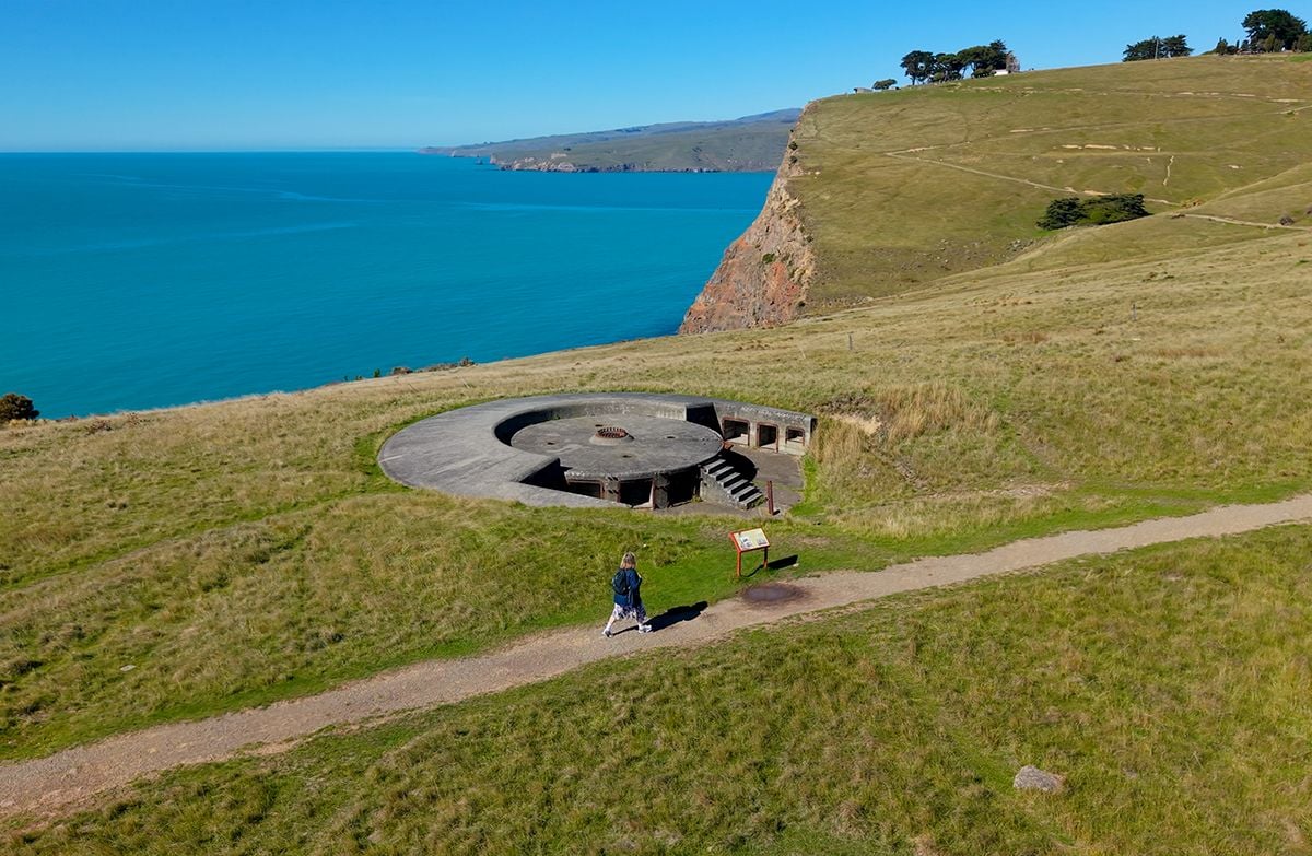
Area context. Taylor Battery, Awaroa/Godley Head. Published in DOC's Awaroa/Godley Head Loop Track guide. Photograph date not supplied; this is route-area context, not a verified trailhead or current-condition photograph.
Photo: Fraser Rudman / CC BY 4.0 / DetailsFrequently asked questions
Is the whole Godley Head site open?
Do not assume unrestricted access. At the 24 September 2026 check, DOC described a safety reroute between the gun emplacements and car park, capped contaminated soil and no public access to the lighthouse remains. The 2024 reopening notice is historical, not a live all-clear. Check DOC alerts and obey current signs.
How long is the Godley Head walk?
DOC's detailed Pilgrims Way and Breeze Bay/Black Rock legs are 4.1 km and 5.6 km, each taking 1 hour 45 minutes. Its headline instead lists 9.3 km and 3 hours for the loop. These figures do not agree; use the named legs for planning and allow extra time for stops.
Can I bring a dog to Godley Head?
DOC and Christchurch City Council require a lead. DOC also prohibits digging where contaminated soil is capped and notes separate summer dog restrictions on Taylors Mistake beach. Check beach signs before adding a beach visit.
Sources & official links
- 1.Awaroa/Godley Head Loop Track— Department of Conservation
- 2.Awaroa-Godley Head Loop Track— Christchurch City Council
- 3.Awaroa/Godley Head— Department of Conservation
- 4.Awaroa/Godley Head reopens after remediation for contamination, 30 August 2024— Department of Conservation
- 5.Awaroa/Godley Head coastal defence battery— Department of Conservation
- 6.Scott's Cabin— Department of Conservation
- 7.Canterbury alerts— Department of Conservation
- 8.Be prepared with the Land Safety Code— Department of Conservation