By Outdoor Next Editorial standards
On this page
Location & access
DOC track reference point, not a verified trailhead, entrance or the whole route. Check the official route directions before travel.
Official location informationLocation source
DOC track reference point, not a verified trailhead, entrance or the whole route.
Reference point: -43.16757, 171.69857. WGS84 coordinates retained at the official service's returned precision; decimal resolution is not survey accuracy. Source positional accuracy is not specified.
DOC Maps walking and tramping reference point (WGS84), exact official-page GUID / Department of Conservation. Checked 2026-10-12.
Key facts
- Distance
- Not confirmed on the checked DOC page; see individual route sections
- Walking time
- Not specified in the checked DOC directory
- Track grade
- Intermediate
- Location
- Craigieburn Forest Park
- Dog access
- Dogs allowed. Keep dog under control at all times. Other pets on conservation land rules.
Checked against official sources on 8 October 2026. Rules and conditions are set by Department of Conservation — confirm with them before you go.
Route overview
This track leads from Jacks Pass to Dracophyllum Flat, a popular picnic spot, then on to Texas Flat
This DOC directory entry covers Dracophyllum Flat Track in Canterbury, within Craigieburn Forest Park. Where DOC groups several walks, times and grades refer to the listed options rather than a single continuous itinerary.
Distance, time and grade
- Distance: Not confirmed on the checked DOC page; see individual route sections
- Walking time: Not specified in the checked DOC directory
- DOC grade: Intermediate
Access and alerts
Source checked 2026-10-08. This page is a dated snapshot, not a live track-status report. Check current DOC route information immediately before travelling. An absence of listed alerts does not establish that a route is open.
Dog access
Dogs allowed. Keep dog under control at all times. Other pets on conservation land rules.
Description
This track begins near Jacks Pass, on the Broken River ski field road. The track gradually descends to Broken River, which is crossed on a pole bridge.
After crossing the river, the track ascends for five minutes (walking) through mountain beech forest. You then come to a sheltered clearing, called Dracophyllum Flat. It is a popular picnic spot.
Dracophyllum Flat is named after the red-brown Dracophyllum that grows here, along with native tussock and a host of small herbs and ground covering plants.
After crossing Dracophyllum Flat, the track re-enters the bush. It goes through several boggy and muddy areas as well as crossing several small streams.
Once through the bush, the track traverses a tussock area and some more forest and then drops into Timms Stream. After climbing out of the stream, the track arrives at Texas Flat on the Cheeseman Ski Field Road.
All major stream crossings are bridged, except for Cuckoo Creek. This area can flood and become impassable during heavy rain.
Getting there
Turns off State Highway 73 into the Broken River Skifield Road, around 108 km from Christchurch.
Broken River Ski-field Road is extremely narrow and winding, we recommend travelling slowly (20 km per hour) to avoid collisions and to look for areas where two vehicles can get past each other.
In winter, this road may require tyre chains to access. We also recommend not travelling inwards on this road in the afternoons as there can be many vehicles exiting the ski-field.
There is no vehicle access to the Environment Centre. There are locked gates near Jack’s Pass, Bridge Hill and on SH.73 (Bridge Hill Road). Parking is very limited at all track-heads; do not block road access.
Know before you go
Fire-damaged trees hazard
Tracks within the Craigieburn Forest areas were affected by a previous large fire and may contain ongoing hazards from fire-damaged trees.
Be aware:
Dead or damaged trees may fall without warning.
Falling branches, limbs, and dead spars can occur at any time, including during calm weather.
Hazards may increase during periods of strong wind, heavy rain, or snow.
Take extra care when travelling through fire-affected areas, remain alert to your surroundings, and avoid stopping beneath dead or damaged trees where possible.
Be ready for alpine weather
This is an alpine area and people should be prepared for extremes of weather. Always check the forecast before you go. Weather forecasts for Mt Cheeseman and Canterbury High Country
Carry warm layers, a waterproof raincoat and sun protection. Find packing lists here.
Expect wasps, especially in summer and early autumn
Wasp populations reach high numbers from January to March – wear light coloured clothing and carry antihistamine cream/tablets as a precaution.
No fires
No fires are allowed within Craigieburn Forest Park.
Shared use area
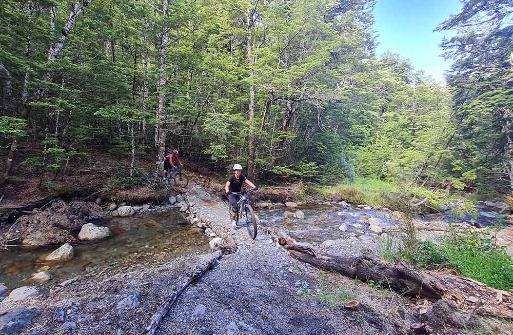
This track is used by walkers and mountain bikers – be respectful of other users. Mountain bikers should go slow and be ready to encounter walkers.
Take care when crossing Cuckoo Creek
There is no bridge and the crossing can be impassable during/after heavy rain.
Sources and reuse
Route descriptions and practical information reproduced from the Department of Conservation, Crown copyright, under CC BY 4.0, subject to DOC's copyright policy. Formatting has been adapted, including flattening page sections; follow the original DOC page for maps, section-specific layout, current notices and linked documents. Outdoor Next is independent and is not endorsed by DOC.
The accompanying photograph is published in DOC's official route gallery with an explicit reuse licence. Its original caption and credit are retained; it does not establish current track conditions.
