By Outdoor Next Editorial standards
On this page
Key facts
- Distance
- Not confirmed on the checked DOC page; see individual route sections
- Walking time
- 3 hr 30 min one way
- Track grade
- Easy
- Location
- Nelson area
- Seasonal restrictions
- The track is open all year but take special care during lambing – early August to early October; there may be temporary closures.
- Dog access
- No dogs. Other pets on conservation land rules.
Checked against official sources on 8 October 2026. Rules and conditions are set by Department of Conservation — confirm with them before you go.
Route overview
Enjoy the coastal views on this walkway between Rotokura/Cable Bay and The Glen, near Nelson. Boating, sea kayaking, and snorkeling are all possible.
This DOC directory entry covers Cable Bay Walkway in Tasman, within Nelson area. Where DOC groups several walks, times and grades refer to the listed options rather than a single continuous itinerary.
Distance, time and grade
- Distance: Not confirmed on the checked DOC page; see individual route sections
- Walking time: 3 hr 30 min one way
- DOC grade: Easy
Access and alerts
Source checked 2026-10-08. This page is a dated snapshot, not a live track-status report. Check current DOC route information immediately before travelling. An absence of listed alerts does not establish that a route is open.
Seasonal restrictions
The track is open all year but take special care during lambing – early August to early October; there may be temporary closures.
Dog access
No dogs. Other pets on conservation land rules.
Description
The complete walk takes about 3½ hours one way, and requires transport arrangements to be made. From the Rotokura/Cable Bay end a shorter return trip is to the top of the first hill (1 hr return) or to the forest edge (2 hr return). From the Glen end, a round trip to the airstrip and back takes about 2 hours.
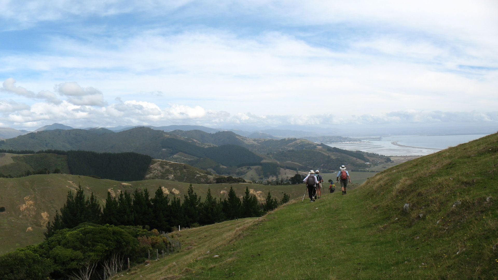
Cable Bay Walkway offers wonderful coastal views of the Boulder Bank, Nelson City and Kahurangi and Abel Tasman National Parks. The middle section of the track passes through a patch of beautiful and varied native forest.
The track is a walking track. It is steep in places and strong footwear is recommended.
Getting there
Buses and other forms of public transport are common in the area but there are no scheduled services to this walk.
Glen end directions
Starting in Nelson head north east out of Nelson on SH6.
After around 10 km turn left on Glen Road. This road becomes Seafield Terrace after around 2 km.
Park your vehicle just before the turn off to Airlie Street. There’s no parking at the start of the track.
The track starts around 550 metres up Airlie Street.
Rotokura/Cable Bay end directions
Starting in Nelson head north east out of Nelson on SH6.
After around 13.7 km turn left onto Cable Bay Road.
After around 8 km you’ll come to the track start – 821 Cable Bay Road. There’s parking at the start of this end of the track.
Know before you go
Respect the stock and farm property.
Be wary of sudden weather changes.
Light fires only in designated areas.
No camping.
History and culture
Evidence of Māori occupation in the Cable Bay area (Rotokura) dates back to about 1150 AD; the area was a fishing ground and a campsite was maintained there. Delaware Bay, across the estuary, was the site of the main pa. In 1863, the pa occupants heroically rescued the crew of the Delaware during a terrible storm.
Cable Bay was once known as Schroders Mistake, after a Nelson skipper mistook the bay for another and put his boat on the rocks there. The laying of New Zealand's first international telegraph cable gave the bay its modern name. The operation, from Sydney to Cable Bay, took 11 days and transmission began on 21 February 1876. A fire razed the station in 1914 and in 1917 the cable was moved to Titahi Bay, near Wellington.
Sources and reuse
Route descriptions and practical information reproduced from the Department of Conservation, Crown copyright, under CC BY 4.0, subject to DOC's copyright policy. Formatting has been adapted, including flattening page sections; follow the original DOC page for maps, section-specific layout, current notices and linked documents. Outdoor Next is independent and is not endorsed by DOC.
The accompanying photograph is published in DOC's official route gallery with an explicit reuse licence. Its original caption and credit are retained; it does not establish current track conditions.
