By Outdoor Next Editorial standards
On this page
Location & access
DOC track reference point, not a verified trailhead, entrance or the whole route. Check the official route directions before travel.
Official location informationLocation source
DOC track reference point, not a verified trailhead, entrance or the whole route.
Reference point: -43.02879, 171.60030. WGS84 coordinates retained at the official service's returned precision; decimal resolution is not survey accuracy. Source positional accuracy is not specified.
DOC Maps walking and tramping reference point (WGS84), exact official-page GUID / Department of Conservation. Checked 2026-10-12.
Key facts
- Distance
- Not confirmed on the checked DOC page; see individual route sections
- Walking time
- 2 hr 30 min one way
- Track grade
- Easy
- Location
- Arthur's Pass National Park
- Dog access
- No dogs. Other pets on conservation land rules.
Checked against official sources on 8 October 2026. Rules and conditions are set by Department of Conservation — confirm with them before you go.
Route overview
Experience stunning views in fine weather from a more gradual track than most alpine tracks around Arthur's Pass village.
This DOC directory entry covers Bealey Spur Track in Canterbury, within Arthur's Pass National Park. Where DOC groups several walks, times and grades refer to the listed options rather than a single continuous itinerary.
Distance, time and grade
- Distance: Not confirmed on the checked DOC page; see individual route sections
- Walking time: 2 hr 30 min one way
- DOC grade: Easy
Access and alerts
Source checked 2026-10-08. This page is a dated snapshot, not a live track-status report. Check current DOC route information immediately before travelling. An absence of listed alerts does not establish that a route is open.
Dog access
No dogs. Other pets on conservation land rules.
Description
This walk has stunning views in fine weather. It is often a good choice when north-westerly winds are bringing rain to Arthur’s Pass, being further east, it is drier in these conditions. The track appeals to many walkers because it is more gradual than most of the alpine tracks around Arthur’s Pass village, and it does not climb above the bush line. It is well marked and is suitable for reasonably fit people who are well equipped.
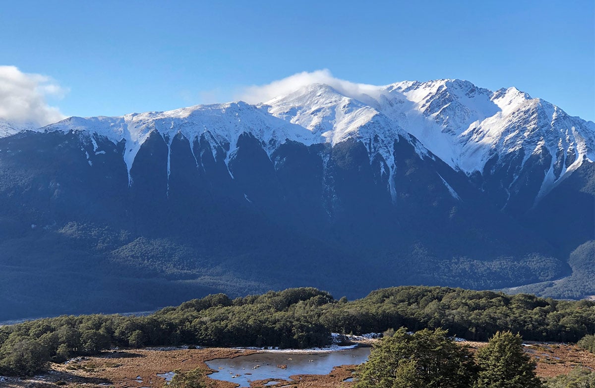
The track climbs gently up the spur, through mountain-beech forest. In summer look out for red-flowering mistletoe/pirirangi near the start of the track. At one point the track comes close to a cliff with a dramatic view down to Bruce Stream - take care with children. Higher up, the track passes through tussock grasslands and subalpine scrub and passes near several tarns. There are expansive views of the Waimakariri River valley and surrounding mountains.
The track ends at the historic Bealey Spur Hut, used by musterers in the days when this area was used for summer grazing for sheep.
Getting there
The track starts from the car park off SH73, just past the Bealey Hotel, 14 km south of Arthur’s Pass village. From the car park walk up Cloudesley Road to the track start at the top.
Know before you go
No fires permitted in the lower carparking area.
Wasp populations reach high numbers from January to April – wear light coloured clothing and carry antihistamine cream/tablets as a precaution.
The track is a gentle climb compared to many in the Arthur’s Pass National Park, but can still be muddy and rough with roots underfoot. In winter there can be snow higher up and exposure to wind and cold temperatures. We recommend sturdy shoes with good grip.
There are no drinkable water sources along the way, we recommend having at least a litre per person with you. The track ends at the Bealey Spur Hut, and there is a long drop toilet there. The hut is very basic. You can stay here overnight but it may be more comfortable to camp.
Sources and reuse
Route descriptions and practical information reproduced from the Department of Conservation, Crown copyright, under CC BY 4.0, subject to DOC's copyright policy. Formatting has been adapted, including flattening page sections; follow the original DOC page for maps, section-specific layout, current notices and linked documents. Outdoor Next is independent and is not endorsed by DOC.
The accompanying photograph is published in DOC's official route gallery with an explicit reuse licence. Its original caption and credit are retained; it does not establish current track conditions.
