By Outdoor Next Editorial standards
On this page
Location & access
DOC track reference point, not a verified trailhead, entrance or the whole route. Check the official route directions before travel.
Official location informationLocation source
DOC track reference point, not a verified trailhead, entrance or the whole route.
Reference point: -40.88774, 175.44981. WGS84 coordinates retained at the official service's returned precision; decimal resolution is not survey accuracy. Source positional accuracy is not specified.
DOC Maps walking and tramping reference point (WGS84), exact official-page GUID / Department of Conservation. Checked 2026-10-12.
Key facts
- Distance
- 7.2 km one way
- Walking time
- 2-3 hr one way
- Track grade
- Easy
- Location
- Tararua Forest Park
- Dog access
- Dogs allowed. Keep dog under control at all times. Other pets on conservation land rules.
Checked against official sources on 8 October 2026. Rules and conditions are set by Department of Conservation — confirm with them before you go.
Route overview
A good overnight option for people new to tramping, leading from Holdsworth road end to Atiwhakatu Hut.
This DOC directory entry covers Atiwhakatu Track in Wellington, within Tararua Forest Park. Where DOC groups several walks, times and grades refer to the listed options rather than a single continuous itinerary.
Distance, time and grade
- Distance: 7.2 km one way
- Walking time: 2-3 hr one way
- DOC grade: Easy
Access and alerts
Source checked 2026-10-08. This page is a dated snapshot, not a live track-status report. Check current DOC route information immediately before travelling. An absence of listed alerts does not establish that a route is open.
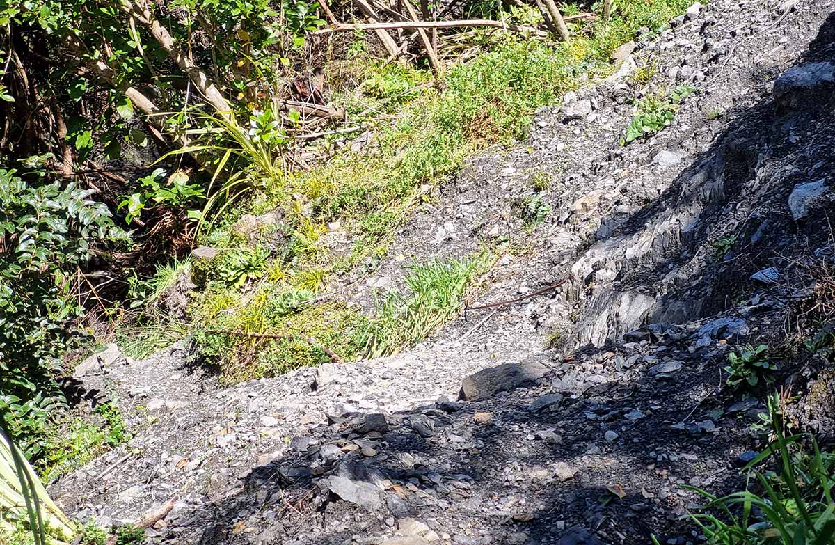
Atiwhakatu Track active slip; First published on 23 October 2025. Last reviewed on 4 August 2026.
Predator control for part of Tararua Forest Park; First published on 2 May 2026. Last reviewed on 3 June 2026.
Dog access
Dogs allowed. Keep dog under control at all times. Other pets on conservation land rules.
Description
Begin this track from car park at the end of Mt Holdsworth Road. Follow the gravel road past Holdsworth Lodge, then cross a bridge over Atiwhakatu Stream.
From the bridge, a wide, flat track leads through beautiful mixed podocarp/broadleaf forest to Donnelly Flat. There is a picnic area and camping places with access down to the stream.
Atiwhakatu Track follows the true right of Atiwhakatu Stream up the valley. You will pass a slip partway up the valley – this requires a small scramble to cross.
Atiwhakatu Track crosses many side streams. One of the bridges is a high, narrow wire swing bridge with a one person at a time restriction. Some people may find it difficult.
The hut is situated in a clearing with a picnic table out front.
Getting there
Atiwhakatu Track starts at the Holdsworth roadend, approximately 15 minutes drive from Masterton.
Turn off State Highway 2 onto Norfolk Road, 2 km south of Masterton. This is signposted and there is a timber processing plant on the corner.
Follow Norfolk Road for about 15 km to Holdsworth road end.
Know before you go
Information for families
This is a popular hut for new trampers and families. The track is well formed. However, if anyone in your party is young or does not have much experience tramping, then we recommend planning for a longer walking time than listed.
There is a high, narrow wire swing bridge with a one person crossing restriction, as well as a section of track that crosses a slip where some scrambling is needed. There are also some steep drop-offs beside the track. Keep this in mind if you are taking children.
Pack for bad weather
The Tararua Ranges are well known for wild, fast-changing and unpredictable weather. Anytime you go into the Tararua Forest Park, pack warm and waterproof clothing (even if the forecast is good).
Find a tramping packing list here.
Sources and reuse
Route descriptions and practical information reproduced from the Department of Conservation, Crown copyright, under CC BY 4.0, subject to DOC's copyright policy. Formatting has been adapted, including flattening page sections; follow the original DOC page for maps, section-specific layout, current notices and linked documents. Outdoor Next is independent and is not endorsed by DOC.
The accompanying photograph is published in DOC's official route gallery with an explicit reuse licence. Its original caption and credit are retained; it does not establish current track conditions.
